Given the temperature in Lisbon at the start of the Vuelta a España as I sat down with a delegation from Rouvy it was hard even to contemplate riding indoors. Perhaps, with climate change progressing as it is, indoor training will become as much an activity for midsummer in air-conditioned rooms as it is for escaping stormy weather through the darker months. In any case, indoor cycling was the order of the day as I sat down in a mercifully cool hotel lobby with two route creators from Rouvy.
For those of you unfamiliar with the brand, it’s a competitor to Zwift, but instead of heading down the gamification route it instead aims to reach a zenith of realism that’s second only to riding outdoors. This means real roads, with your avatar superimposed on them. How, then, does one create a 3D world, in which a virtual rider on screen can have his or her shadow play across terrain, or other riders disappear behind trees? That’s what I was here to find out.
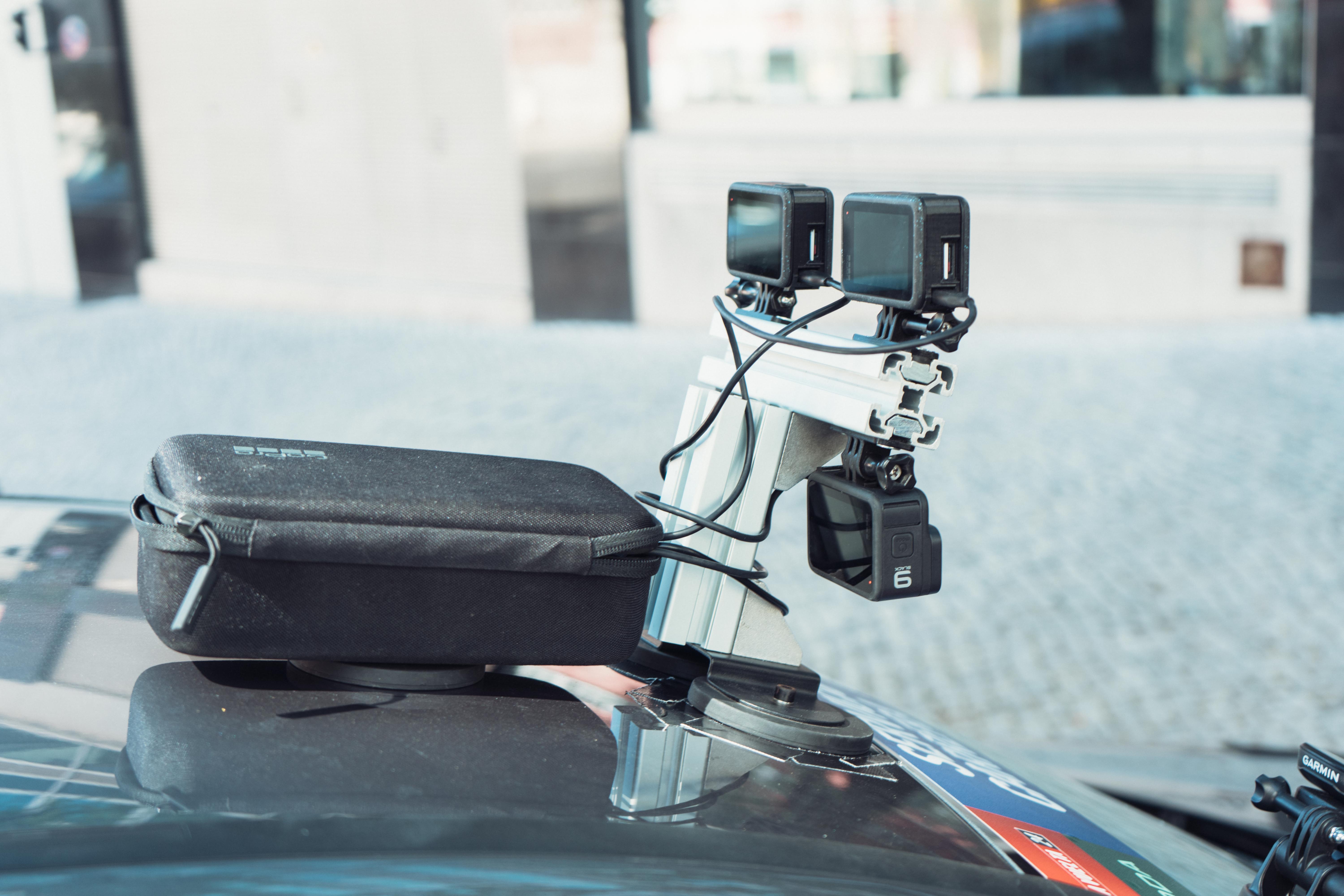
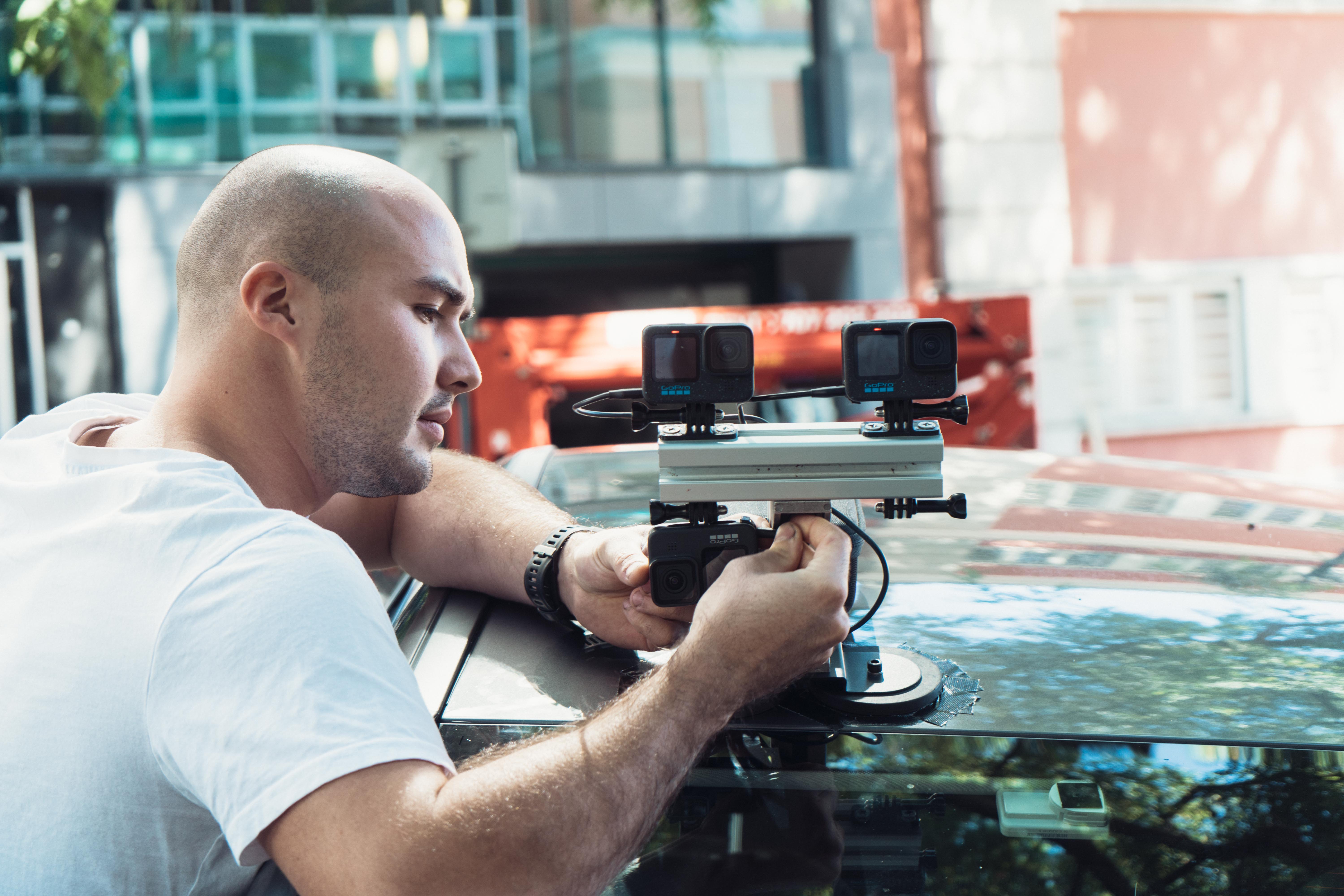
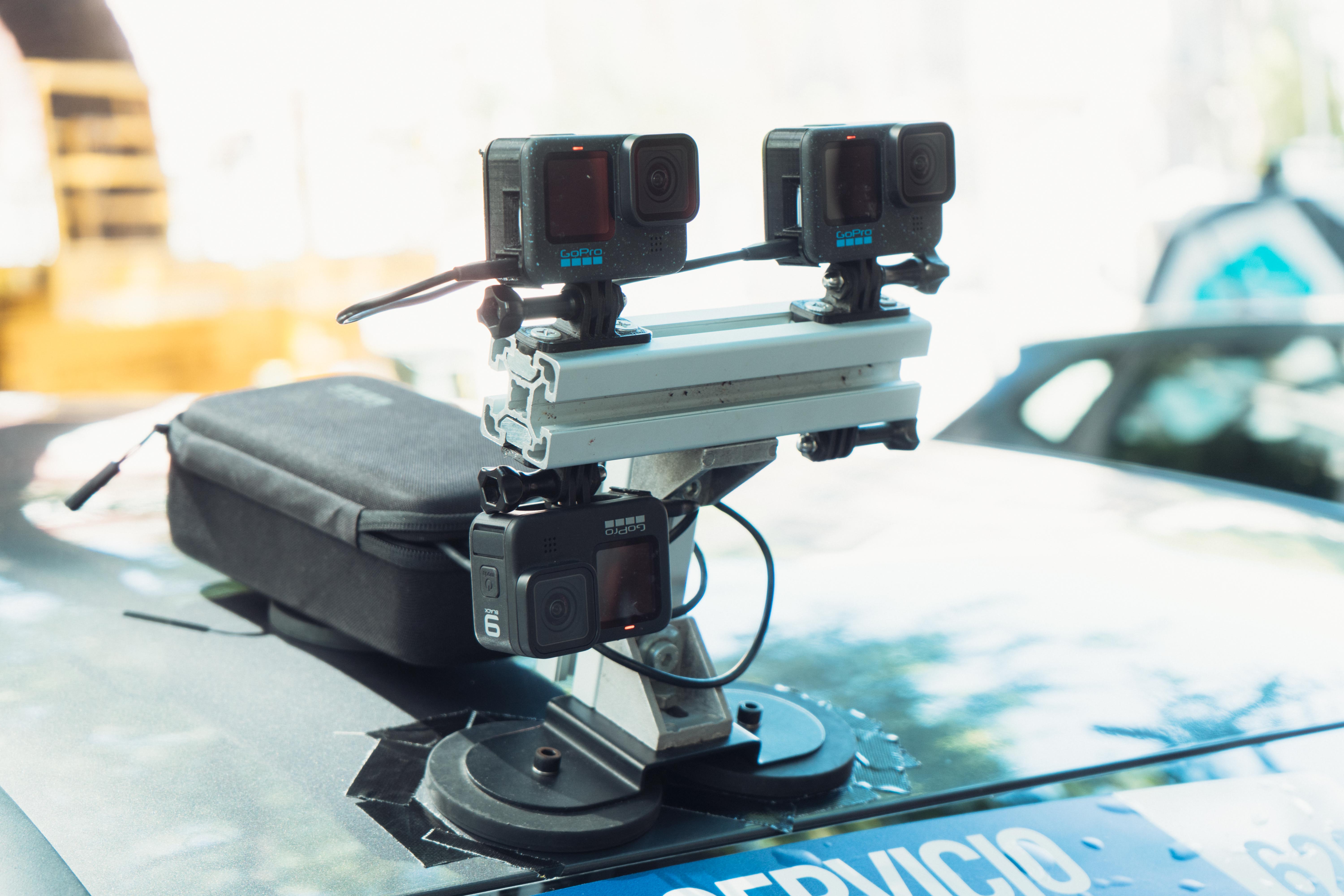
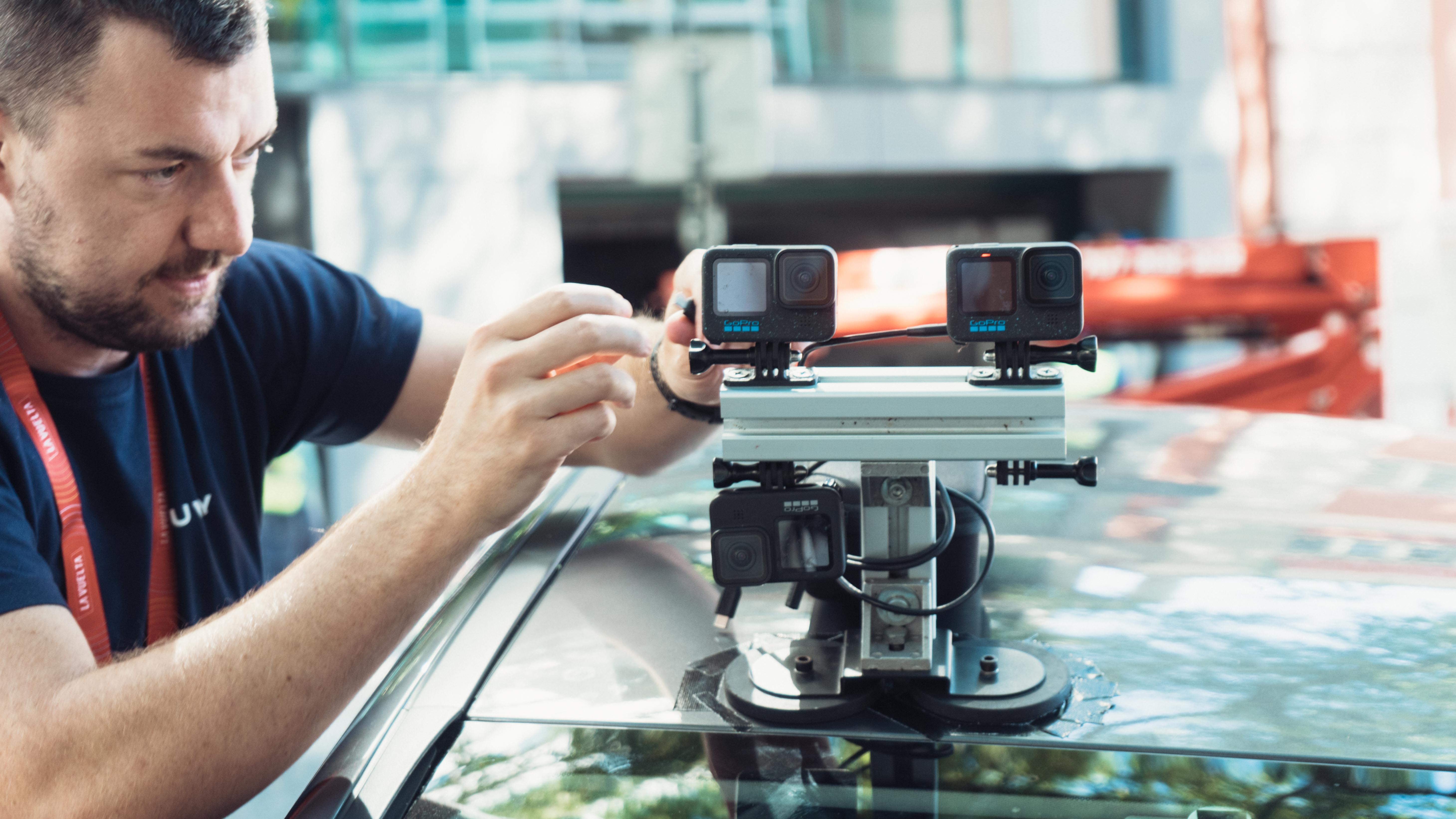
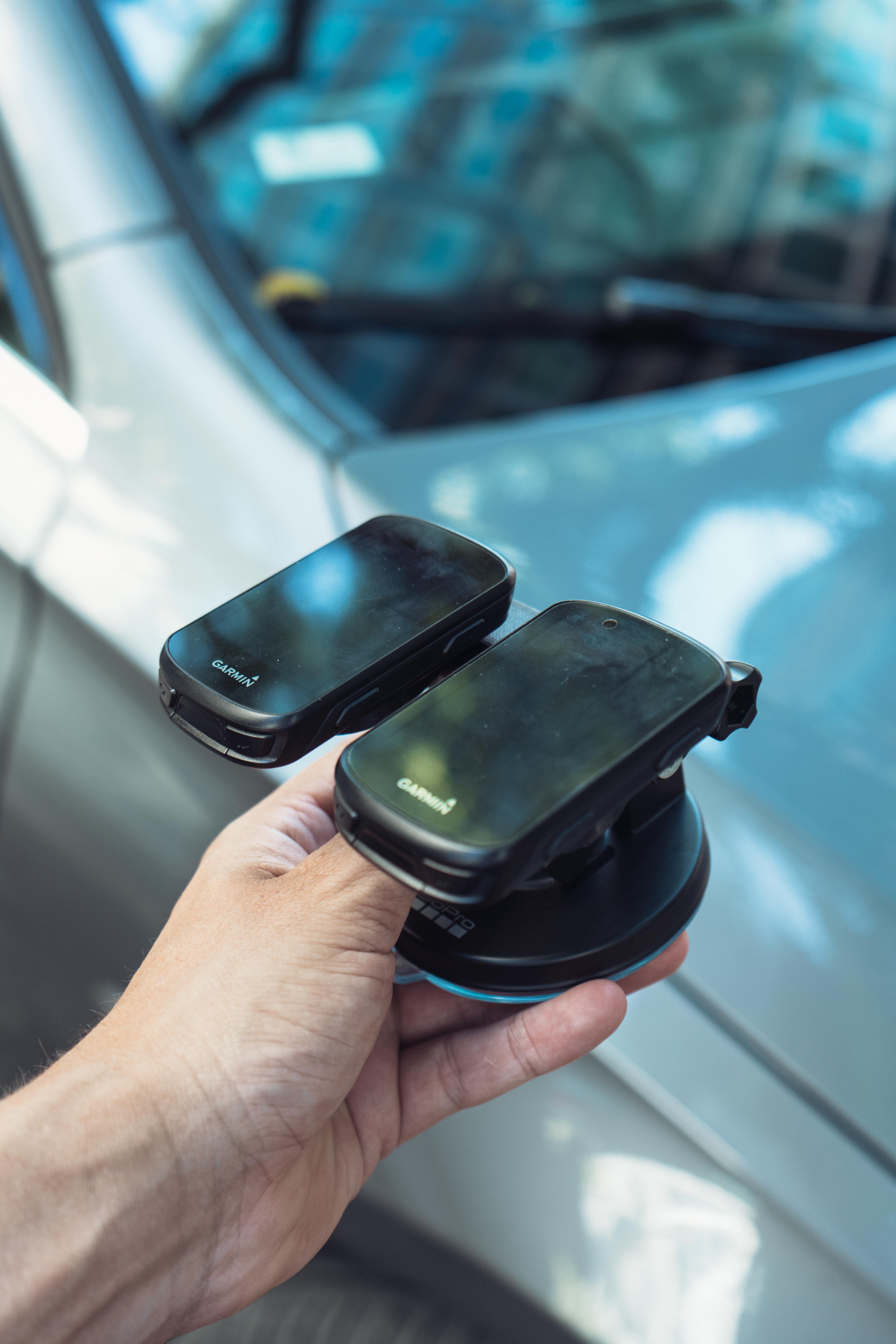
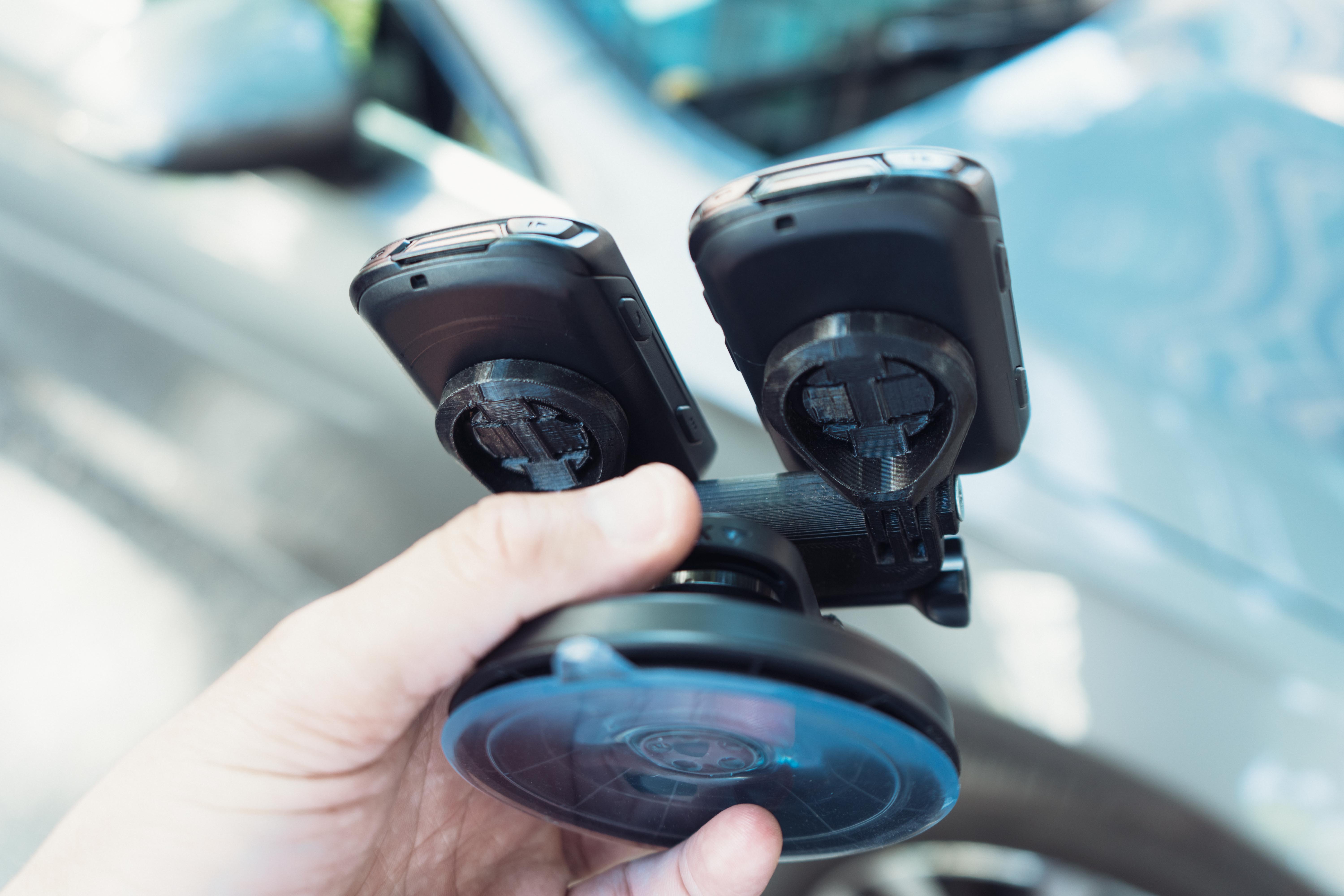
Three GoPros, two Garmins, and a load of power banks
The bank of routes available on the platform is ever-growing, and real-world routes have been an integral part of the experience since 2013, but this would all be impossible if not for the work of three route creator teams driving around and recording gigabytes of footage. Each team spends about a month on the road per year just gathering route data. At the Vuelta, a team of two were recording five routes from the race with an impressive turnaround time of a week from recording to it being available in-app, though for non-time critical routes, the turnaround is more like a month.
The system swings on a very simple array of three GoPro cameras - though two of these are there just for redundancy - and a pair of Garmin head units, with one of these also just a backup. The cameras are mounted to the roof of a car via a suction cup, powered by a zipped case full of power banks. It’s all very homemade, created from off-the-shelf aluminium extrusion, and inside the cab, the Garmin holders are also a homemade design, though this time they have at least been 3D printed.
The team then sets off down the route, ideally at around twice the speed of a rider for the algorithm to work effectively. It also requires a relatively constant speed, which is why there are so few inner-city routes. The Garmins log the GPS track, and the GoPros handle the video, though the GoPros are also GPS enabled which I’m told is key, especially for the future of user-generated routes as I’ll get onto shortly.
How does it turn an image into a 3D rendering then? My initial thought was it would take something like publicly available LIDAR data (a satellite-mounted laser grid of local topography), but that turned out to be over-egging the pudding. The beauty, it seems, is in the algorithm, which uses the speed and the positions of recognisable objects relative to each other to create a 3D world in a way similar to autofocus tracking, but for multiple objects at once. Mountains in the distance move a lot slower in the eyeline than roadside trees. Other cars, moving as they do at non-standardised speeds, do pose something of a challenge, but there’s no way to cut them out of a route and so if a white van man cuts the route creators up while they’re filming then into the route the white van man goes… talk about realism!
The future of user generated routes
Realism is one thing, and escaping up Alpe d’Huez is certainly an enticing prospect even if only virtually, but the future of the platform appears poised to be placed in the hands of the 1.5 million users by means of allowing them to create and upload their own routes into the virtual world. Details are still a little thin on the ground, but I am told that anyone armed with a GPS-enabled GoPro and a bike, car, or motorbike should in the not-too-distant future be able to record and then ride their own routes, and share them publicly too.
For some reason, my brain immediately thought of recording my commute, but a more exciting prospect is perhaps user-added gravel content. The system does struggle with shaky footage, but there’s a wealth of trails out there that could end up in the bank. This could have implications for the consumer in terms of holiday planning, reminiscing, or showing off to your mates about how good your local roads are, but in a more tangible sense, there is likely more of a benefit to professional teams in terms of route recon.
Rouvy is a sponsor of Lidl-Trek, though there is no compulsion for the team riders to use the platform. Some do, others don't, though the route creation department does occasionally get route requests from the riders. Both Elisa Longo Borghini and Ellen van Dyk are on the list, the former after a specific stage finish and the latter was after the Paris Olympic time trial route.
Marrying the two worlds up, in terms of facilitating the pro cycling cosplay in which we all engage to some degree or another there is a future in which one could ride along at home on pro riders' actual training rides, in the (admittedly virtual) conditions in which they rode them.
My final thought was on the possibility of creating hybrid routes, a greatest-hits amalgam. Alpe d’Huez followed by a stretch of Unbound gravel, a quick jaunt along the shore of Lake Garda followed by the Bristol to Bath bike path. Apparently there are all sorts of reasons why this wouldn’t be possible, primarily due to all the different elevations, but it’s still something I imagine should be possible if someone put their mind to it.