For years, I used Google Maps the same way most people do. I'd decide to leave, enter my destination, and start my trip. If traffic or delays appeared on the route, I'd see them during navigation and either deal with it or take whatever alternate route the app suggested.
It never occurred to me to check conditions before stepping out the door. Google Maps was something I opened after deciding to go somewhere, not before. Then I started checking the traffic layer first, before leaving.
Now, I avoid the congestion I used to sit through. This one habit saves me 20+ minutes daily, and it's the simplest change I've made to how I use Google Maps.
How to check traffic before you leave
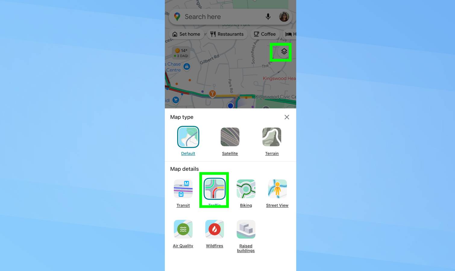
Open Google Maps without entering a destination. On the main map screen, tap the layers icon in the upper-right corner, it looks like two stacked squares. Select Traffic from the menu.
Roads across your area immediately appear color-coded. Green means clear, orange indicates moderate congestion, red shows heavy delays. The darker the red, the worse the backup.
You can also zoom out to see traffic patterns across your entire region, or zoom in to inspect specific roads.
Why it's a game-changer
Every morning, I open Google Maps and turn on the traffic layer before leaving for work. This prevents me from hitting the worst delays. I used to leave at a fixed time and accept whatever traffic existed. Now I leave when conditions are better, and my travel time has dropped.
If I'm taking the bus, I check traffic along the bus route. Heavy congestion means the bus will be slow or delayed, so I leave earlier or consider alternatives.
This habit is a game-changer because it replaces all the guesswork.
I used to plan travel based on assumptions — what traffic is usually like, or what it was like yesterday. But traffic is dynamic. By checking it before you leave (and even while you’re out), means you're avoiding as many delays as possible.