Parts of the UK are bracing for yet more atrocious weather with heavy snow, lightning and gusts of up to 60mph forecast to arrive on Wednesday.
The Met Office issued two yellow weather warnings for Scotland, Northern Ireland and northern England. However, the impact is not feared to be on the same level as the triple whammy of havoc wreaked in recent days by Storms Dudley, Eunice and Franklin.
The weather alerts came as two severe flood warnings and 84 flood warnings, issued by the Environment Agency, remained in place as river levels continued to rise in the wake of Storm Franklin.
Both weather warnings begin on Wednesday. Between about 6am and 3pm the north-east of England and south-east of Scotland can expect strong winds, as high as 60mph, likely to lead to some travel disruption.

From 1pm on Wednesday until Thursday afternoon, heavy snow showers, gusty winds and a possibility of lightning are expected in parts of Scotland and Northern Ireland. Up to 10cm of snow could fall even at low levels with up to 30cm building up on higher ground by Thursday morning.
There is a small chance of injuries and danger to life from flying debris, the Met Office warned. Power cuts, road and bridge closures and travel disruption are also possible.
Met Office spokesperson Stephen Dixon said that this week’s weather was “largely more typical February weather rather than the more impactful weather we saw last week”.
The UK has gradually been getting back to normal after the storms. About 1.48m households and businesses lost electricity because of the weather. Power has been restored to the vast majority of people but the Energy Networks Association, which represents providers across the UK, said 11,400 customers were still without power on Tuesday afternoon.

Most train services had on Tuesday returned to normal after several days of disruption.
Rotherham Central station was still closed because of flooding, with Northern services between Doncaster and Sheffield diverting around it.
Network Rail said it recorded about 200 storm-related incidents on its western route between London Paddington and Penzance in recent days.
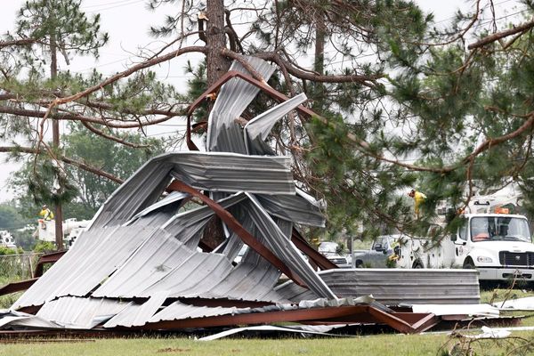
In the past week, rail staff worked in extreme conditions to clear trees, sheds, trampolines and other objects from tracks, and fix overhead electric wires, the company said.
Flooding remains the most pressing concern for thousands of people with severe flood warnings in place on the River Severn at Ironbridge, in Shropshire, and Bewdley, in Worcestershire. Residents were urged to evacuate and police declared major emergencies.
The Environment Agency warned that temporary flood barriers in Wharfage, Ironbridge, could be overtopped on Tuesday evening with river levels reaching nearly 7 metres high.
In Bewdley, officials said they expected temporary structures to “exceed their capacity” on Tuesday, meaning flooding to homes and main roads was expected. River levels in the village were not expected to peak until Wednesday afternoon.

More than 80 flood warnings, meaning flooding is expected, were in place across England on Tuesday afternoon , mostly along the Severn near the Welsh border and in Yorkshire. Four flood warnings were in place in Scotland.
In York, river levels were thought to have peaked at 4.53 metres on Tuesday morning, at least 3 metres higher than normal, causing flooding to nearby properties. That was only 80cm short of the record level the river reached in 2000, which was the highest measured in the centre of York.


