Storm Ciaran has arrived, bringing destruction in its wake including roofs ripped off houses, damaged cars- and smashed windows.
The Environment Agency has issued flood warnings and alerts across much of the country, including dozens along the south coast.
Thousands of homes are still without power after heavy storms lashed against the southcoast of England on Thursday.
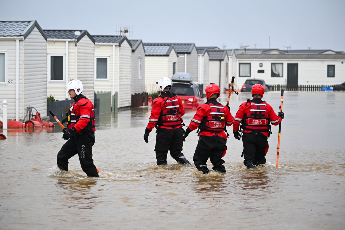
People were rescued from their holiday chalets in Dorset after downpours— (Getty)
As of midday on Friday there are 42 flood warnings - where flooding is expected - and 194 flood alerts - where flooding is possible.
Roofs were torn off homes and “golf ball-sized hailstones” hit as Storm Ciarán battered southwest England, bringing travel chaos, school closures and leaving thousands of homes without power.
As winds of up to 104mph swept across the UK, the Channel Islands were particularly badly affected by the severe thunderstorm, which is thought to be the worst to hit the small island of Jersey since 1987.
Residents on the island endured a “terrifying” night as dozens were forced to flee their homes, while a tornado warning was issued by the Tornado and Storm Research Organisation (TORRO) from south Wales to London, as winds and heavy rain brought havoc.
Hundreds of schools were closed in the south of England because of the risk to pupils, after the Met Office issued a yellow weather warning for winds that were “strong and potentially disruptive” in the southwest, Wales, London, the southeast and the east of England.
Flood warnings and alerts across England— (Environment Agency)
States of Jersey Police said 35 people were put up in hotels overnight Wednesday to Thursday, and three were taken to hospital after their homes were damaged.
The Royal National Lifeboat Institution (RNLI) urged people watching the conditions to stay away from the coast.
RNLI water safety manager Ross Macleod said: ‘This rough weather could make visiting our coasts around southern England and Wales treacherous and bring very dangerous sea conditions.
“While people may want to experience extreme weather around the coast, we would strongly advise against doing so. It is not worth risking your life, so we urge people to respect the water and watch from a safe distance.”
Storm Ciaran is the latest bout of severe weather to hit the UK— (PA Wire)
The storm has battered the south coast of England this week— (PA)
A yellow warning for rain is in place for large swathes of southern England for Saturday, with thunderstorms likely to catch in the southeast as up to 30-40mm are expected in the coastal regions.
The ground is saturated in many areas, so some disruption is possible, especially for travel, the Met Office said.
Cars, homes and buildings have been damaged as the storm hits the UK— (Supplied)
Frank Saunders, chief forecaster for Met Office, said: “After the events of this week, the forecast is moving into a period of fairly typical autumnal weather, with breezy conditions and spells of rain and showers, interspersed with some clearer and brighter periods.
“We still have warnings in the forecast, partly because the ground is already so wet but overall conditions are expected to be less impactful than we’ve seen over the last few days.
“Aside from scattered showers in the north and west of the UK, Bonfire Night (Sunday) will be largely dry and settled, although temperatures will be dipping compared with values last week.”


