The UK is bracing for a cold and wintry few days as Storm Pedro brings rain, ice, and snow across the country.
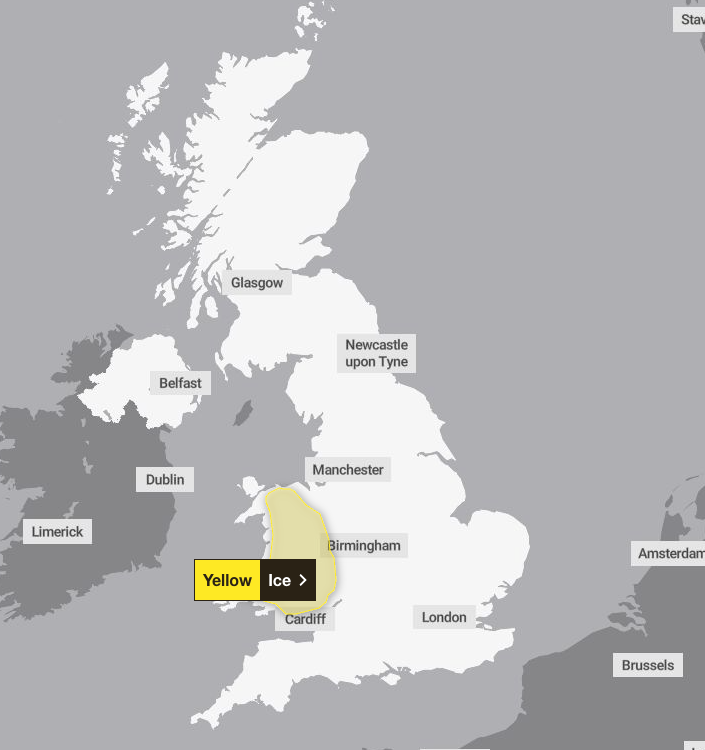
A yellow ice weather warning covering much of Wales is in force on Thursday morning and will be lifted at 10am.
Heavy rain battered the south coast on Wednesday evening as the storm passed over south western and central England, with dozens of flood alerts and warnings now in place. Forecasters also warned parts of Wales, central England and the southern Pennines should be prepared for snow as the storm passed over on Wednesday.
Storm Pedro was named by Meteo France, the country’s equivalent of the Met Office.
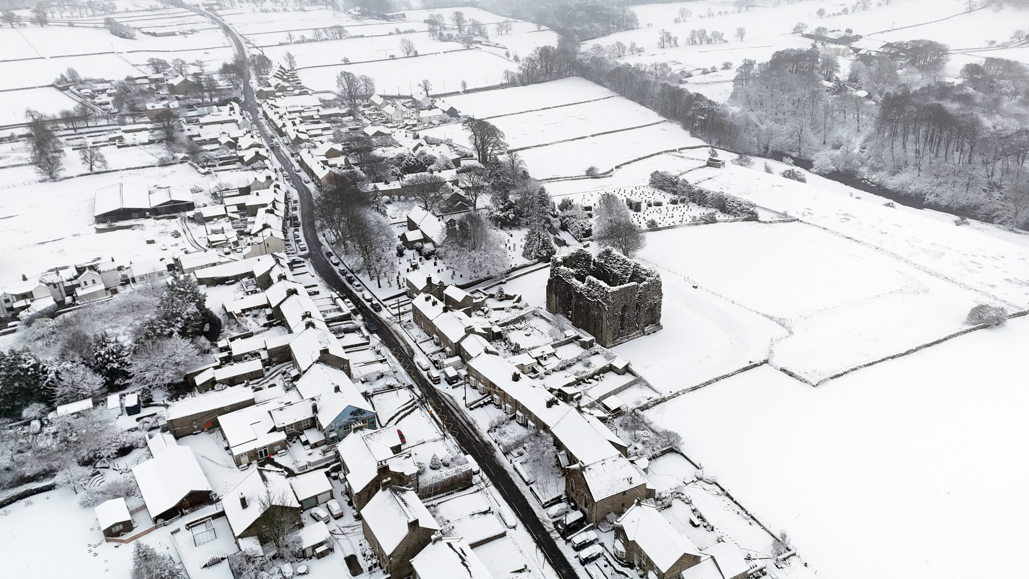
Forecasters warned ice could form on untreated surfaces on Thursday morning as areas of rain, sleet and snow gradually clear to the east during Wednesday evening and early Thursday morning and temperatures fall below freezing in places.
The icy weather could also cause disruption in parts of Wales and south-west England, as the Met Office urged people to be mindful of slips and falls on untreated surfaces.
The Environment Agency has also issued a number of flood warnings following heavy rain.
There are 78 flood warnings in place for England, where flooding is expected, and 217 flood alerts, where it is possible.
Numerous places across Britain have been hit by flooding this year thanks to repeated heavy downpours.
Last month, Storm Chandra forced schools to close and disrupted everyday life.
Further cold weather alerts have been issued by the UK Health Security Agency across parts of England.
The agency said the weather was likely to lead to higher demand on healthcare services by vulnerable people, as well as a greater risk to life of vulnerable people.
Strong winds will accompany the wet weather, which could exacerbate the effects in places, the Met Office said.
The UK Health Security Agency yellow cold health alert, issued for the East Midlands, West Midlands, North East, North West, South West, east of England and Yorkshire and the Humber, is in place from 6pm on Tuesday until 6pm on Friday.
Senior Met Office meteorologist Craig Snell said: “By the time we get into the late part of the day on Thursday, by that stage, the winds should be clearing away and Thursday will just be a slow improvement day.
“It’s all change after that, by the weekend it will be feeling much, much milder with temperatures reaching the low-to-mid teens, if we see some sunshine.
“There will be further spells of wind and rain but most of us will certainly see an uplift of temperatures as we go into the weekend.”
Eight skiers found dead and one still missing after Lake Tahoe avalanche
Terrifying moment massive avalanche smothers crowd of fleeing skiers in Italian Alps
Avalanches, deaths and a train crash: Why Europe’s mountains are dangerous right now
Painful tropical virus could become established in UK as temperatures rise
Motorists left out of pocket by car insurance over key policy
Ofcom to speed up decision on rules over blocking illegal images online