Get all your news in one place.
100's of premium titles.
One app.
Start reading
Space
Space
Science
Samantha Mathewson

Satellites reveal a hidden lake burst through Greenland Ice Sheet in 2014, causing major flooding and a deep crater

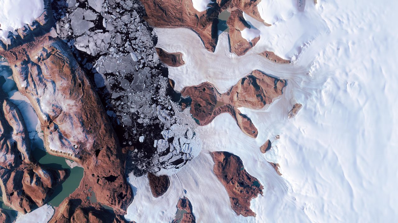
An aerial view of a snowy sheet toward the right and rocky areas toward the left. There appears to be a stream within, very close to the left side.

A hidden lake beneath the Greenland Ice Sheet unexpectedly drained more than a decade ago, fracturing the ice surface and forming a large crater — an event only recently uncovered by Earth-observing satellites.

The massive ice sheet, located in a remote region of northern Greenland, harbors a subglacial lake that appears to have flooded in 2014, releasing 23.8 billion gallons (90 million cubic meters) of meltwater over the course of 10 days — roughly equivalent to nine hours of peak flow over Niagara Falls.
Sign up to read this article
Read news from 100's of titles, curated specifically for you.
Already a member? Sign in here
Related Stories
Top stories on inkl right now
One subscription that gives you access to news from hundreds of sites
Already a member? Sign in here
Our Picks
Fourteen days free
Download the app
One app. One membership.
100+ trusted global sources.