In late October, torrential rain caused a series of flash floods across southern and eastern Spain — particularly hard hit regions include Costa del Sol, in which the city Malaga is located, as well as the city of Valencia in eastern Spain.
The Margo, Turia and Poyo river basins received massive deluges of rainfall, creating flash floods that have laid waste to homes, streets, bridges, and vehicles. Over 200 people lost their lives, with many more still missing and thousands displaced. An astonishing year's worth of rain fell in just eight hours on Valencia's coastal region, according to Spanish national weather agency, Aemet.
While emergency services are continuing to deal with the situation on the ground, satellite imagery captured by the US-Landsat-8 and Copernicus Sentinel-2 satellites, among others, have helped officials detail the scale and extent of the damage.
Earth observation systems are set to play a larger and larger role in the coordinated responses to natural emergencies, where close to real-time information can inform first-responders where to focus efforts, while also providing post-event analysis of damage.
Related: Satellites watch devastating floods in Spain from space (photos)
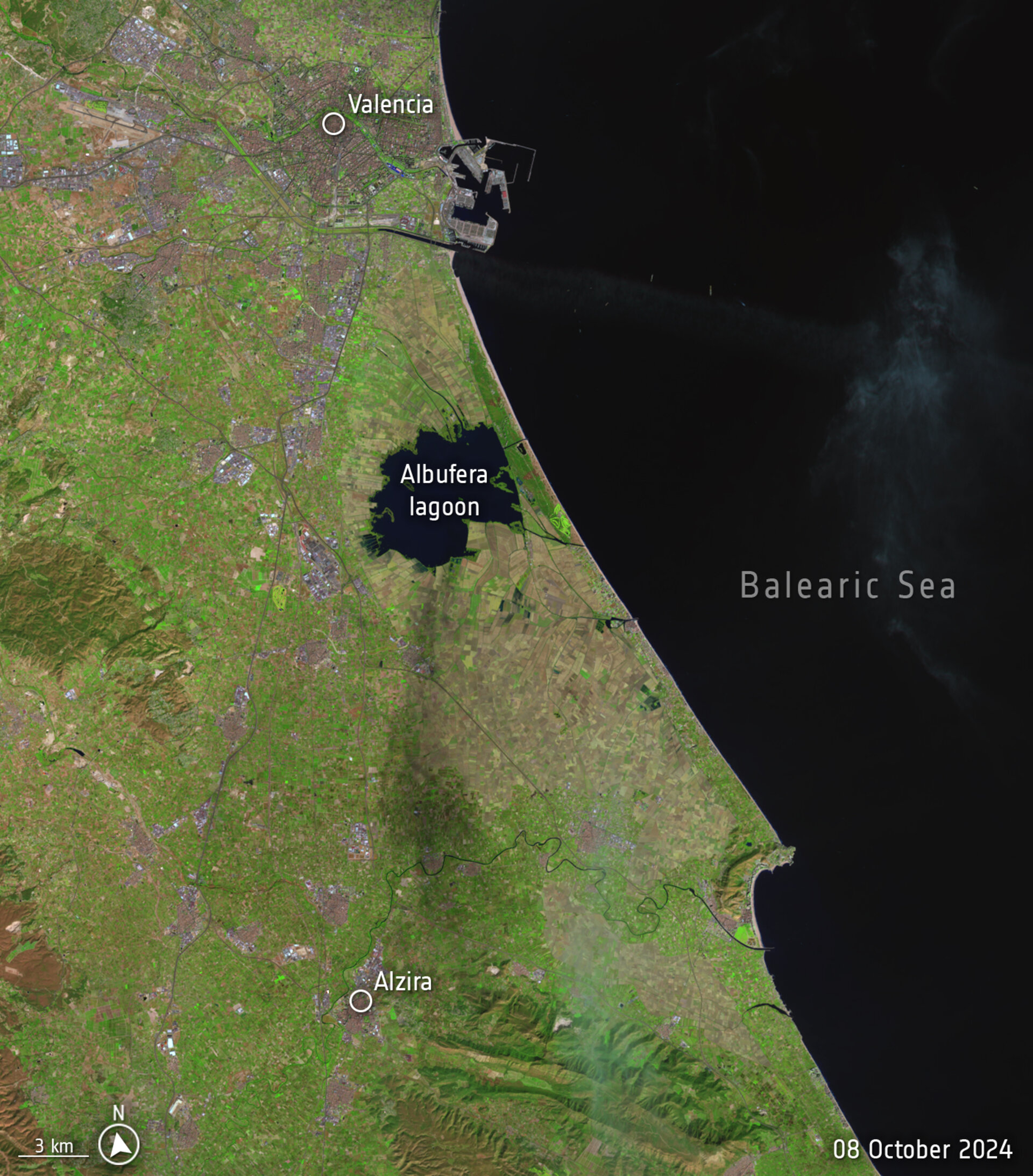
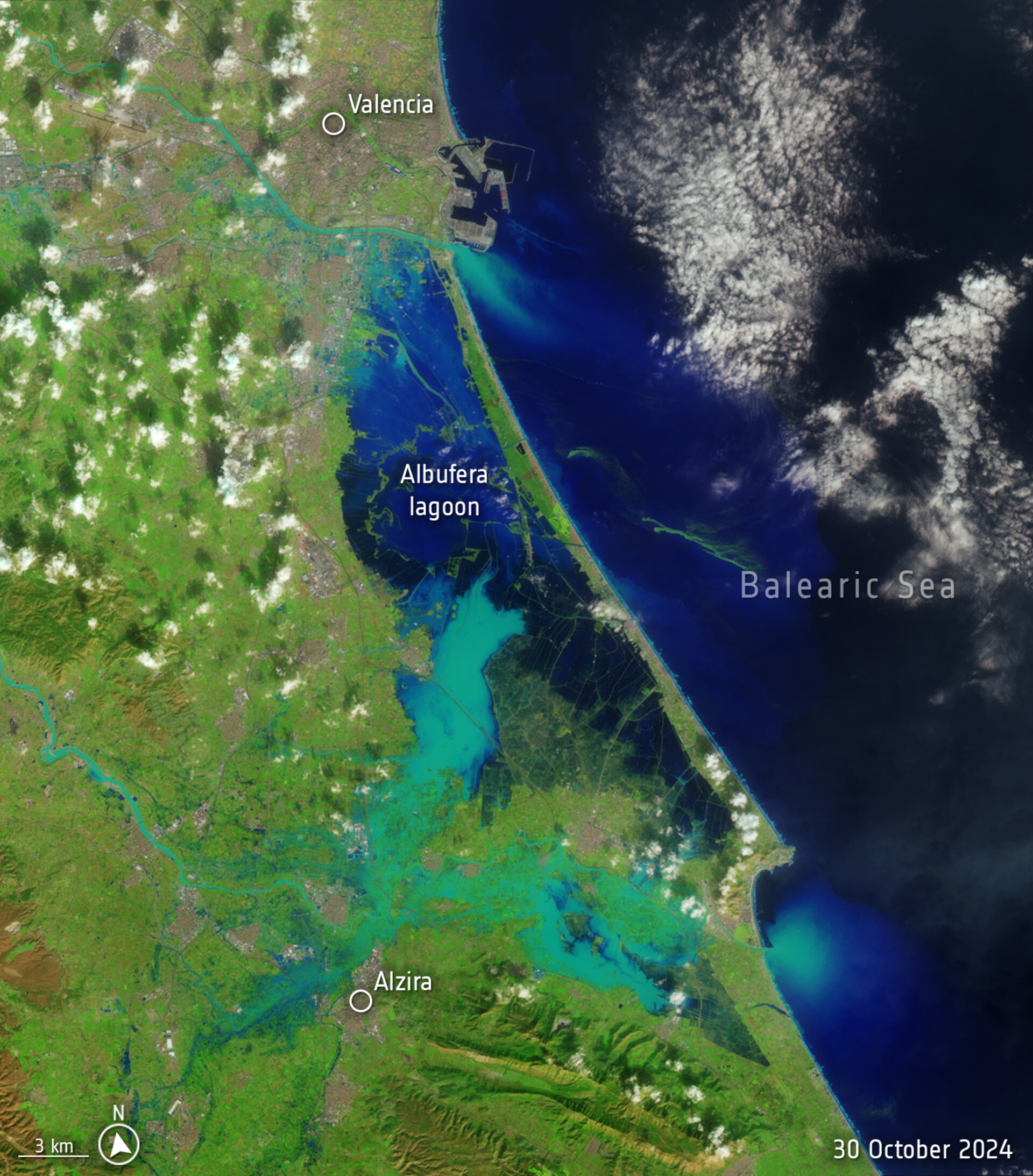
Aemet says that the intense storm resulted from a high-altitude, low-pressure weather system isolated from the jet stream, which are bands of strong winds that generally blow from west to east. Such storm systems form when cold fronts meet warm humid air masses, such as those which hover over the Mediterranean Sea. The resulting storms can become immobile, releasing the majority of their moisture in one location, causing severe flooding.
On Oct. 29, the Directorate-General for Civil Protection and Emergencies (Dirección General de Protección Civil y Emergencias) activated the Copernicus Emergency Rapid Mapping Service (EMS) to create maps that would illustrate the severity of the flooding in affected areas.
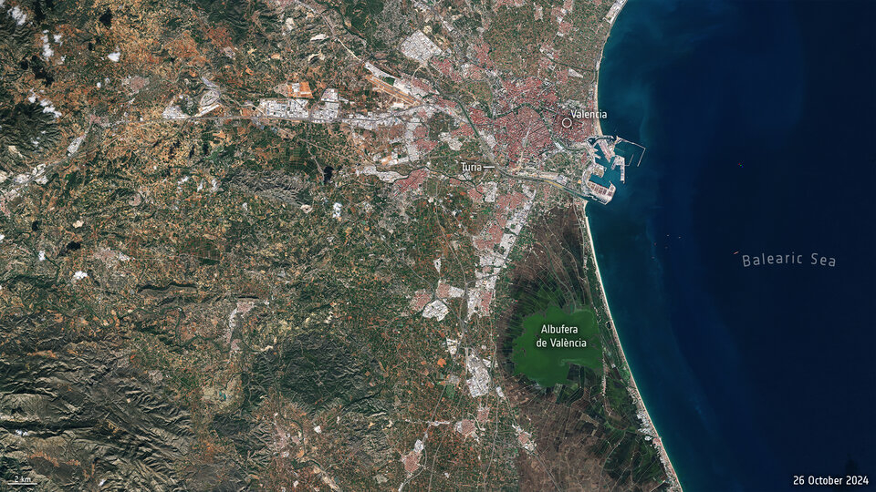
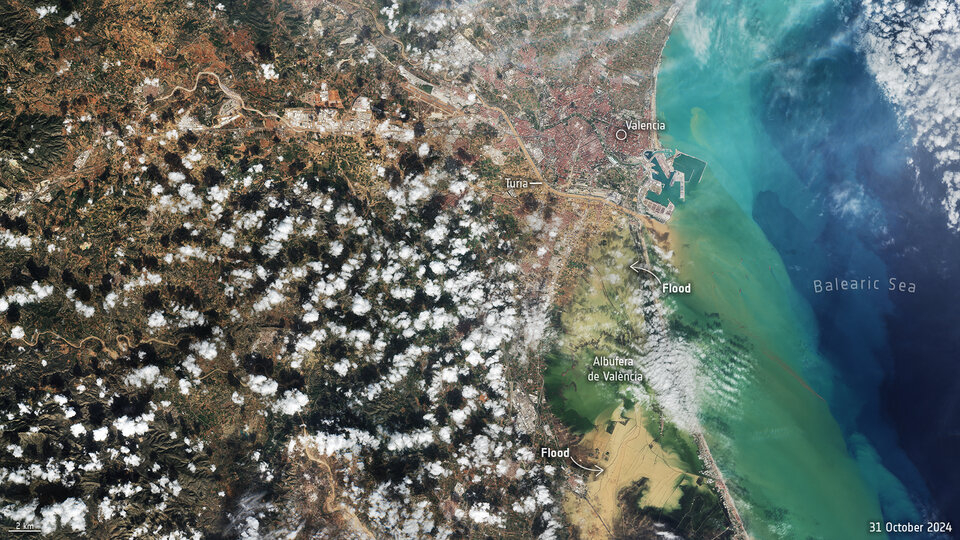
The Spanish Civil Protection Agency has also activated the International Charter "Space and Major Disasters," which draws on Earth observation technologies from 17 space agencies from across the world to provide further information of the extent of the damage.
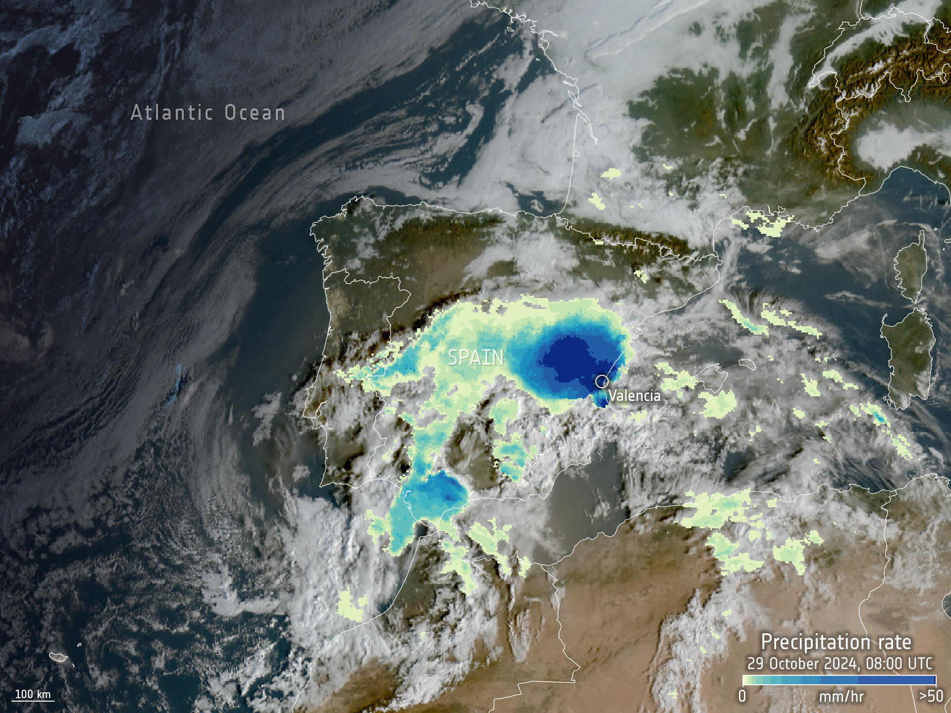
"Space-based observation plays an invaluable role during natural disasters like the recent floods in Spain," Simonetta Cheli, Director of Earth Observation Programmes at ESA, said in a press release.
"Our mission is to rapidly coordinate with partners through the International Charter and the Copernicus Emergency Mapping Service to deliver critical, real-time Earth observation data to aid emergency teams on the ground. We are committed to supporting rescue and relief efforts, providing the data needed to assess the damage and ensure timely response in affected communities," the officials added.


