Tucked into the Arctic, Greenland's mountains do far more than provide stunning scenery. They steer winds and weather, shape regional climate patterns, and help dictate how the Greenland ice sheet moves by funneling ice into fast-flowing outlet glaciers and directing meltwater toward the coast. Those outlet glaciers matter globally because they are among the main pathways by which ice from the interior can reach the ocean, contributing to sea-level rise.
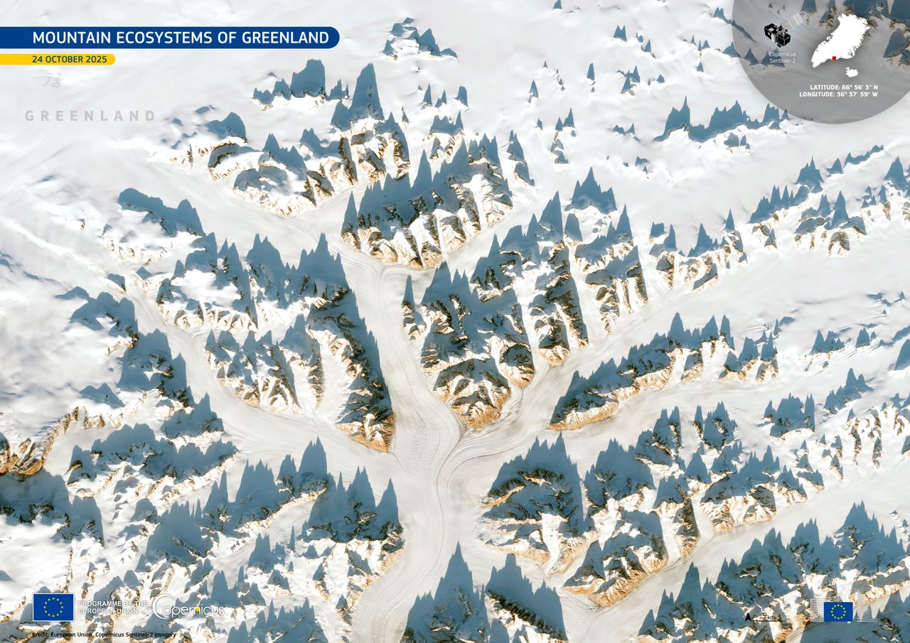
Europe's Copernicus Sentinel-2 mission, which consists of three Earth-observing satellites, recently took an image of southeast Greenland, capturing a landscape that's equal parts rock, ice and shadow. In the image, steep mountains throw long, inky silhouettes across bright glacial ice near the Helheim Glacier, one of the major outlets that drains Greenland's vast interior ice toward the ocean.
What is it?
The Sentinel-2 satellites are designed to capture wide-swath, high-resolution imagery in 13 spectral bands, making the mission especially useful for tracking changes to land, coasts, snow and ice over time. The satellites are part of the Copernicus program, led by the European Union (EU), with collaborations from partners like the European Space Agency (ESA). The goal of the program is environmental monitoring, using data collected by the Sentinel satellites as well as other missions and sensors.
Where is it?
This image was taken from low Earth orbit above Helheim Glacier.

Why is it amazing?
This picture is beautiful in the way only the Arctic can be — sharp, minimalist and impossibly vast — but it’s also a snapshot of how terrain controls Greenland's ice. Outlet glaciers behave like icy rivers, and the mountains around them act like the banks, narrowing and guiding flow as ice drains seaward. When conditions change — from warming air, shifting snowfall, or warmer ocean waters reaching glacier fronts — these fast-moving outlets can respond dramatically, affecting how quickly Greenland loses ice.
With the sun lower in the sky in late October, long shadows exaggerate ridgelines and valleys, making it easier to see the topographic complexity that influences where ice thickens, where it fractures and where meltwater can route toward the coast.
Want to learn more?
You can learn more about the Copernicus program and glacier melting.