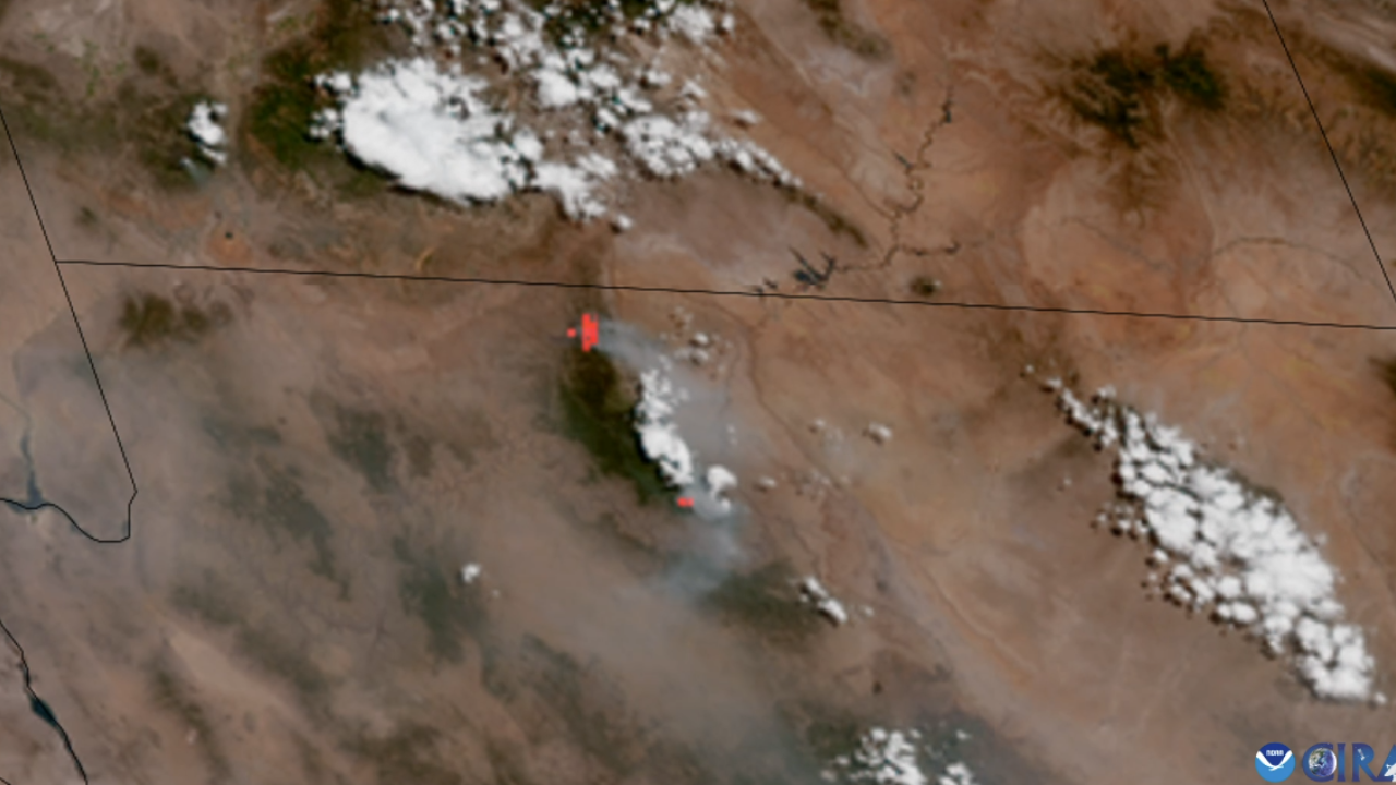
Two wildfires in Northern Arizona, sparked from lightning, have burned at least 60,000 acres in a little over a week — and, while firefighters work around the clock trying to contain the fires, National Oceanic and Atmospheric Administration (NOAA)'s satellites are aiding the fight from space. The fires have also spread to the Grand Canyon.
The first wildfire to directly impact Grand Canyon National Park was the Dragon Bravo Fire, which began on July 4. Dragon Bravo has already scorched thousands of acres and continues to destroy a number of structures, including the monumental Grand Canyon Lodge, along its path within the park’s North Rim. Five days after the Dragon Bravo Fire began, another thunderstorm resulted in the creation of the White Sage Fire, which rapidly grew and expanded during a period of dry and hot weather accompanied by powerful wind gusts.