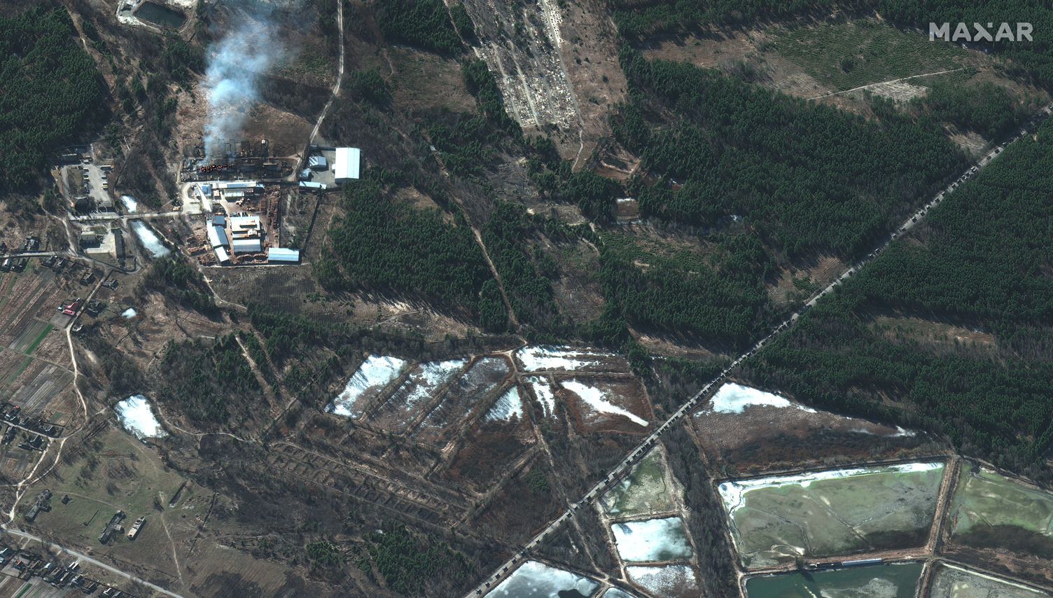
New satellite images show a massive convoy of Russian military vehicles heading toward Kyiv is more than twice as long as analysts previously estimated it to be.
The big picture: Analysts originally believed the procession of invading vehicles spanned 17 miles. They now estimate it's closer to 40 miles long, stretching from near Ukraine's Antonov Airport in the south and north to near the tiny town of Prybirs'k, according to satellite imaging firm Maxar Technologies.

A satellite image of the convoy near Kyiv, which stretches from near Antonov Airport in the south to the northern end of the convoy near Prybirs'k on Feb. 28. Photo: Maxar Technologies

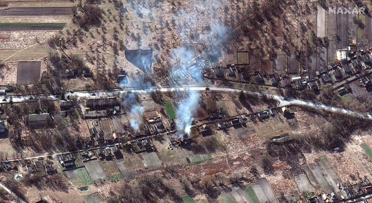
The convoy passes burning homes north of Kyiv on Feb. 28. Photo: Maxar Technologies

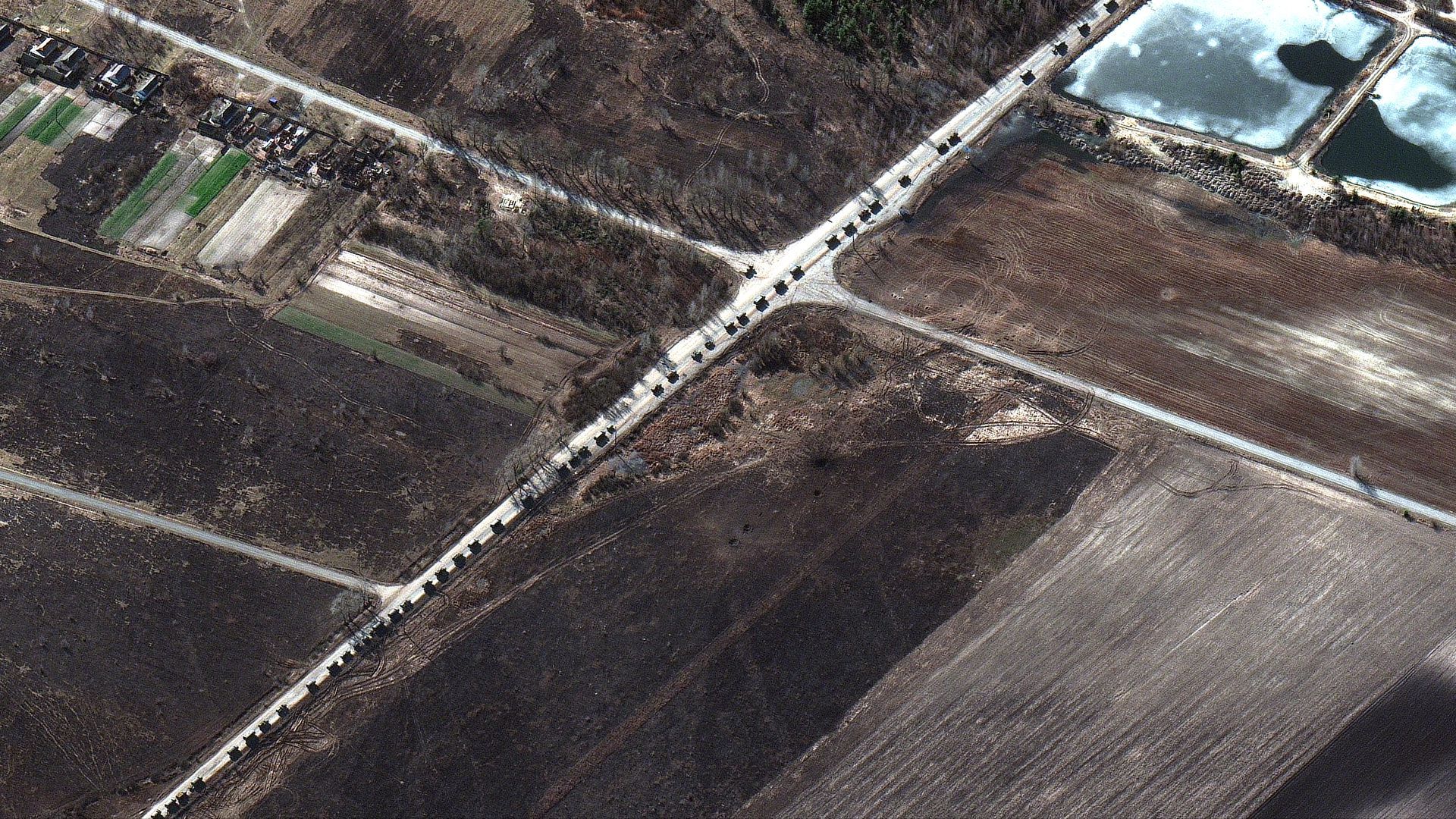
Along parts of the route, some vehicles traveling on Feb. 28 are spaced fairly far apart while in other sections, military equipment and units are traveling two or three vehicles abreast on the road, according to analysts. Photo: Maxar Technologies

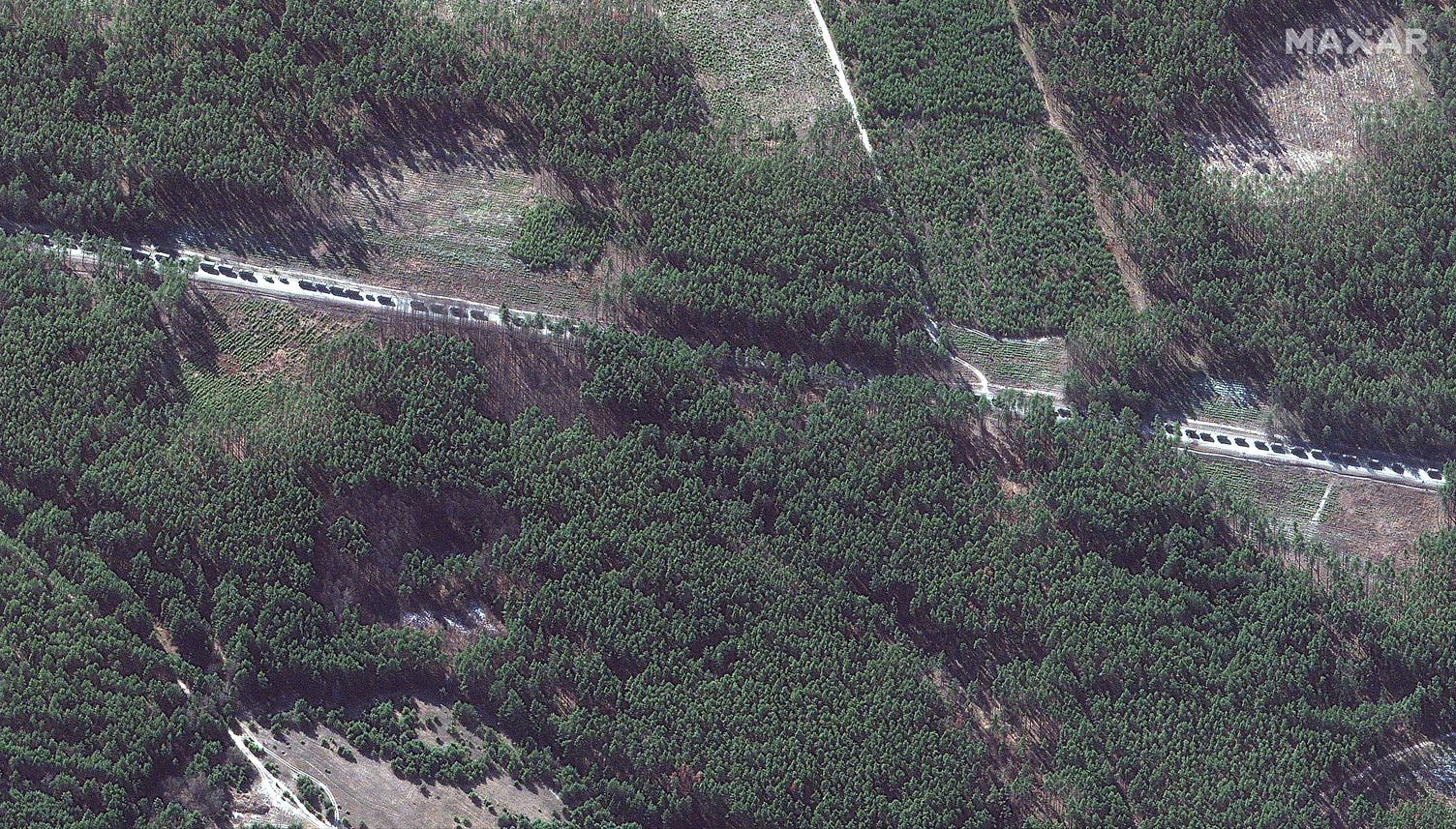
The convoy snakes through woodland on Feb 28. Photo: Maxar Technologies
Go deeper: The latest on the Russia-Ukraine crisis


