QUICK FACTS
Where is it? La Palma, Canary Islands [28.62120467, -17.89960469]
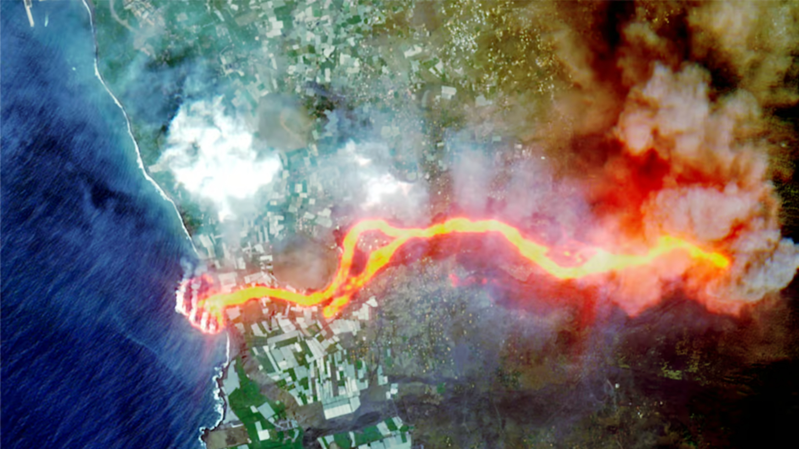
What's in the photo? A highly destructive lava flow winding into the sea
Which satellite took the photo? European Space Agency's Sentinel-2 mission
When was it taken? Oct. 1, 2021
This striking satellite photo shows red-hot lava winding into the sea during a volcanic eruption on La Palma in the Canary Islands. The "river of fire" completely wiped out a small town and unleashed plumes of toxic gases, which have plagued the Spanish island for years, locals and experts told Live Science.