Magnitude 4.8 and 3.8 earthquakes rocked the Northeast, including the Greater New York area, on Friday (April 5), according to the U.S. Geological Survey (USGS).
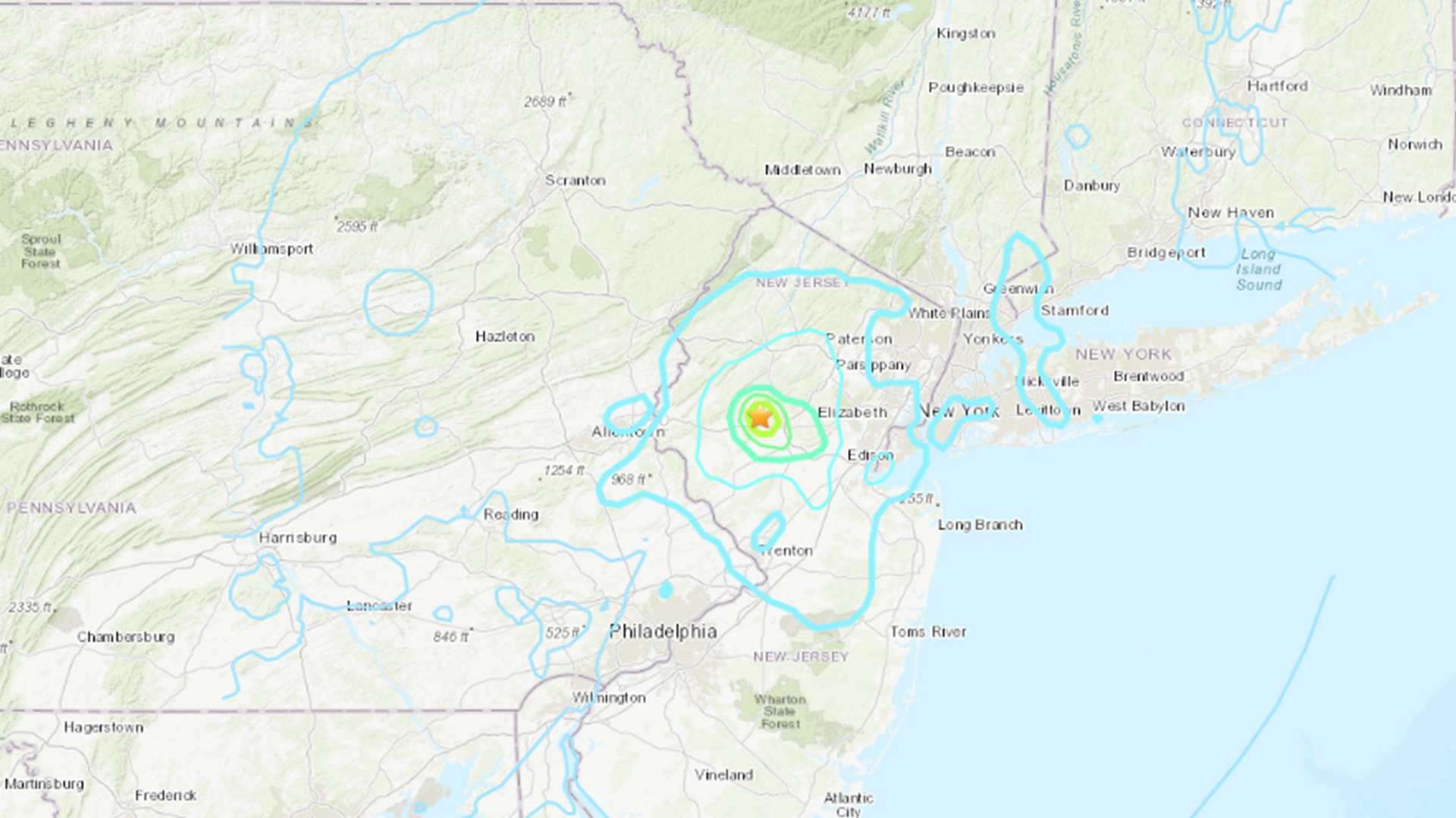
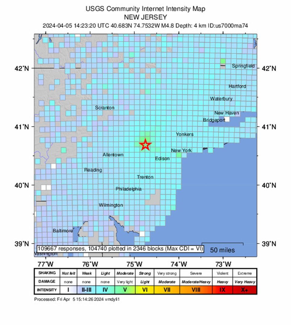
The first earthquake struck at 10:23 a.m. EDT at a depth of 2.9 miles (4.7 kilometers), USGS reported. It hit 4.3 miles (7 km) north of Whitehouse Station in New Jersey, about 40 miles (64 km) from Manhattan.
The second earthquake hit at 5:59 p.m. EDT at a depth of 5.8 miles (9.4 km), with an epicenter 4.3 miles (7 km) southwest of Gladstone, New Jersey, USGS reported. It was originally reported as a magnitude 4.0, but later downgraded to a magnitude 3.8 "based on more complete physical modeling," USGS said.
For the first quake, shaking was felt as far south as Baltimore, Maryland, and as far north as Springfield, Massachusetts, according to the USGS' "Did You Feel It?" map. Some airports on the East Coast issued ground stops to halt air traffic directly after the morning quake, but there were no immediate reports of damage, according to The New York Times.
Related: The 20 largest recorded earthquakes in history
Earthquakes in the Greater New York area are rare, but smaller and occasionally more powerful earthquakes have previously rattled this region spanning New York, Philadelphia and Wilmington. Smaller earthquakes hit around every two to three years, and larger ones strike roughly twice a century, according to USGS.
"It's unusual to get really big earthquakes in the Northeast of the U.S., but you do occasionally get these intermediate-size earthquakes, which is what we had this morning," Benjamin Fernando, a postdoctoral fellow in the Department of Earth and Planetary Sciences who studies seismology at Johns Hopkins University, told Live Science.
Most earthquakes occur at tectonic plate boundaries, but the closest plate boundaries to New York City are in the center of the Atlantic Ocean and in the Caribbean Sea. The U.S. Northeast doesn't have tectonic plate subduction zones like those by California and the Pacific Northwest, Fernando said. These are places where a thinner plate dips beneath an adjacent, thicker one.
"But this region, Appalachia if you like, has got lots of faults," Fernando said.
These faults are left over from ancient mountain building events, including the rise of the Appalachian mountains. When the supercontinent Pangaea arose and broke up, it left deep fractures and faults in the bedrock that can reactivate for various reasons, such as the crust readjusting to changes, Fernando told Live Science.
"There's lots of what we call faults, and those are basically contacts between different rock units," Fernando said. "Occasionally, you get motion on those faults that when the stress gets too high they slip. And that's what gives you an earthquake."
Many smaller or deeper faults in the New York, Philadelphia and Wilmington urban corridor likely remain undetected, USGS says, and most of the region's small earthquakes cannot be linked to a named fault. Moreover, "it is difficult to determine if a known fault is still active and could slip and cause an earthquake," USGS noted.
The largest earthquakes to rock New York City in the past 300 years include two magnitude 5.2 quakes that struck on Dec. 19, 1737, and Aug. 10, 1884, according to the Lamont-Doherty Earth Observatory at Columbia University in New York. In 1944, a magnitude 5.8 earthquake with an epicenter at the U.S.-Canada border by Quebec was felt in New York City, Boston, Quebec and Toronto.
The last big earthquake to strike the region was the magnitude 5.8 earthquake that hit near Mineral, Virginia, on Aug. 23, 2011. That earthquake occurred "within a previously recognized seismic zone, the 'Central Virginia Seismic Zone,'" according to USGS.
Editor's note: Updated at 6:25 p.m. EDT to include information about the second earthquake and again at 10:31 p.m. EDT to note that USGS downgraded the second earthquake from a magnitude 4.0 to 3.8.
