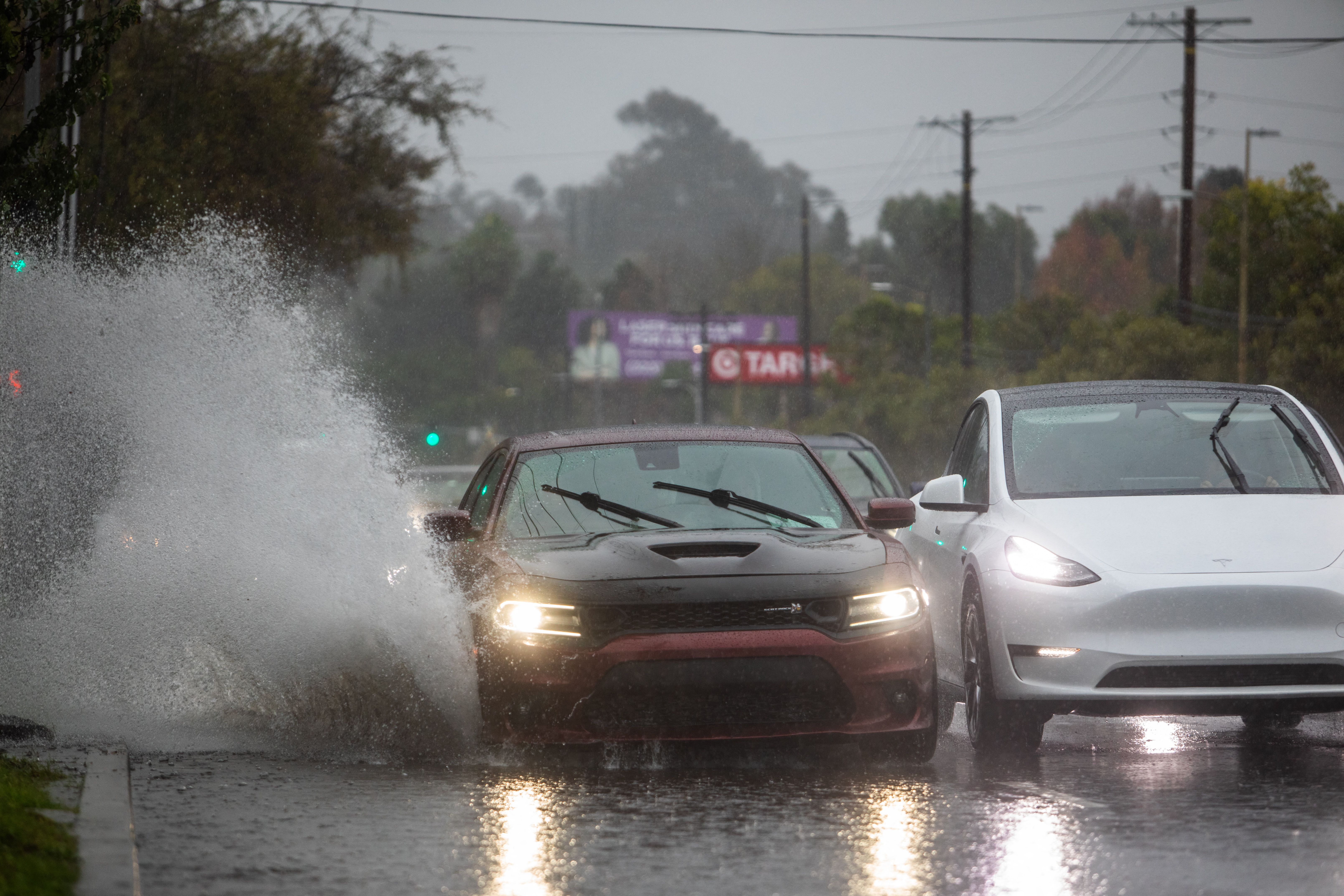
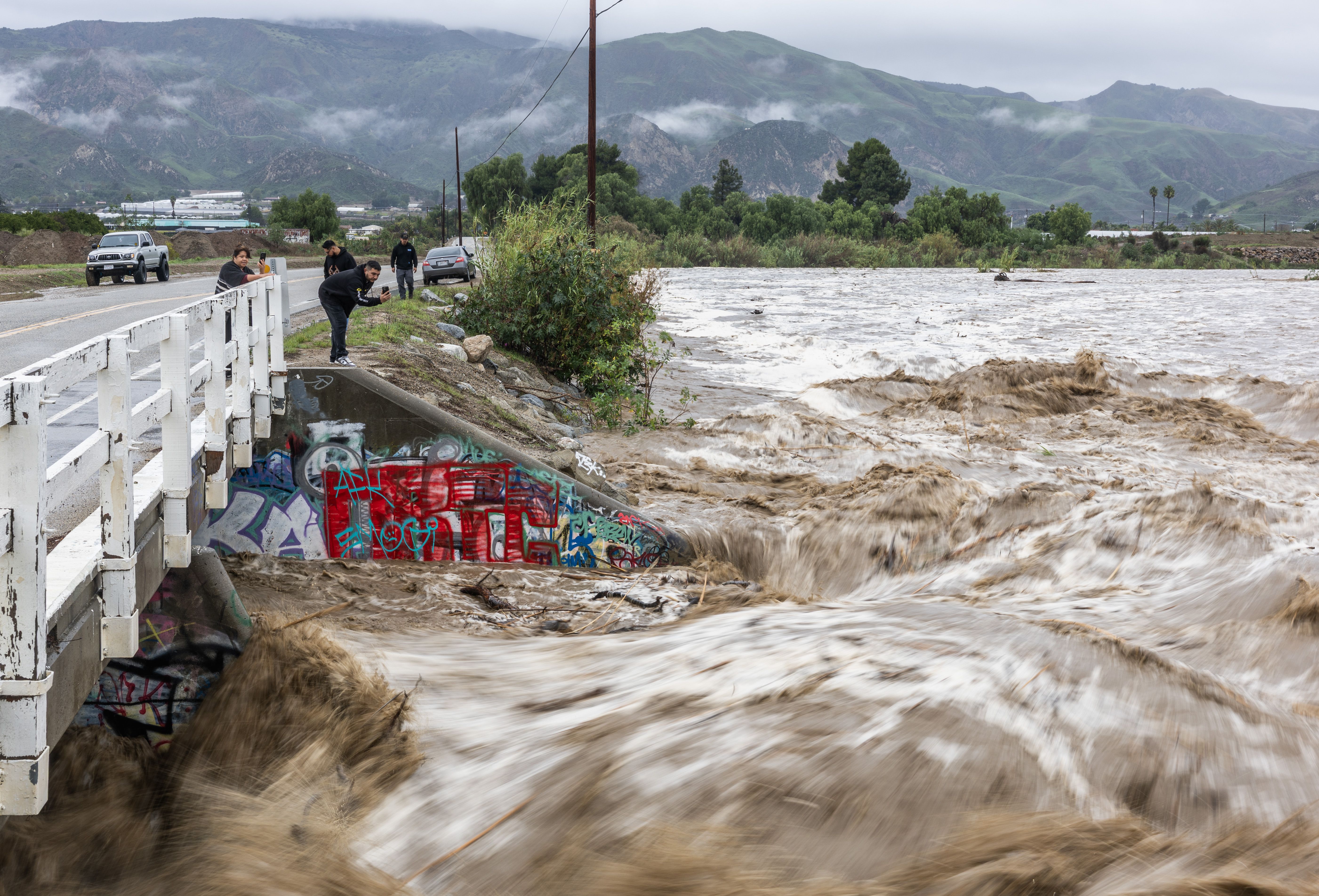
Flooding rains slamming Southern California forced families to evacuate their Los Angeles-area homes over Christmas in a deadly winter storm system that's set to disrupt holiday travel into Friday.
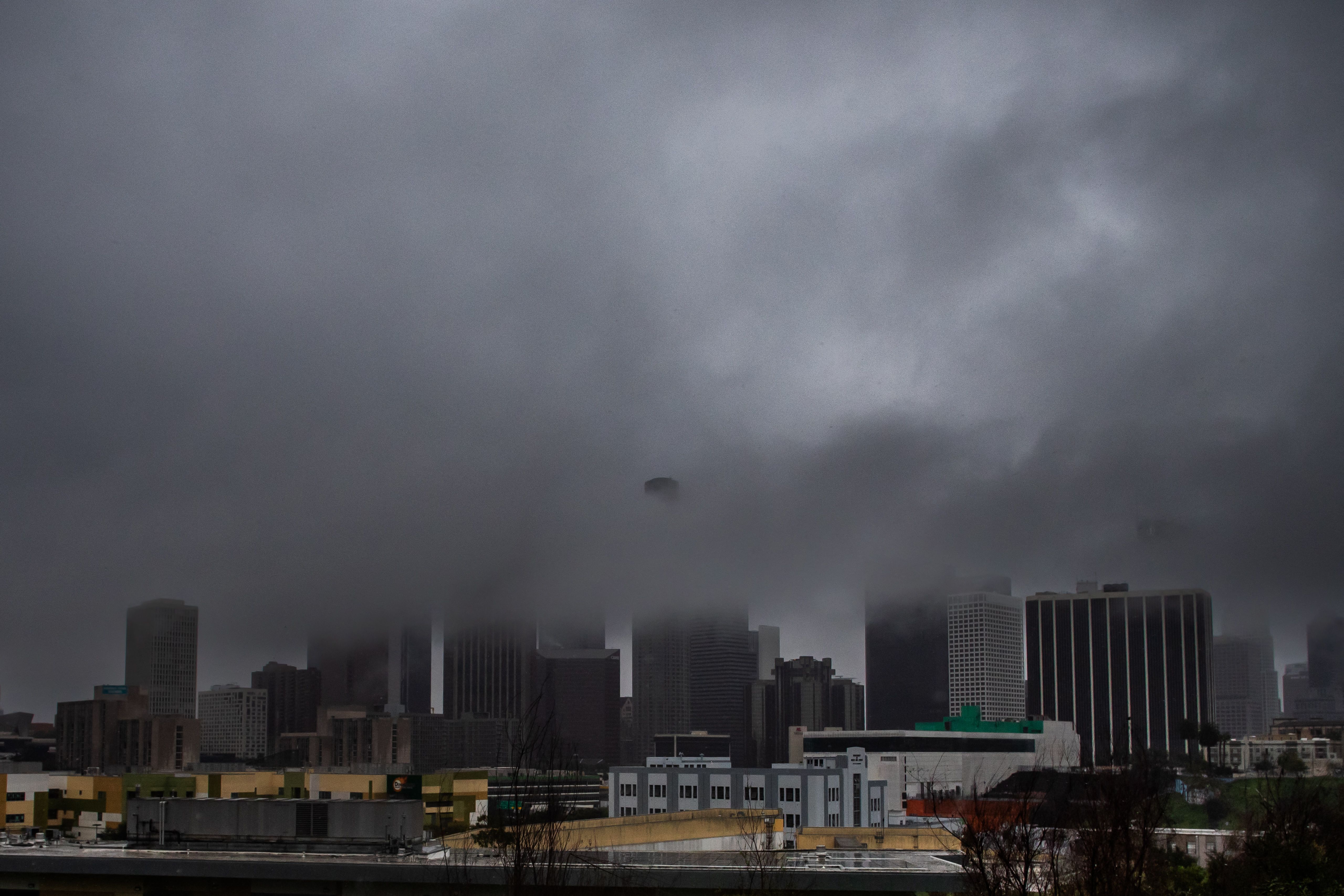
The big picture: Nearly 32 million people were under flood watches Thursday. California Gov. Gavin Newsom declared an emergency in multiple SoCal counties as atmospheric rivers triggered intense rain and winds to already saturated soil this week.
WRIGHTWOOD/DECEMBER STORMS INCIDENT
— San Bernardino County Fire (@SBCOUNTYFIRE) December 25, 2025
EVENING UPDATE
San Bernardino County Fire is devastated that many families are unable to be home together this Christmas due to the ongoing impacts of this incident. Our hearts are with everyone affected, and our crews remain committed to… pic.twitter.com/r4AjevZB1b
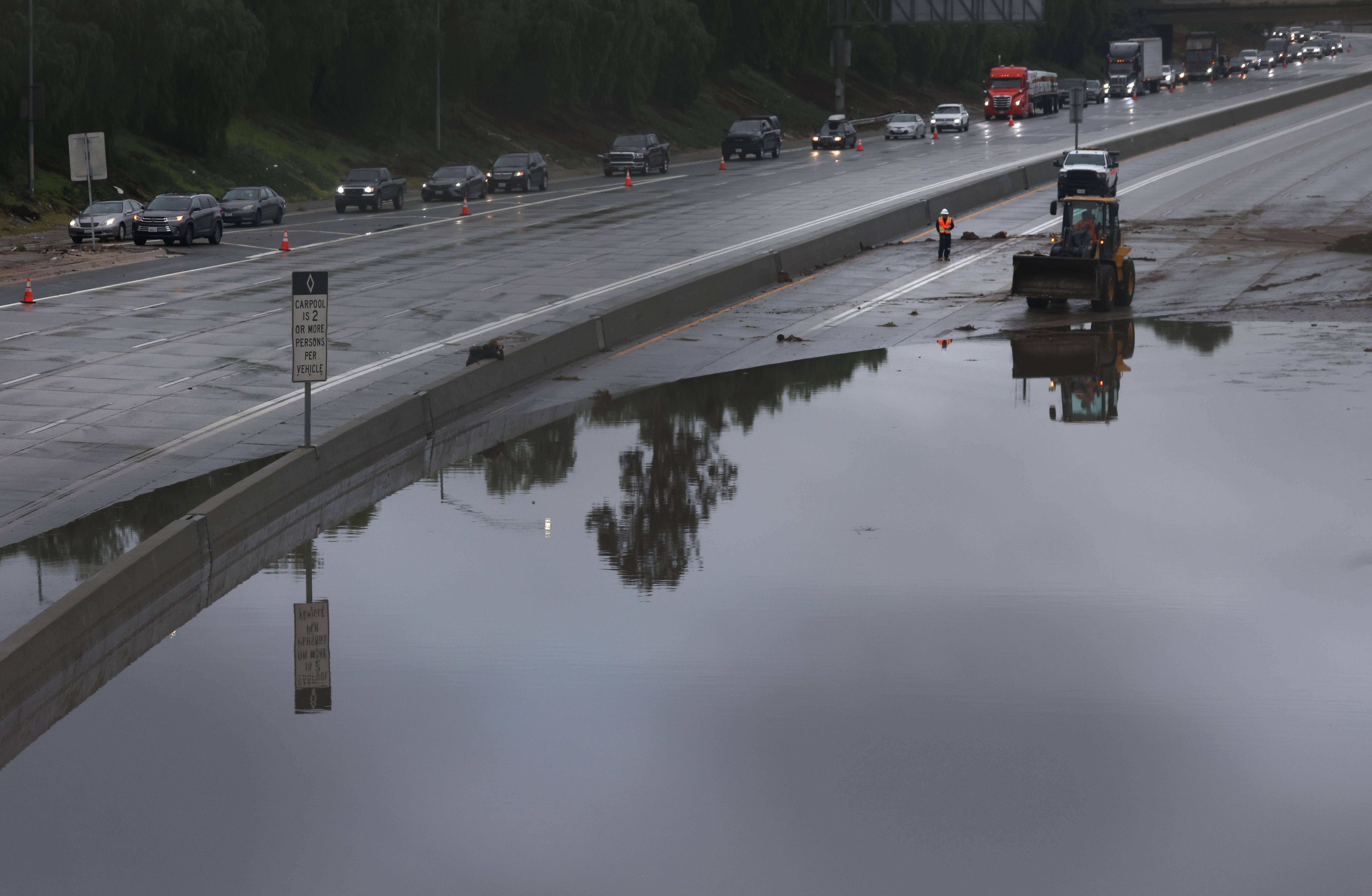
- The days-long extreme weather shut roads across the region, caused widespread power outages and triggered evacuations in San Bernardino and LA counties amid flash floods and mud and debris flows.
- At least three storm-related deaths were reported as of Christmas Day.
Threat level: The National Weather Service warned a "strong atmospheric river will continue heavy rain" over SoCal through Friday, with the heaviest rainfall in the LA Basin.
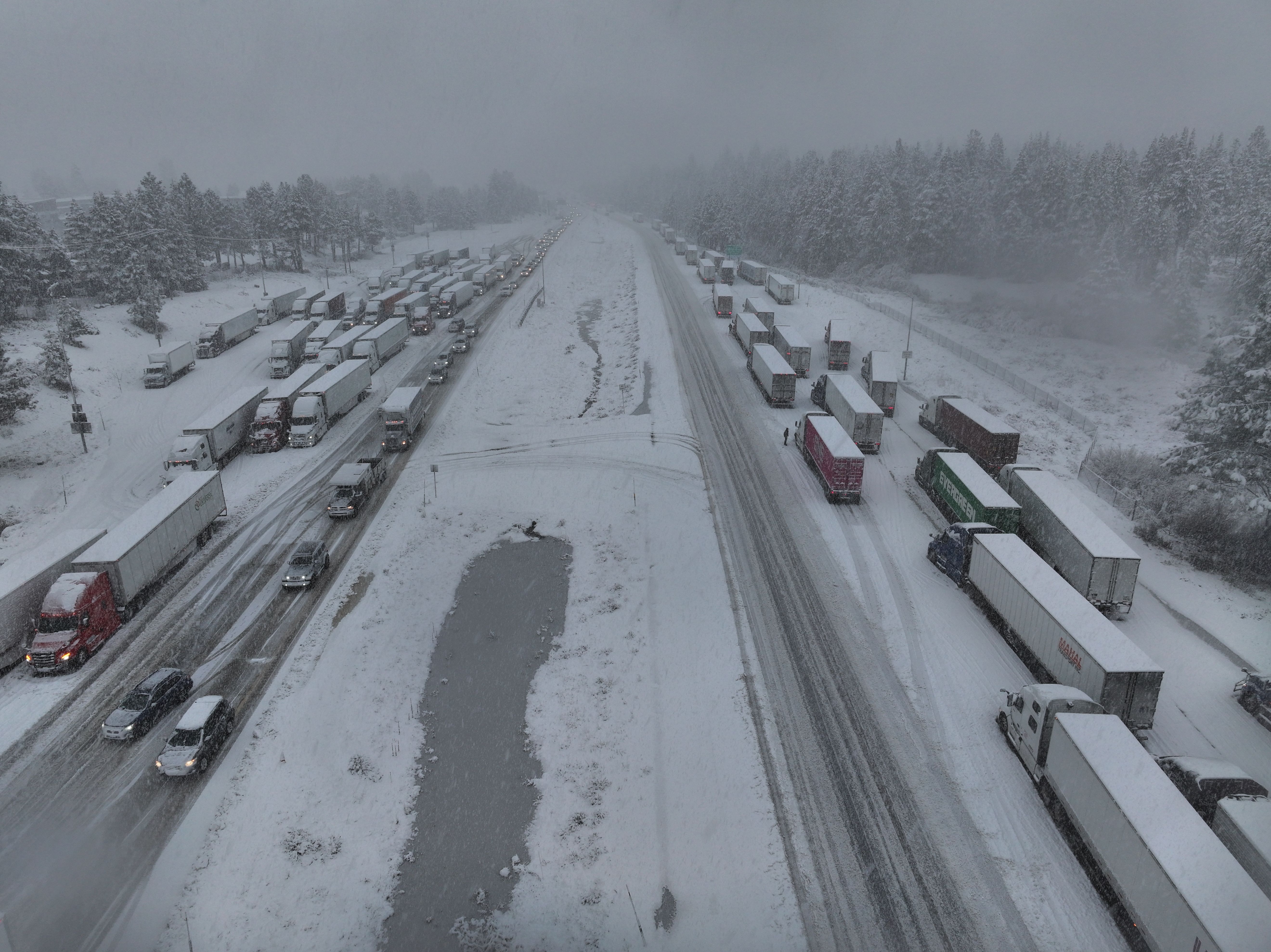
- "Flash and urban flooding is possible. A prolonged heavy snowfall has begun over the Sierra Nevada Mountains and will continue through Friday," per an NWS forecast discussion Thursday.
- Flash flood warnings were in effect in Santa Barbara, Ventura and Fresno counties Thursday, and flood watches remained in place for the rest of the LA and San Francisco Bay areas until Friday.
- "Bands of heavy rainfall continue to move across California ahead of another developing area of low pressure in the Pacific," per the NWS, noting this would continue into Friday.
- "Hazards of flash flooding, strong winds and severe weather chances, and heavy snow in the high terrain of central and northern California are likely."
WRIGHTWOOD/DECEMBER STORMS INCIDENT
— San Bernardino County Fire (@SBCOUNTYFIRE) December 25, 2025
MORNING UPDATE
San Bernardino County Fire remains in unified command with the Los Angeles County Fire Department.
With a break in the weather this morning, crews were strategically placed in neighborhoods that were severely impacted by the… pic.twitter.com/CQbXnviLYY
State of play: Newsom proclaimed a state of emergency Wednesday in LA, Orange, Riverside, San Bernardino, San Diego and Shasta counties, citing heightened risks of flooding, landslides, debris flows, and rapidly rising creeks and rivers.
- "Recently burned areas in Southern California, including the Airport, Bridge, Line, Palisades, and Eaton Fire burn scars, face an increased threat of mudslides and debris flows as heavy rain continues," per the proclamation.
- LA Mayor Karen Bass also declared an emergency on Christmas Eve and noted an evacuation warning remained in effect through 11pm Thursday local time for the Palisades, Sunset and Hurst burn scar areas.
- While evacuation orders in San Bernardino County lapsed Thursday, those issued in LA County in burn scar areas were extended through 1pm Friday local time.
Zoom in: Much of SoCal experienced the "most ever" two-day rainfall for the Christmas Eve-Christmas Day period, according to an NWS statement Thursday.
- "For downtown Los Angeles, the total rainfall of 2.59 inches of rain through noon today has made the Christmas Eve-Christmas Day holiday period the wettest since 3.24 inches fell in 1971," the NWS said.
- More rain was forecast into Friday, and the NWS LA noted that flood threats would be exacerbated "due to the super saturation of all of the area," adding: "Any rainfall that occurs will immediately turn to run off."
- NWS San Francisco said Thursday afternoon the region faced "scattered storms, and "small hail and an unconfirmed funnel cloud" had been reported. Although widespread damaging winds had generally eased, there were "still reports of gusts near 50 mph," it said.
- The San Diego NWS warned of a "secondary surge of moisture set to move through" late Thursday into Friday afternoon.
Yet another round of heavy showers and thunderstorms, some strong to even severe, immediately inbound into the SF Bay Area this evening. Yet more strong/damaging winds likely, plus torrential downpours & urban flooding in some areas. A brief tornado remains possible. #CAwx pic.twitter.com/Frj6s0KKXj
— Dr. Daniel Swain (@Weather_West) December 26, 2025
Of note: The first storm-related death occurred Sunday when a 74-year-old man was killed during flooding rains in Shasta County, officials said.
- The Mendocino County Sheriff's Office announced the death of a woman in her 70s a day later after witnesses reported she was "knocked off a rock by a large wave and swept into the ocean," per a statement.
- The third storm-related death occurred on Christmas Eve when a falling tree hit a San Diego man in City Heights, officials told local media.
Context: Atmospheric rivers are narrow currents of moisture-laden air that can transport vast amounts of water vapor thousands of miles.
Between the lines: Research shows climate change is adding more moisture to atmospheric rivers, leading to higher rainfall and snowfall totals.
- This current atmospheric river has subtropical origins, according to a blog post by Daniel Swain, a climate scientist at the University of California Agriculture and Natural Resources.
- It's "inherent warmth is being further boosted by anomalously warm ocean surface temperatures along and offshore the entire California coast," per Swain, who notes, "December 2025 is likely to end up as the warmest on record" across much of the U.S. West.
In photos: Powerful storms slam SoCal

Go deeper: Rainstorms are getting more intense amid climate change
Editor's note: This is a breaking news story. Please check back for updates.