Get all your news in one place.
100's of premium titles.
One app.
Start reading
The Conversation
The Conversation
Stephanie Brown, Lecturer in Criminology, University of Hull

Our medieval murder maps reveal the surprising geography of violence in 14th-century English cities

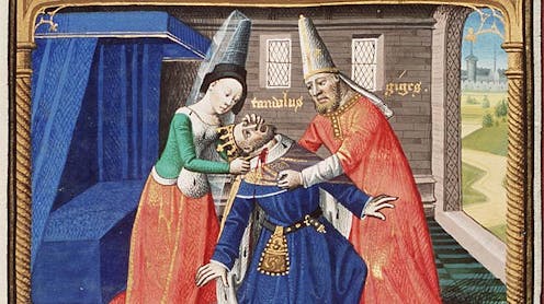
Bodyguard and queen kill King of Lydia. Illuminated manuscript of Cité de Dieu by Maître François (circa 1475). Author provided, CC BY-SA

A recent YouGov poll found that the word that Americans most associate with the middle ages is “violent”. Medieval towns may appear to be full of random violence, every alleyway a potential crime scene, every tavern brawl ending in bloodshed. But our recent research reveals a more complex, and in some ways familiar, reality.

In 14th-century London, York and Oxford, lethal violence clustered in a small number of hotspots, often no more than 200 or 300 metres long. Just as in modern cities, crime was not evenly spread but concentrated in certain streets and intersections where people, goods and status converged. The surprising difference is that in the middle ages, the busiest and wealthiest areas were often the most dangerous.

Sign up to read this article
Read news from 100's of titles, curated specifically for you.
Already a member? Sign in here
Related Stories
Top stories on inkl right now
One subscription that gives you access to news from hundreds of sites
Already a member? Sign in here
Our Picks
Fourteen days free
Download the app
One app. One membership.
100+ trusted global sources.