Get all your news in one place.
100's of premium titles.
One app.
Start reading
The Conversation
The Conversation
Science
Zhe Zhu, Assistant Professor of Natural Resources and the Environment, University of Connecticut

New satellite mapping with AI can quickly pinpoint hurricane damage across an entire state to spot where people may be trapped

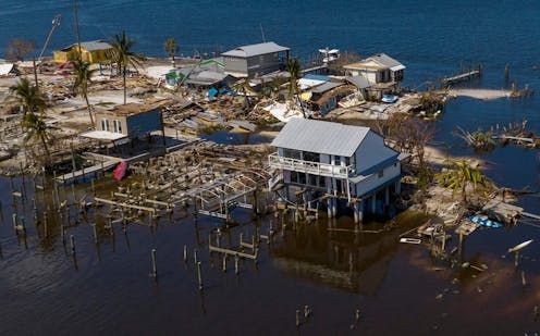
New satellite mapping techniques can quickly locate washed out and damaged areas. Ricardo Arduengo / AFP via Getty Images

Hurricane Ian left an extraordinarily broad path of destruction across much of South Florida. That was evident in reports from the ground, but it also shows up in satellite data. Using a new method, our team of spatial and environmental analysts was able to quickly provide a rare big picture view of damage across the entire state.
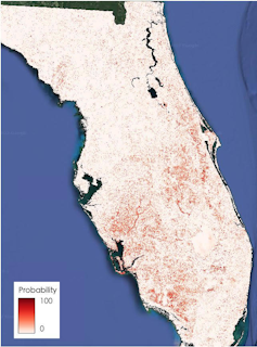

State of Florida with red dots across a large swath of the state from Charlotte Harbor to the Space Coast and for large distances on either side showing likely damage
Satellite images and artificial intelligence reveal Hurricane Ian’s widespread damage. The dark areas have a high probability of damage. Su Ye
Sign up to read this article
Read news from 100's of titles, curated specifically for you.
Already a member? Sign in here
Related Stories
Top stories on inkl right now
One subscription that gives you access to news from hundreds of sites
Already a member? Sign in here
Our Picks
Fourteen days free
Download the app
One app. One membership.
100+ trusted global sources.