Get all your news in one place.
100's of premium titles.
One app.
Start reading
The Conversation
The Conversation
Environment
Anna Nisi, Postdoctoral Researcher in Biology, University of Washington

New maps show high-risk zones for whale-ship collisions − vessel speed limits and rerouting can reduce the toll

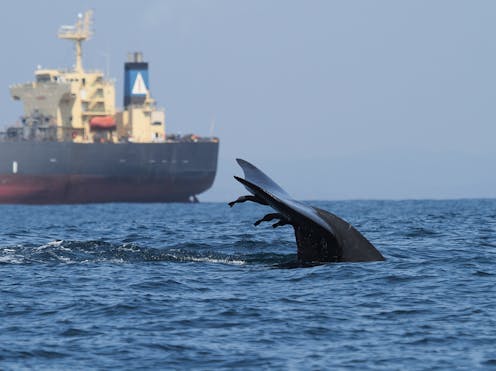
A blue whale swims close to a large vessel near the Port of Colombo, Sri Lanka. Asha de Vos, CC BY-ND

Imagine you are a blue whale swimming up the California coast, as you do every spring. You are searching for krill in the Santa Barbara Channel, a zone that teems with fish, kelp forests, seagrass beds and other undersea life, but also vibrates with noise from ship traffic. Suddenly, the noise gets louder.

You start to make a slow, shallow dive, but without much urgency – after all, your species evolved over millions of years without this mysterious noise, so why would you know what to do when you hear it? A minute later, you are fatally struck by a container ship.
Sign up to read this article
Read news from 100's of titles, curated specifically for you.
Already a member? Sign in here
Related Stories
Top stories on inkl right now
One subscription that gives you access to news from hundreds of sites
Already a member? Sign in here
Our Picks
Fourteen days free
Download the app
One app. One membership.
100+ trusted global sources.