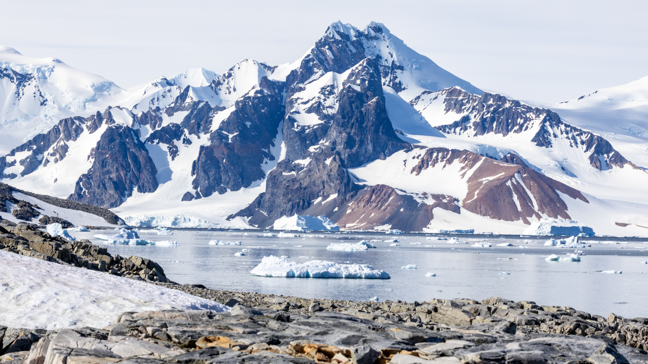
Scientists have mapped the bedrock beneath Antarctica's massive ice sheet in unprecedented detail, revealing hidden structures that form the glacier.
The ice sheet, which spans more than 5.4 million square miles (14 million square kilometers), shrouds underlying mountains, valleys, lakes and basins, according to a new study published in the journal Science on Thursday (Jan. 15).
This polar landscape below the ice has long been one of the inner Solar System's least mapped planetary surfaces, the team wrote in the study. Geological features shape how ice flows from below, sculpting the glacial surface, and a clearer picture of this process could help scientists predict how ice changes in response to warming.
Yet much about the landscape under the ice has been uncertain, because ground and air surveys are difficult in the region. Scientists often estimate information between distant or irregular survey points, for example, which can miss valleys in the bedrock that guide ice flow.
In the new study, researchers addressed this gap by combining high-resolution satellite images of the ice sheet surface with ice thickness measurements, and an ice flow analysis based on the physics of how ice flows over bedrock. The scientists integrated these data to create a continent-scale map of Antarctica's topography under the ice.
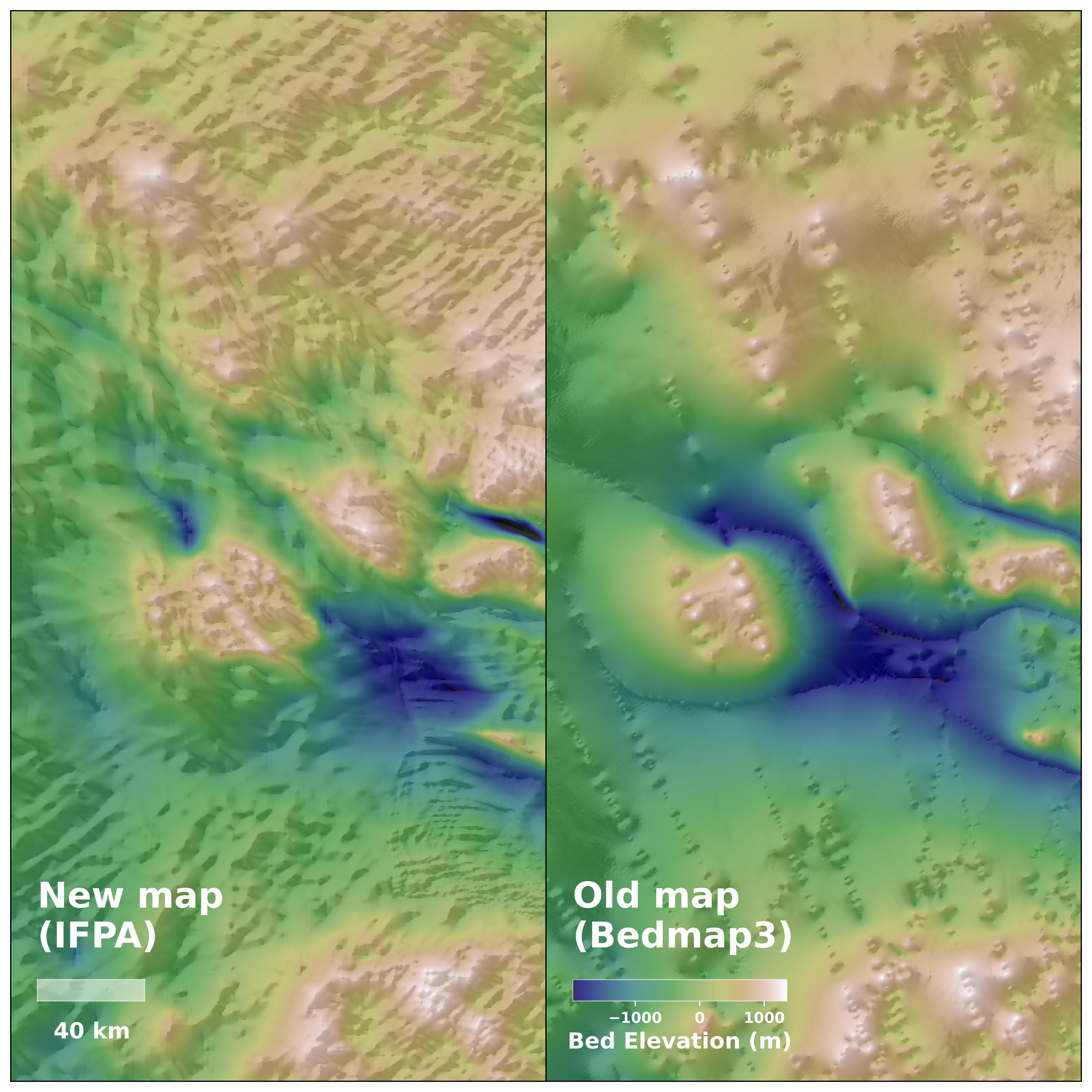
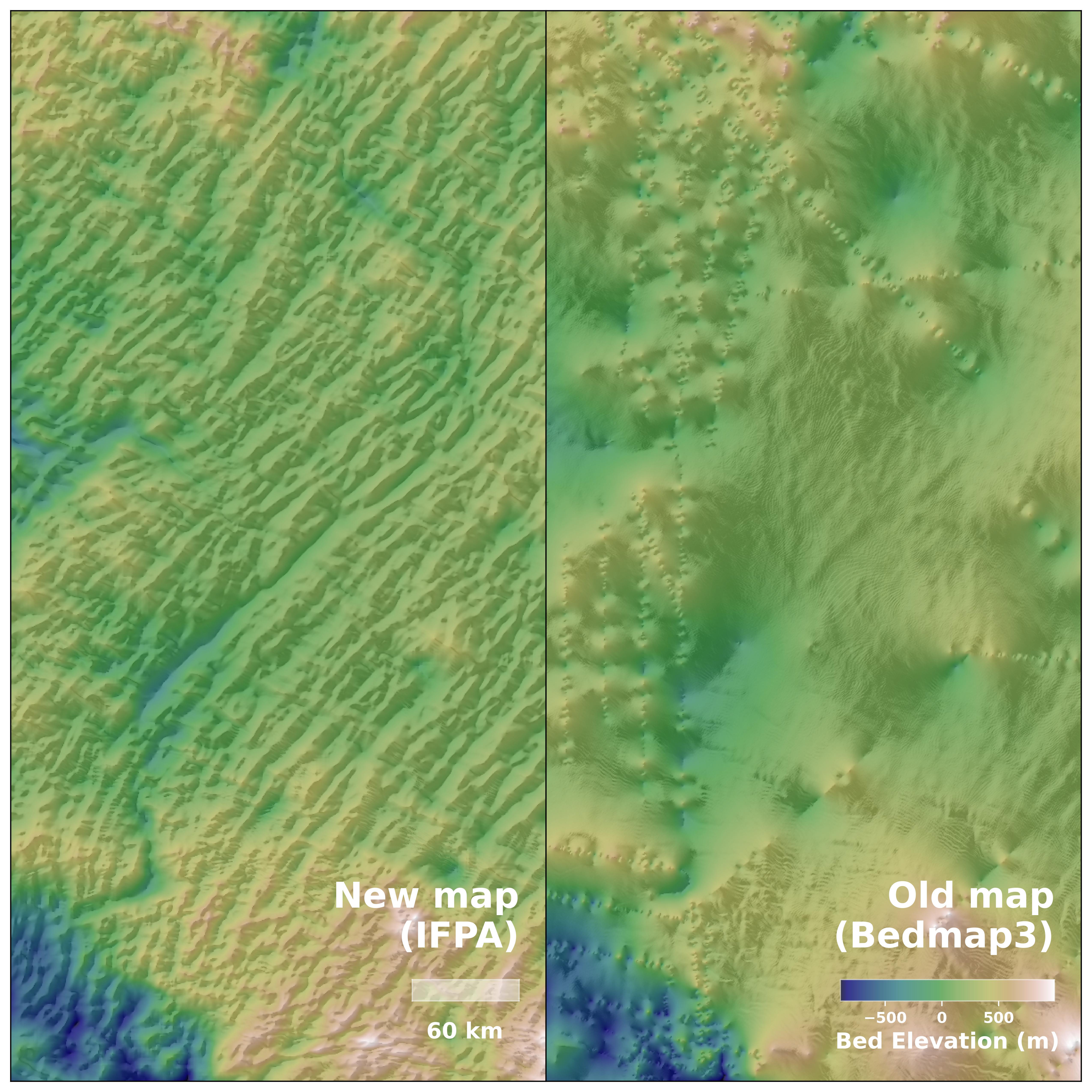
The extensive map revealed features 1.2 to 18.6 miles (2 to 30 kilometers) beneath the ice sheet that were previously unknown or unclear to science, such as river channels stretching hundreds of miles, which could be traces of the landscape predating the ice sheet.
The map also uncovered sharp transitions between highland and lowland terrain, suggesting tectonic boundaries. In one region where previous air surveys had predicted an ancient river landscape covered by ice, the new map actually identified deep valleys underneath.
The map enables scientists to observe how the ice sheet has evolved and interacted with underlying topography. Visualizing the processes affecting these glaciers can improve models of ice sheets and make projections of climate change-driven ice melt and sea-level rise more exact.