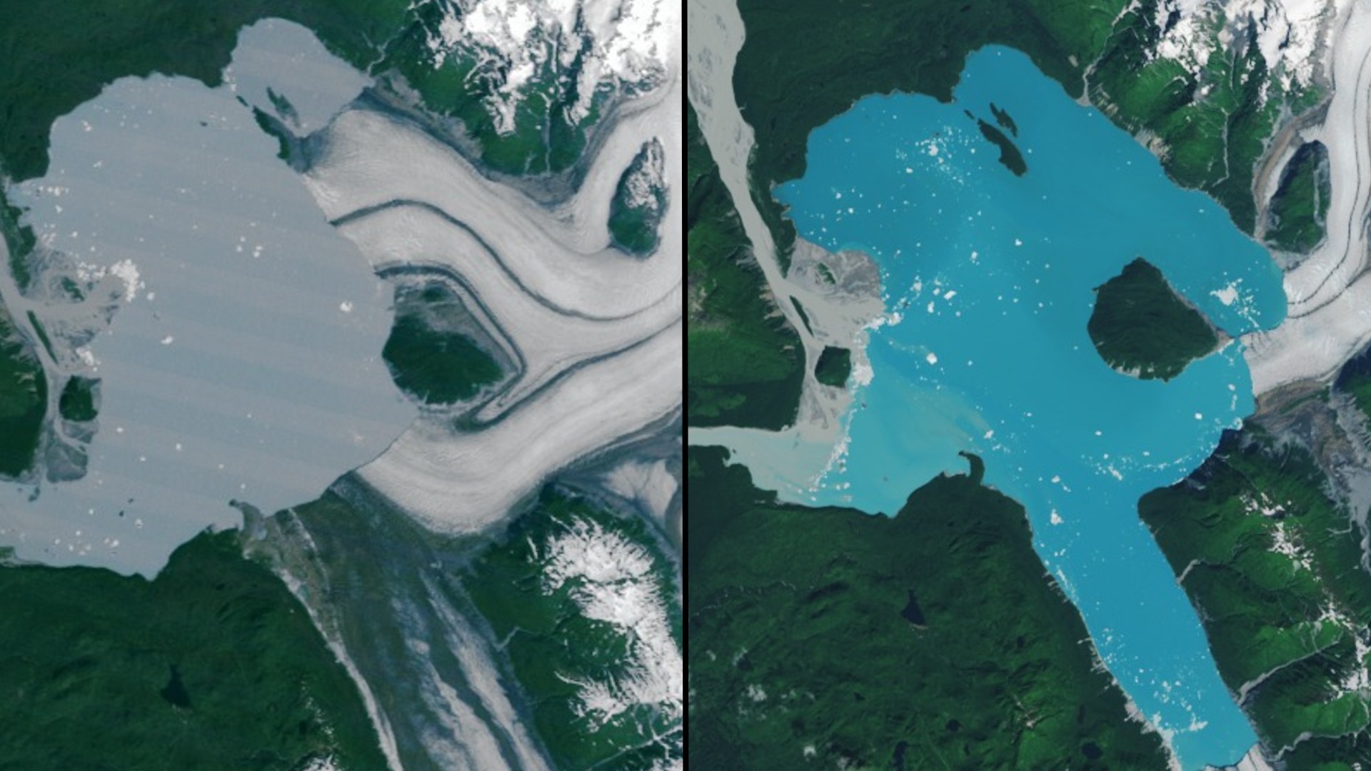
NASA satellite imagery has revealed a new island off Alaska's coast that emerged after long-standing glacial ice melted, isolating a small mountain that was once part of the mainland.
The island sits in Alsek Lake, where the Alsek Glacier has been steadily thinning and flooding the region with meltwater. Two Landsat images — captured on July 5, 1984 by the TM (Thematic Mapper) on Landsat 5 and on Aug. 6, 2025 by the OLI-2 (Operational Land Imager-2) on Landsat 9 — show the transformation in striking detail, according to a statement from NASA.