GPS enabled head units have ushered in a new era of navigation for cyclists. Riders can plan routes in advance, and push them to their cycling computers, which offer turn-by-turn navigation. In addition, many units - such as those from Garmin, Hammerhead and Wahoo - also offer ‘A to B’ style navigation, too, much like a car Sat Nav.
However, judging by the experience of one reader who emailed Cycling Weekly with the subject line ‘Help! My cycling computer is trying to kill me!’, the experience isn’t always as smooth as we’ve come to expect from the apps we use elsewhere in our lives.
Our reader, who wanted to use mapping for rides across London, said his sense of direction was “appalling” and that he found the city streets “intimidating due to all the cars”. Using Apple Maps, he was able to navigate well, “the directions on Apple Maps are cycling specific and always prioritise the cycling infrastructure,” he said, adding “I’ve been really pleased with the results and I’m now more than happy cycling around in relative safety.”
However, when he tried to navigate from A to B using a cycling computer, things took a turn for the worse. A 3.5 kilometre/2.2mile route from St Pancras to London's Rapha store resulted in a 10.6km/6.5m “scenic tour of London’s best tourist destinations”. Adjusting the settings did allow him to reduce this to 3.7km/2.2m, but with “200 turns”; feeling unsafe on busy roads, he concluded that the route planning didn’t “prioritise cycling infrastructure”.
It’s impossible for us to say exactly what settings our reader was using to return a 10.6km/6.5m route, and he was equally unimpressed having tested out the same function offered by a range of providers. Whilst the accusation that the computer had grave plans for our reader is somewhat exaggerated, cycling's GPS navigation devices sending users on wild goose chases is not unheard of.
The email raised an important question: why is ‘A to B’ style navigation often so much better on the likes of mass market apps, like Apple and Google Maps? And, how can we get the most from more cycling specific apps?
How are routes created?
All navigational services start with base map data and the majority use OpenStreetMap (OSM), a free open-source website that’s built and updated by a community of users, with the map then sharing its data to websites and apps. It’s used by cycling specific route planner Komoot, athlete social media and route planning platform Strava, and Apple Maps to name but a few.
Given that OSM relies on regular updates, it’s possible that you might plot a route and then encounter some unseen issues on the journey itself. As Rob Marshall from Komoot told us, when asked how best to plot cycling-specific routes, “firstly, the cycling infrastructure must be added to OSM and tagged correctly”.
Google Maps features a Geo Data Upload tool, which allows government agencies to have their latest bicycle infrastructure incorporated into its route planning. On its website it says that in order to supply the most up-to-date bike routes it uses “a combination of machine learning, complex algorithms and an understanding of real-world conditions based on imagery and data from government authorities and community contributions.”
Real-world data drawn from user contributions and activities is also integral. And, here’s where the distinction is likely to come in. Whilst, for example, Strava has over 100 million athlete users, cycling specific route planning apps are always going to be operating with a smaller base than the likes of Google and Apple Maps. Search results suggest that Google Maps “has over 1 billion active users monthly.” According to a recent Wall Street Journal article, the lesser used ‘Waze’ driving app has 151 million monthly active users.
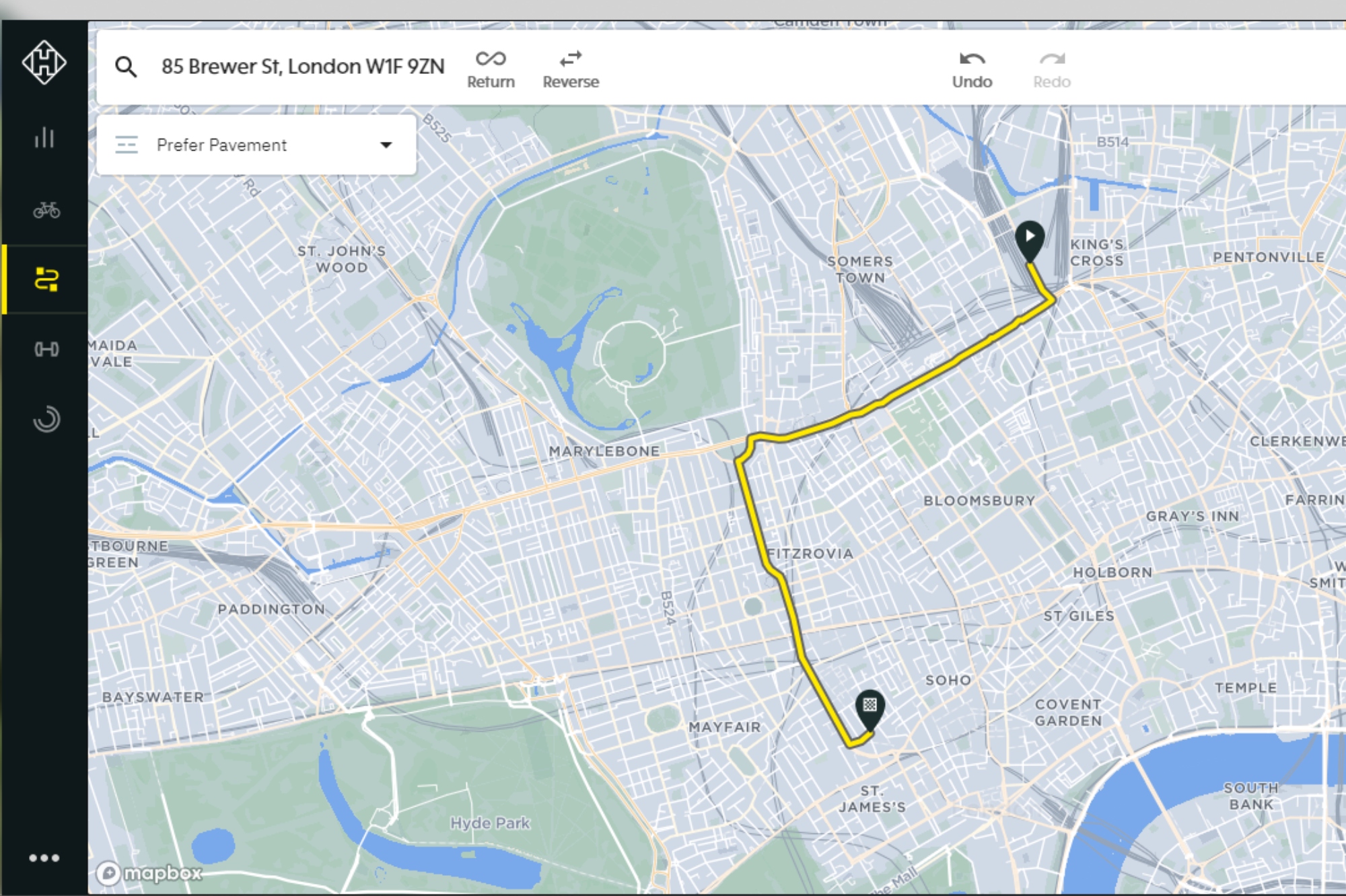
That said, a cycling-specific brand like Hammerhead can rely on its specialist knowledge when creating A to B routes. The makers of the Karoo 2 head unit told us that its navigation feature, calculated on-device, uses a “proprietary routing algorithm developed by Hammerhead's full-time navigation software experts”, with source data pulled from OSM.
“Cycling infrastructure, such as bike lanes, is weighted over busy roads,” a company spokesperson confirmed. “Hammerhead uses a combination of all the factors that matter to a cyclist, from the presence of dedicated infrastructure, to the size of the roadway, elevation changes and more”.
So, if you just want to get from A to B and navigate on the fly, there are options. Choosing to rely upon a larger network might end up being your preference. As our reader put it, “buy a posh elastic band for £6.11 from eBay to loosely strap your mobile phone to your handlebars.” We’d probably recommend a cycling specific phone case, but that’s up to you.
You can also choose the A to B navigation provided by the likes of Hammerhead, Wahoo and Garmin. However, the routing is always going to be swayed by the preferences of a user base that, whilst large, is much smaller than that of mainstream apps. Which is where the ability to download and edit routes can really be of benefit.
How can you optimise cycling specific route planning software?
Jon Stone is a former courier and founder of the London Cycle Routes YouTube channel, a resource dedicated to helping people find the best routes to get around the city.
When I was cycle couriering, I worked for Deliveroo and Uber Eats. The driver apps have their own maps built in. They were mostly alright, except when they weren't! When things went wrong it was mostly a case of getting lost. There were no gradients on the maps, I once got sent up an insane hill, fortunately the guy I delivered to at the top tipped well!
For my London Cycle Routes channel I actually don't tend to use app route finding, I pretty much research and plan all my own routes by hand. I've not found an app that can replicate that yet.
I do use several tools when planning though... I contribute to the Safe Cycle London map which is a big database of infrastructure in a Google Map layer, I wouldn't be able to work without it. I also check out parts of routes I'm not sure about in advance on Google Streetview to see what infrastructure is like.
Most of it is my own knowledge, going on scouting expeditions, there's a lot of keeping on top of new developments as well - there's a group of us on X who obsessively look for ever tidbit of new cycling infrastructure in London and I try to incorporate that into routes or work out what sort of new ones it opens up.
If Google Maps and the like ticked all the boxes for bike riders, then cycling specific entities wouldn’t need to exist. But, they do. So, how can you get the most from them?
The capabilities offered by these apps are best used when planning routes in advance, either for travel or pleasure/training, and then editing them - guided by a combination of in app tools, additional resources, and local knowledge.
Use customisable settings - Cycling specific platforms have a greater understanding of the needs of different types of cyclists, and different types of rides. They use their data to supply alternative routes, based on your preferences, if you choose to use the settings.
“Komoot has several different sport-type routers and each uses a different routing planning algorithm to try and ensure the user gets the best suggested route for their chosen sport. Essentially the algorithms add weights/penalties to different data tags, like distance, elevation, surface, waytype, and many many more”, Marshall explains.
So, for example, if you’re using Komoot’s Road Cycling router, off road paths will receive a high penalty while a flat road will be favorably weighted. As a cyclist using komoot you can also specify touring, gravel and mountain biking and choose your fitness level before you create your route.
On Strava you can prioritise traffic-free routes or minimise elevation gain, for example. Whichever mapping service you're using, look to add as many ‘data tags’ as you can to help fine-tune the route to your specific needs.
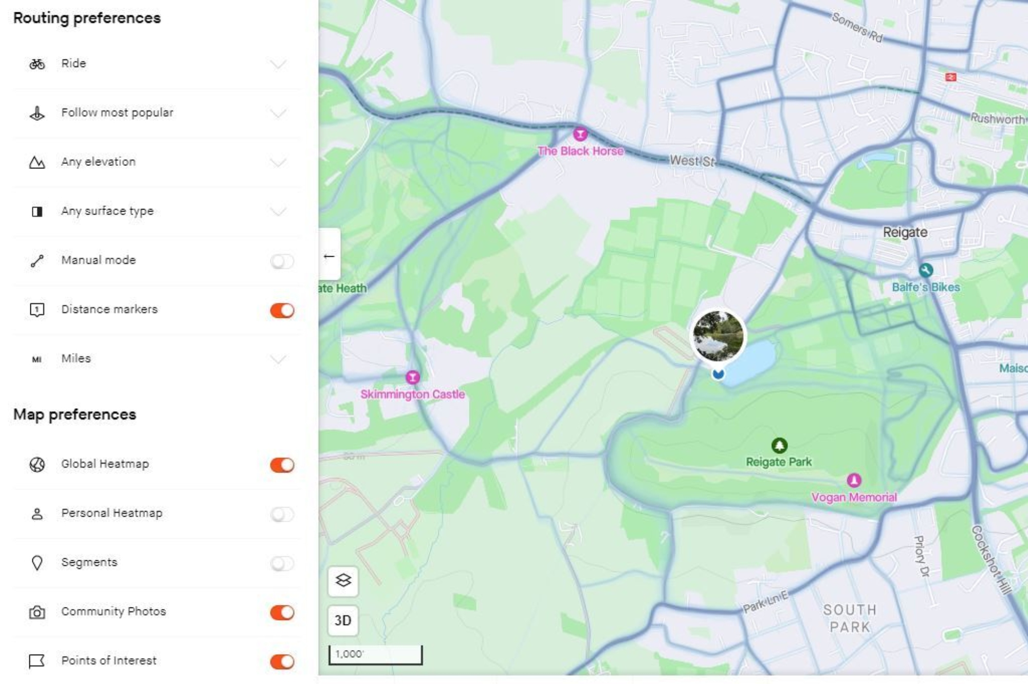
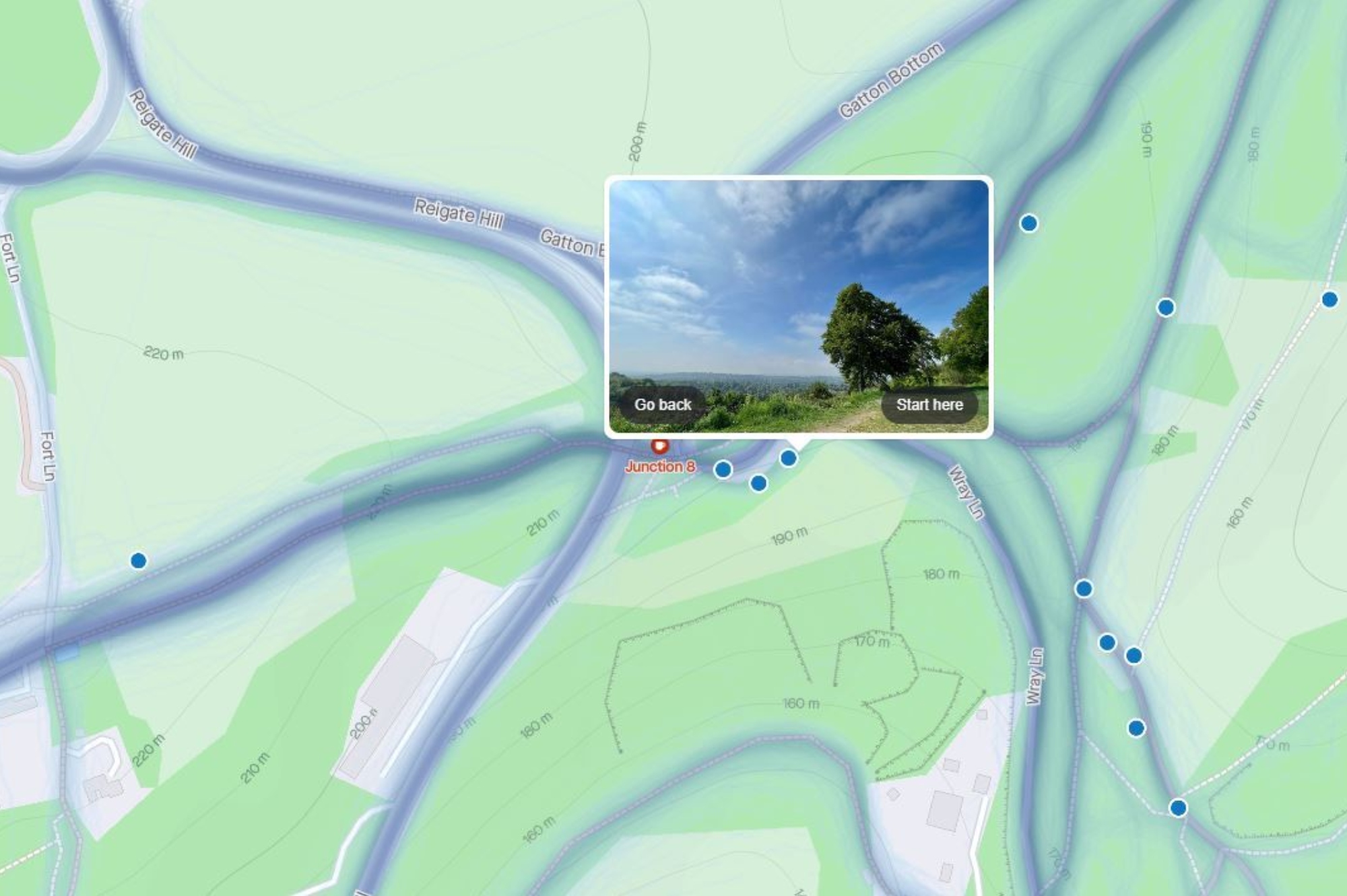
Use photos and street view options - Strava has recently integrated photos into its routes that allows subscribers to see images of exact locations, and Komoot has been offering this for some time, with most ‘tours’ supported by user uploaded images of the roads and trails you can expect to enjoy.
These images can provide another layer of detail and help determine whether a route, or section of a route, is right for you.
Komoot has also layered on Google Street View, Marshall said: “Safety is a high priority for Komoot and this is one of the reasons we added Google Street to the Route Planner, so if users were concerned about road size, they could get a detailed look.”
Similarly, most services offer an option to take in points of interest, or route highlights, drawn from user suggestions. These can range from a stunning view on a particular road to a recommended café stop. Strava has introduced custom waypoints, allowing you to search for a particular landmark, etc. and then add it to your custom route.
Use heatmaps - Strava incorporates a heatmap into its service, which is updated monthly to show public user activity (using their GPS location) in any chosen area. In essence it demonstrates the popularity of a route.
Putting theory to the test
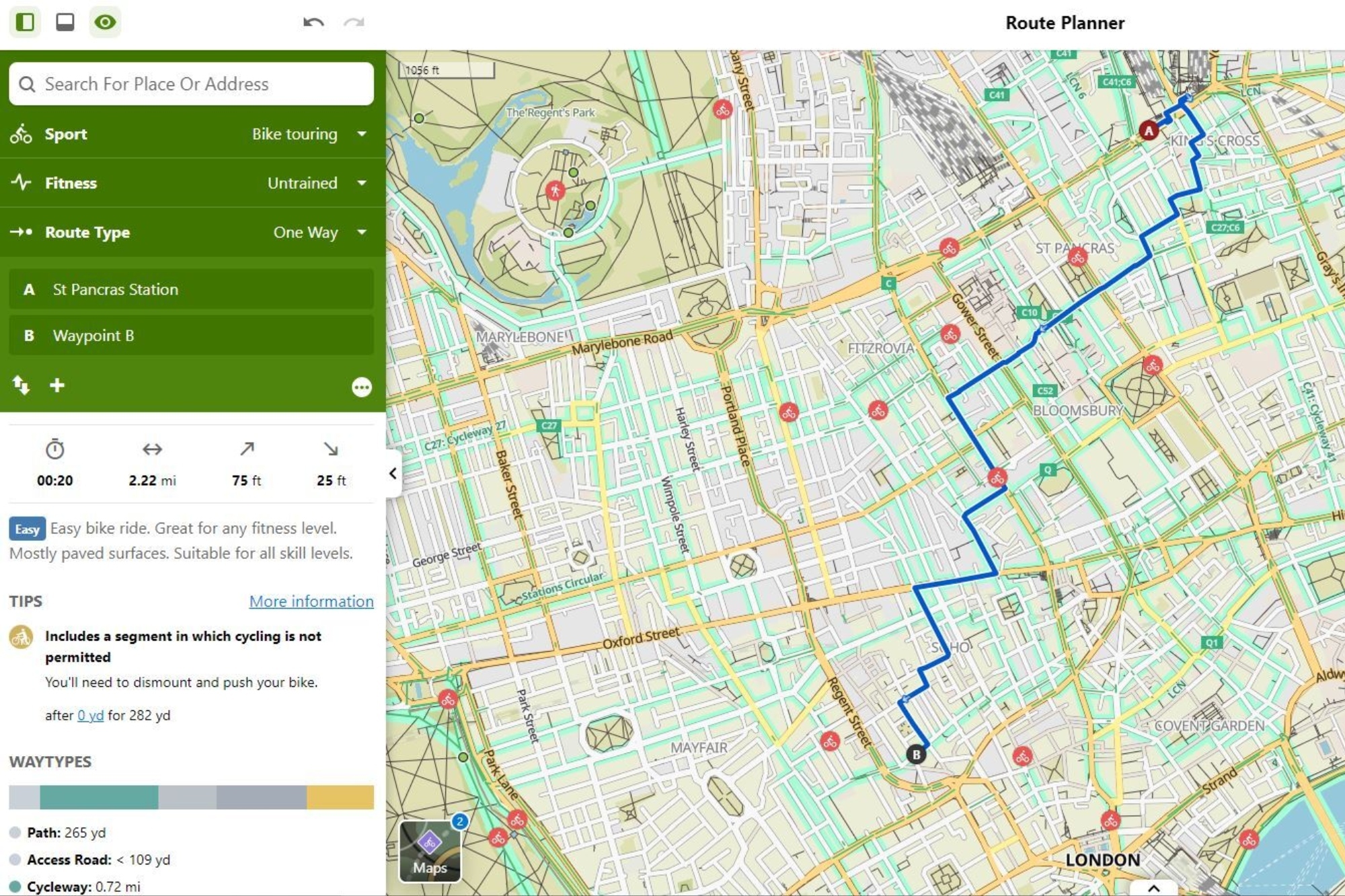
I decided to plot the reader’s route from London’s St. Pancras Station to the Rapha on various mapping services. On Komoot I first used the Touring option, with the route described as: ‘Easy bike ride. Great for any fitness level. Mostly paved surfaces. Suitable for all skill levels.’
Time, distance, uphill and downhill are all clearly shown as is a more detailed breakdown of the route using both waytypes and road surfaces. On this 2.18 mile ride it said I’d encounter a range of roads including singletrack, cycle path and street, with cobblestones present alongside the paved and asphalt surfaces. It also pointed out that there were steps involved and that I'd likely need to carry my bike for 19 yards.
Switching to the Road riding option lengthened the journey a tad but shortened the estimated time it would take me. This is worth highlighting as it demonstrates the ability to ‘customise’ a route to best suit your needs. While many of us might prefer to avoid cars where possible, for confident road cyclists, sharing a multi use path with pedestrians could be frustrating. Equally, keeping speedy roadies off these paths could also be beneficial to everyone's safety, so the ‘road’ algorithm sensibly avoids these shared-access paths.
Further engaging with the route and the route insights allows you to explore in more detail and then change the journey accordingly. Don’t fancy the cobbles? Spotted a route warning? Want to take in a suggested ‘highlight’? By dragging the tour line I was able to further customise the route with relative ease.
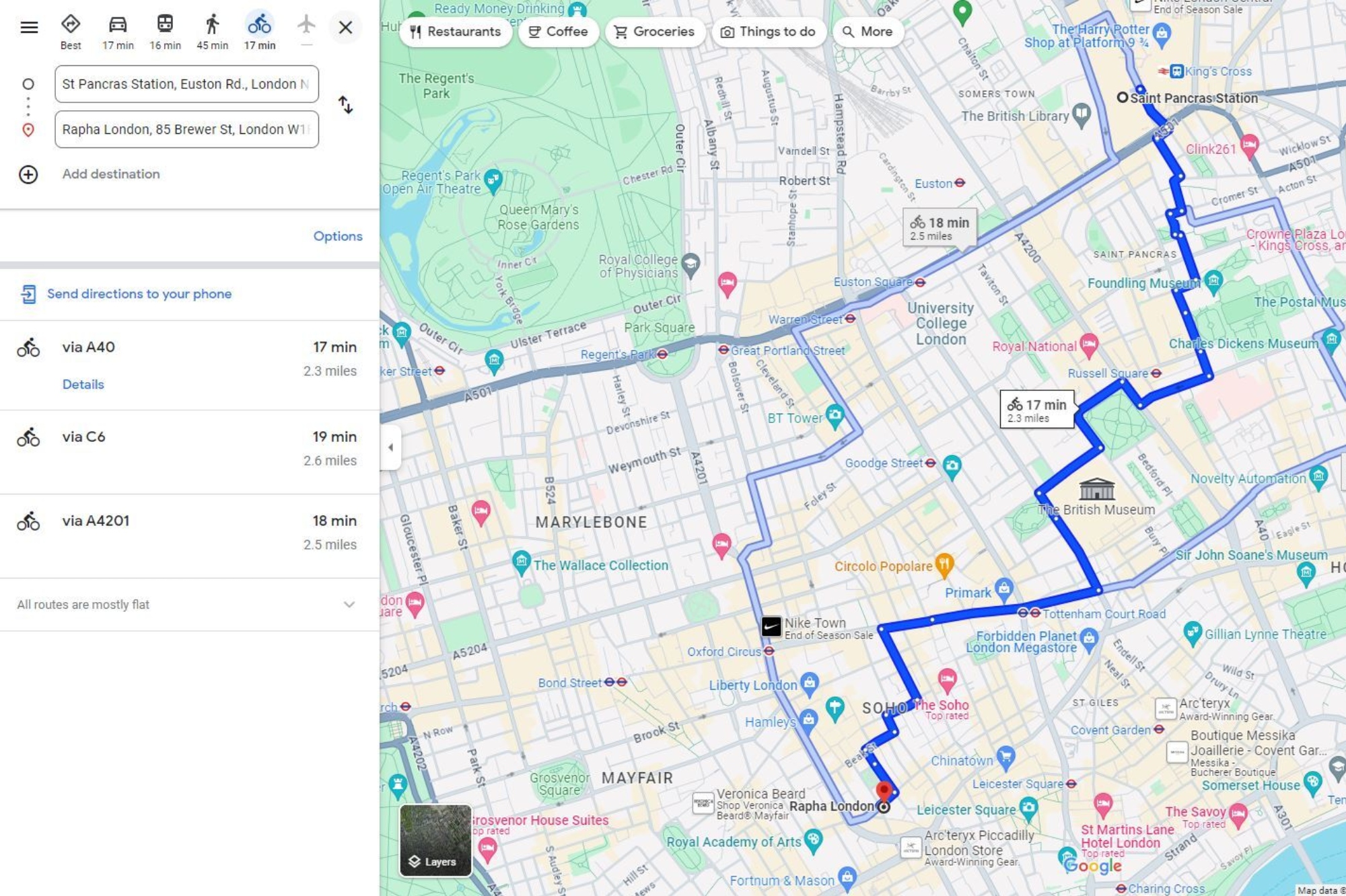
Putting the same start and end point into Google maps, and using the cycling mode option, creates a similar looking journey, albeit with three options offered. Again, the ability to customise the route is there, done in a similar ‘drag the line’ fashion, as well as to add the previously mentioned ‘layers’ to the route map.
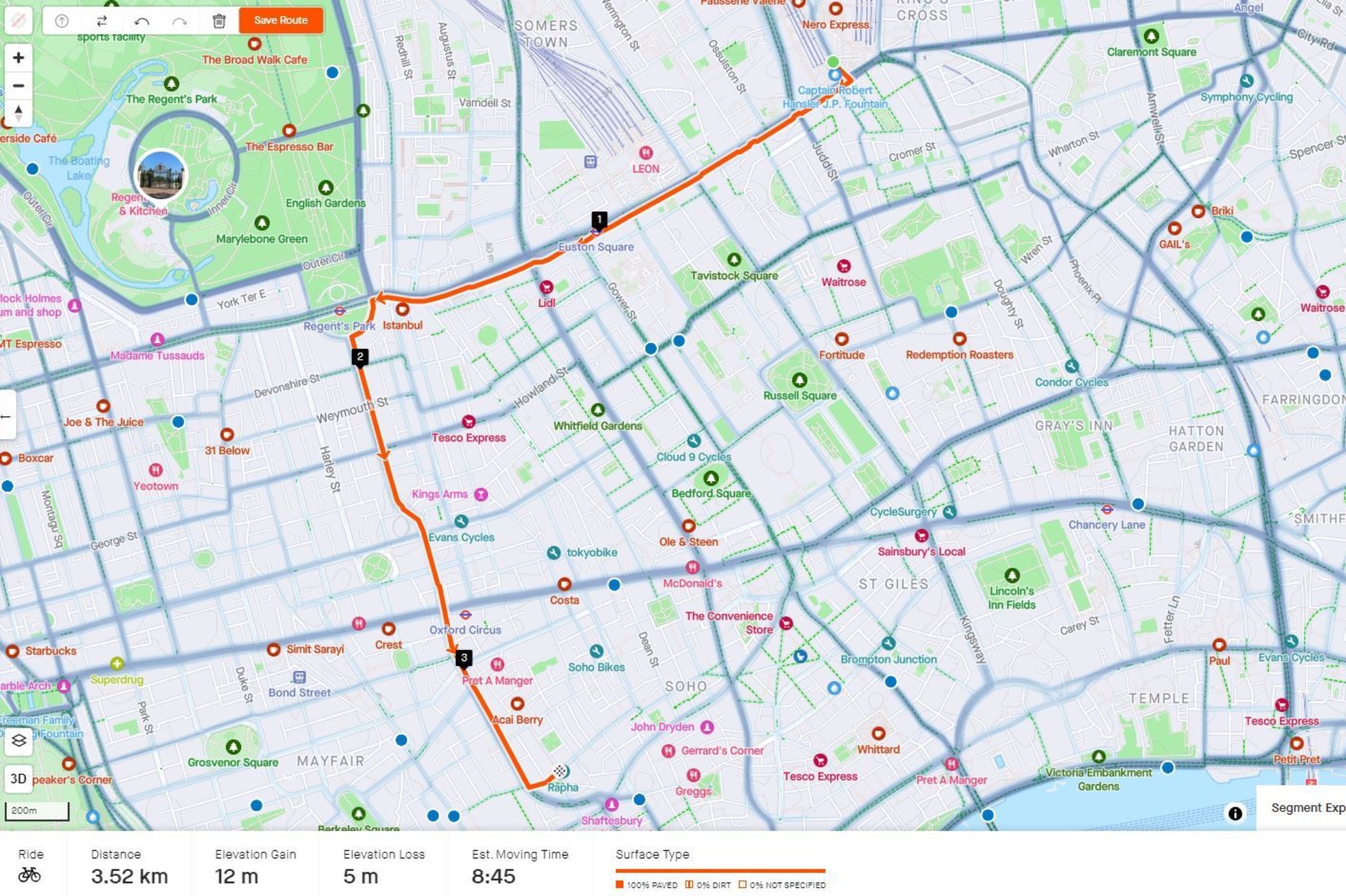
Interestingly Strava serves up a far more straightforward route but one that used ‘main’ roads. Because I’d chosen to plot the route using the ‘most popular’ function it could indicate a bias on Strava’s heat maps towards ‘fast’ roads ridden by experienced or confident riders.
We say
We’re all for the continued improvement of route planning, especially when it comes to incorporating cycling infrastructure. However, as we’ve highlighted, any route offered by a service is essentially only as good as the data available. Fortunately, the open-source nature of OpenStreetMaps, and the community element of many navigational websites and apps, means there’s always an opportunity for continued updates and improvements.
In the meantime? The best way to ensure that your route is likely to live up to expectations is to explore your chosen navigational service and use the custom features available to fine tune the route as best you can, especially if you have specific needs.
We’d also encourage you to use the breadth of services on offer, allowing you to cross-reference one route against another. Not only does it give you better insight to the route, but it also allows you to counterbalance the strengths and weaknesses of the various route planners.