Get all your news in one place.
100's of premium titles.
One app.
Start reading
Space
Space
Science
Keith Cooper

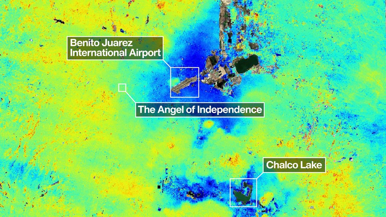
Mexico City is sinking up to 14 inches per year, satellite images show

A bright green view of Mexico City with blue areas surrounding the airport and chalco lake. The angel of independence is also in a slightly blue area.

Mexico City is sinking, and a powerful new orbiting satellite that's monitoring changes in land levels all across the globe has discovered how quickly this is happening. It's all thanks to the mission's innovative dual-frequency band radar.

NISAR, the NASA–ISRO Synthetic Aperture Radar satellite, launched on July 30, 2025 as a joint partnership between NASA and the Indian Space Research Organisation (ISRO). Its mission is to track in real-time surface changes on Earth, from ground subsidence and the retreat of glaciers to and the movement of tectonic plates and the spread of wildfires — all to a precision of within a centimeter.
Sign up to read this article
Read news from 100's of titles, curated specifically for you.
Already a member? Sign in here
Related Stories
Top stories on inkl right now
One subscription that gives you access to news from hundreds of sites
Already a member? Sign in here
Our Picks
Fourteen days free
Download the app
One app. One membership.
100+ trusted global sources.