Get all your news in one place.
100's of premium titles.
One app.
Start reading
Space
Space
Science
Harry Baker

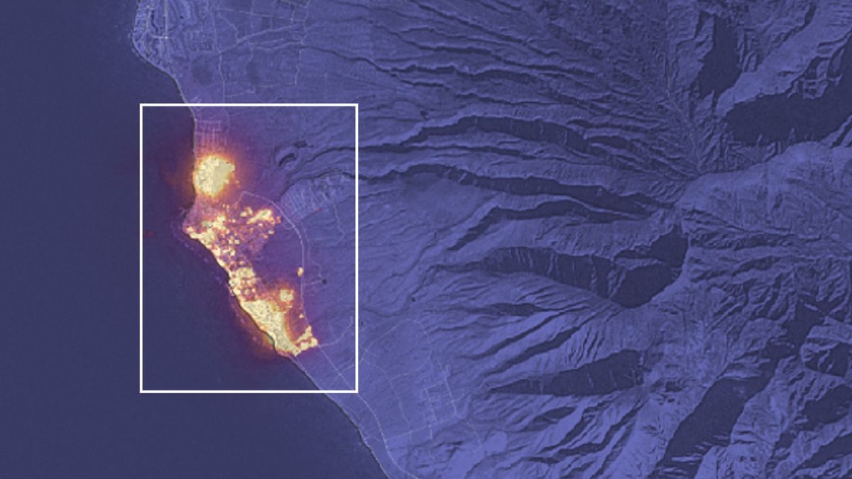
Maui satellite photo shows full scale of deadliest US fire in more than a century

a map of Maui with Lahaina highlighted y a white box. A majority of the town is covered in flames.

A new satellite photo has captured a somber aerial view of the devastating wildfire that burned through the town of Lahaina on Hawaii's Maui island last week.

On Aug. 8, fast-moving flames appeared on Lahaina's border and rapidly spread through the town, burning down buildings, exploding cars and filling the air with ash and smoke. Many survivors, who either fled the town or escaped into the ocean, reported knowing almost nothing about the fire until the flames were almost right on top of them, CNN reported.

Sign up to read this article
Read news from 100's of titles, curated specifically for you.
Already a member? Sign in here
Related Stories
Top stories on inkl right now
One subscription that gives you access to news from hundreds of sites
Already a member? Sign in here
Our Picks
Fourteen days free
Download the app
One app. One membership.
100+ trusted global sources.