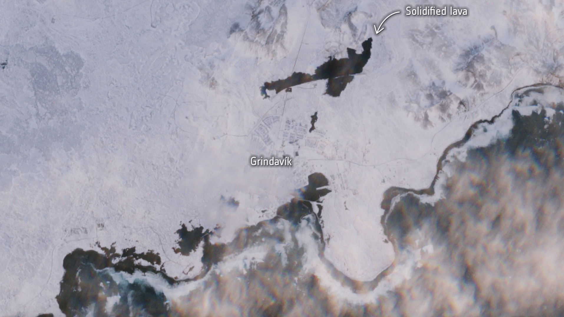
Solidified lava surrounds the small Icelandic town of Grindavík in a new satellite photo, following recent volcanic eruptions.
Satellite imagery taken on Jan. 27 by the European Space Agency's (ESA) Copernicus Sentinel-2 mission shows dark patches of solidified lava near the fishing village of Grindavik in Iceland's Reykjanes Peninsula. Areas covered in the solidified lava stand out against the contrast of freshly fallen white snow, ESA officials said in a statement describing the new image.
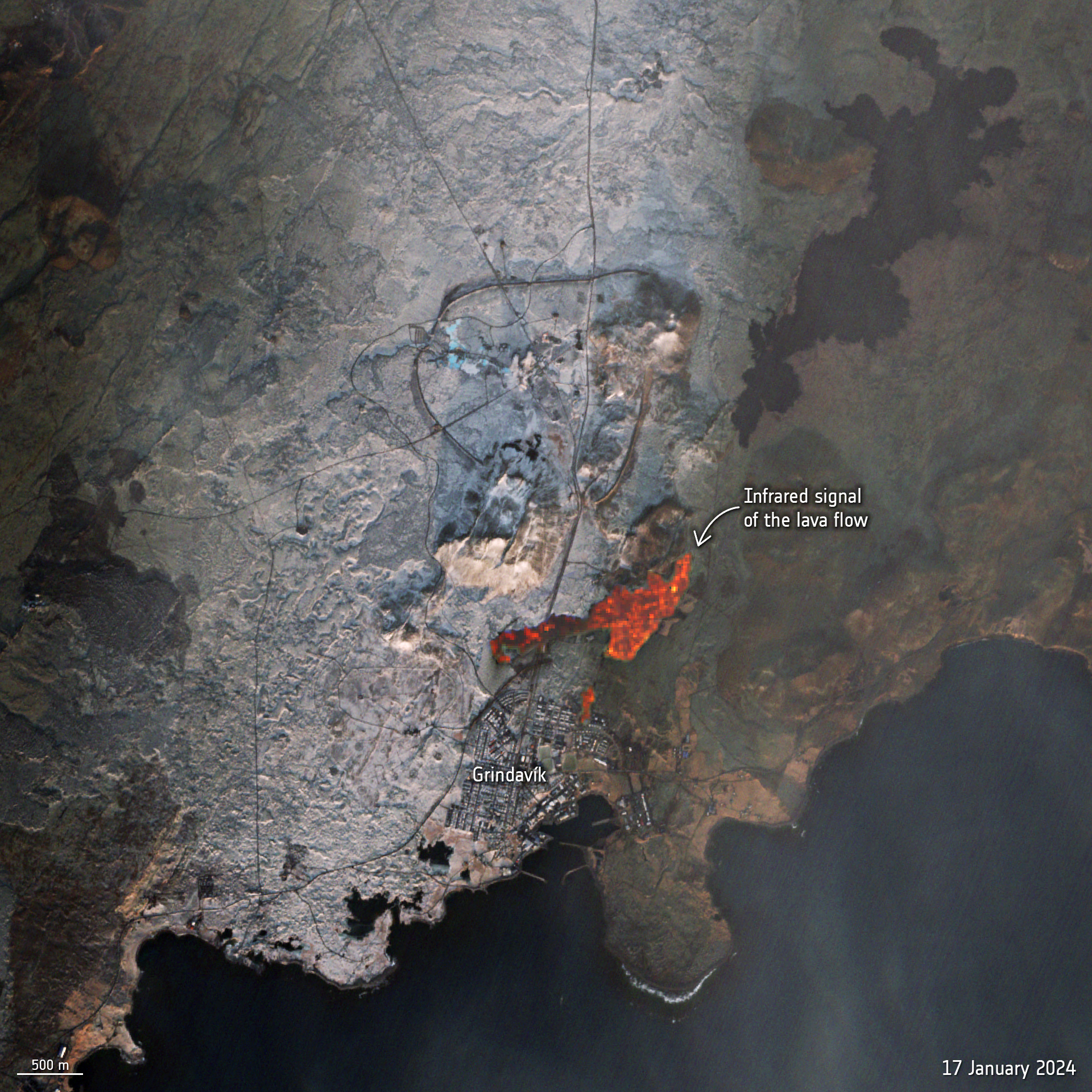
The Svartsengi volcano system, located roughly 2.5 miles (4 kilometers) north of Grindavík, erupted on Dec. 18 and Jan. 14, triggering lava flows and emergency evacuations of the town. The first eruption, which lasted until Dec. 21, occurred at Sundhnukagigar — a row of craters just outside the town of Grindavík — which previously erupted over 2,500 years ago. The second eruption, which lasted until Jan. 16, occurred near Hagafell mountain, located much closer to Grindavík.
Related: Satellite sees glowing Iceland volcano (photos)

ESA's Copernicus Sentinel-2 satellite previously captured infrared signals from the active lava flows on Jan. 17. At the time, the satellite images showed the bright red glow of the lava flow's heat as it neared Grindavík.
Magma has continued to accumulate beneath Svartsengi since the last eruption, causing concerns that new eruptive fissures may open without warning due to heavily fractured land that allows for magma to readily reach the surface, the Iceland Met Office (IMO) said in a statement.
"It should be noted that, although the overall hazard level for Grindavík has been reduced by one level, the hazard associated with fissures remains very high," IMO representative said in the statement. "The current hazard is now referred to as 'subsidence into a fissure,' describing the danger that may be present where fissures are hidden beneath unstable surfaces that could collapse and develop sinkholes."
Current estimates of magma accumulation suggest the land has been rising at a rate of approximately 0.3 inches (8 millimeters) per day, which slightly exceeds the recorded rate of uplift before the eruption on Jan. 14. However, computational models are being updated to gain more precise measurements, IMO representatives wrote.
"At this point, it is challenging to determine exactly how much magma has accumulated beneath Svartsengi since the eruption ended on January 16th," IMO representatives said. "Low levels of seismic activity persist and are mostly concentrated around Hagafell. The current seismic activity aligns with that observed in the area following the previous eruption."


