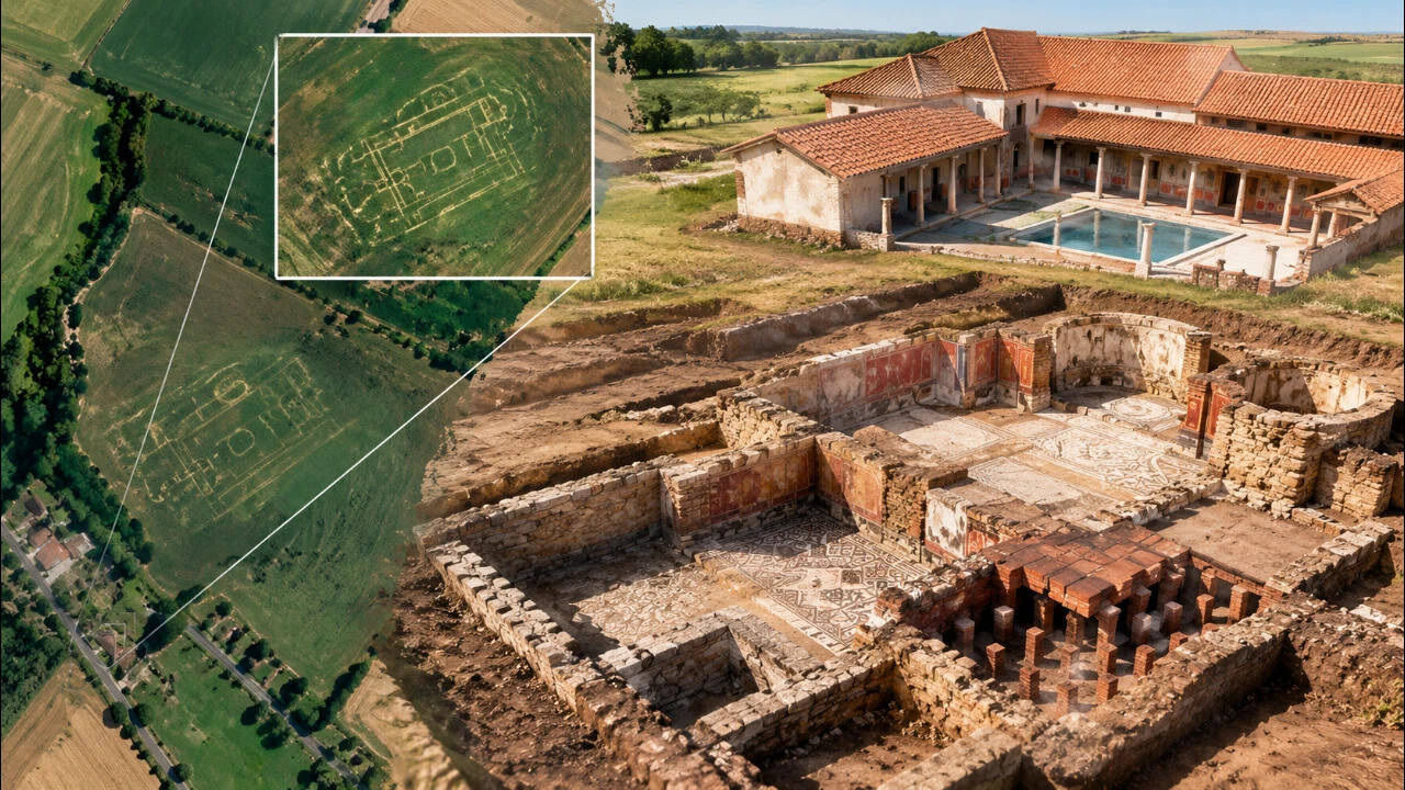
The Kent Archaeological Society runs the ongoing Trosley Heritage Project, which Current Archaeology describes as a larger landscape project studying how Trosley has been inhabited over time. Part of this work is done at the desk, with members searching publicly available satellite imagery of the fields for signs of buried features. Because crops can grow differently above buried walls and ditches, creating crop marks visible in satellite imagery even when they are not apparent at ground level, volunteers noticed a distinctive pattern in farmland near the village. Kent’s Historic Environment Record provides the relevant heritage record. The Society later held a community excavation of the site, with residents working alongside the Society’s more experienced excavators and the dig also hosted school visits. The dig uncovered partial foundations of what may have been a high-status Roman villa, along with painted wall plaster and remains of the villa’s hypocaust system.
Get breaking news anytime, anywhere. Download the TOI app now!