Get all your news in one place.
100's of premium titles.
One app.
Start reading
The Economic Times
The Economic Times

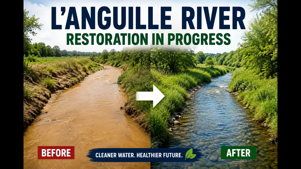
In 1998, officials listed Arkansas' L’Anguille River as impaired for siltation and turbidity. Six miles of Lateral 1A were restored; today, landowners have restored two more miles

For years, the L’Anguille River carried more than water through eastern Arkansas. Sediment was moving through its waterways too, clouding the river and damaging its water quality. Arkansas officials formally listed the river as impaired for siltation and turbidity in 1998. Nearly three decades later, restoration is still taking place, but the work has moved forward.

One important piece of that effort is Lateral 1A, a smaller waterway within the L’Anguille watershed. Six miles of the channel have already undergone restoration work. Landowners have now restored another two miles, extending a project aimed at keeping sediment from moving farther downstream.

The numbers may look modest beside the size of the watershed. Yet that is part of what makes this restoration worth watching. Large river problems can sometimes be addressed by changing what happens in smaller channels long before water reaches the main river.

The problem started far beyond the main river channel

The L’Anguille River runs through eastern Arkansas, a region where agriculture has shaped the landscape for generations. Its watershed covers hundreds of square miles and contains extensive farmland. Water moves through a network of drainage channels before eventually reaching the larger river.

That system creates a practical challenge for water-quality managers. Soil does not need to enter the main river directly to become a problem there. Rainwater moving across fields and drainage areas can carry loose sediment into smaller waterways. That material can then travel downstream during later storms and high-water events.

Turbidity describes how cloudy water becomes when particles remain suspended in it. Siltation occurs when those particles eventually settle and accumulate. Both problems can affect stream habitat, water movement and the physical condition of a river.

Why does Lateral 1A matter?

Lateral 1A is part of the drainage network connected with Larkin Creek. That creek ultimately belongs to the broader L’Anguille River watershed. Restoring a smaller channel therefore addresses one pathway through which sediment can reach larger waterways.

Restoration can involve several approaches rather than one single fix. Conservation projects in the watershed have included sediment ponds, streamside buffers and work designed to stabilize channels. These measures can slow water down and give sediment more opportunities to settle before traveling farther downstream.

That idea is important in heavily farmed landscapes. Farmers need drainage systems to move excess water from their fields. At the same time, water moving too quickly can carry soil and other materials into nearby streams. Restoration has to balance those competing needs instead of treating them as separate problems.

What changed after the original restoration?

The restoration of six miles of Lateral 1A provided a substantial starting point for the effort. The addition of two more miles shows that the work has continued beyond the first phase. It also reflects the role private landowners can play in improving watershed conditions.

That involvement matters because much of the surrounding landscape is privately owned and actively farmed. Government agencies can identify impaired waters and establish conservation priorities. But changes on the ground often depend on cooperation from the people who manage the land every day.

A landowner does not have to restore an entire watershed to make a difference. Keeping soil in place, protecting vegetation near waterways and slowing runoff can each reduce pressure on downstream channels. When those practices occur across multiple properties, their combined effect can become much more significant.

Can a small channel help a troubled river?

That is one of the most useful questions behind this work. Rivers are not isolated strips of water running through a landscape. They are connected systems, and what enters a small tributary can eventually become part of the larger river.

The L’Anguille watershed has been monitored for years to understand those connections. Water-quality measurements have included suspended sediment along with nutrients such as nitrogen and phosphorus. Those observations help researchers and managers determine how conditions change through time.

That monitoring also provides a way to judge whether restoration is doing what it was designed to accomplish. A channel can look different after restoration, but appearance alone cannot establish whether water quality has improved. Longer-term measurements are needed to show whether sediment loads are actually declining.

The L’Anguille restoration effort also illustrates a broader challenge across the United States. Many agricultural watersheds depend on drainage systems while facing pressure to protect nearby rivers. Finding workable solutions often means improving water quality without undermining the farms that depend on the landscape.

That is why voluntary conservation has become an important part of watershed work in Arkansas. Practices such as filter strips, conservation cover and streamside buffers can help reduce the amount of material entering waterways. Their effectiveness depends on where they are installed and how consistently they are maintained.

The approach is less dramatic than rebuilding a major river. It is also slower and more dependent on local cooperation. But watershed restoration rarely happens through one large project alone. It usually comes from many smaller changes that gradually alter how water moves across the landscape.

The restoration story is not finished

The L’Anguille River is not suddenly a completely restored waterway. Its water-quality challenges have developed over decades, and improving the watershed will take continued work. The additional two miles represent progress rather than a final endpoint.

Arkansas is also continuing broader planning for the watershed. Future efforts will need to consider sediment, agricultural runoff, drainage and the needs of communities and landowners. Those decisions will help determine whether restoration spreads farther through the watershed.

For people outside eastern Arkansas, the story offers a useful reminder about how river pollution develops. A river can reflect decisions made miles away, sometimes on land that looks completely disconnected from the water. The same connection offers a reason for optimism, because restoring those smaller pathways can give a larger river a chance to recover.

Sign up to read this article
Read news from 100's of titles, curated specifically for you.
Already a member? Sign in here
Related Stories
Top stories on inkl right now
One subscription that gives you access to news from hundreds of sites
Already a member? Sign in here
Our Picks
Fourteen days free
Download the app
One app. One membership.
100+ trusted global sources.