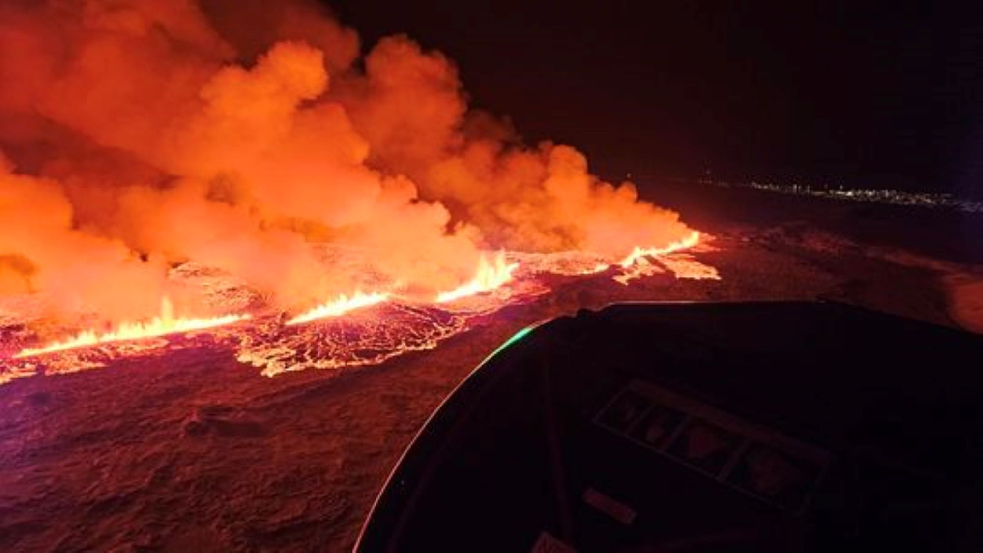
A volcano erupting on the Reykjanes peninsula in Iceland has opened a 2.5-mile-long (4 kilometers) fissure that appears to have stabilized and is spewing a "curtain" of lava, experts say.
The eruption began on Monday (Dec. 18) at 10:17 p.m. local time (5:17 p.m. EST Eastern Time) following an hour-long earthquake swarm. The northern end of the fissure is located just east of Stóra-Skógfell and its southern tip extends to a point just east of Sundhnúk, which sits less than 2 miles away from Grindavík, the Icelandic Met Office (IMO) said in a translated statement on Tuesday (Dec. 19).
"The power of the eruption that started about four hours ago seems to be decreasing," IMO representatives wrote in the statement. "The fact that the activity is already reducing is not an indication of how long the eruption will last, but rather that the eruption is reaching equilibrium. This trend has been seen at the beginning of all the eruptions on the Reykjanes Peninsula in recent years."
The eruption is occurring all along the fissure, with the highest level of activity recorded around the center of the crack, in an area labeled "zone 3" and colored orange on a hazard assessment map first published on Dec. 8.
Related: Japan's new volcanic island has erupted again — and the dramatic explosion was caught on camera
Recorded seismic activity was moving southward in the early hours of Tuesday, according to the statement, indicating the eruption may creep into the small fishing town of Grindavík, which was evacuated on Nov. 10.

"The measured activity is just east of the magma tunnel that formed on Nov. 10," representatives wrote at 2:50 a.m. local time (9:50 p.m. EST). "This development of the seismic activity, together with measurements from GPS devices, is an indication that the magma is moving southwest and the eruption could extend in the direction of Grindavík."
David Pyle, a professor of Earth sciences at the University of Oxford in the U.K., said the earthquakes have now died down, suggesting the fissure has stabilized with a "curtain" of magma erupting from it.
"The eruption rate is likely to be in the region of a few hundred cubic metres of lava per second — enough to fill an Olympic swimming pool in about 20 seconds," Pyle told Live Science in an email. "The length of the fissure may be an indication of how much magma had been able to accumulate in the crust over the past few weeks."
It's likely the eruption will continue for some days, Pyle said.
The activity on the Reykjanes peninsula is following a known pattern that will likely trigger more eruptions in the coming months and years. "We are still learning what the 'thresholds' are between slow magma accumulation in the crust and rapid episodes of dyke formation, and potential eruptions," Pyle said.
IMO representatives said in the statement that Iceland's National Weather Service will continue to monitor the development of the activity at the fissure and maintains direct contact with responders and civil defense in the area.


.jpg?w=600)


