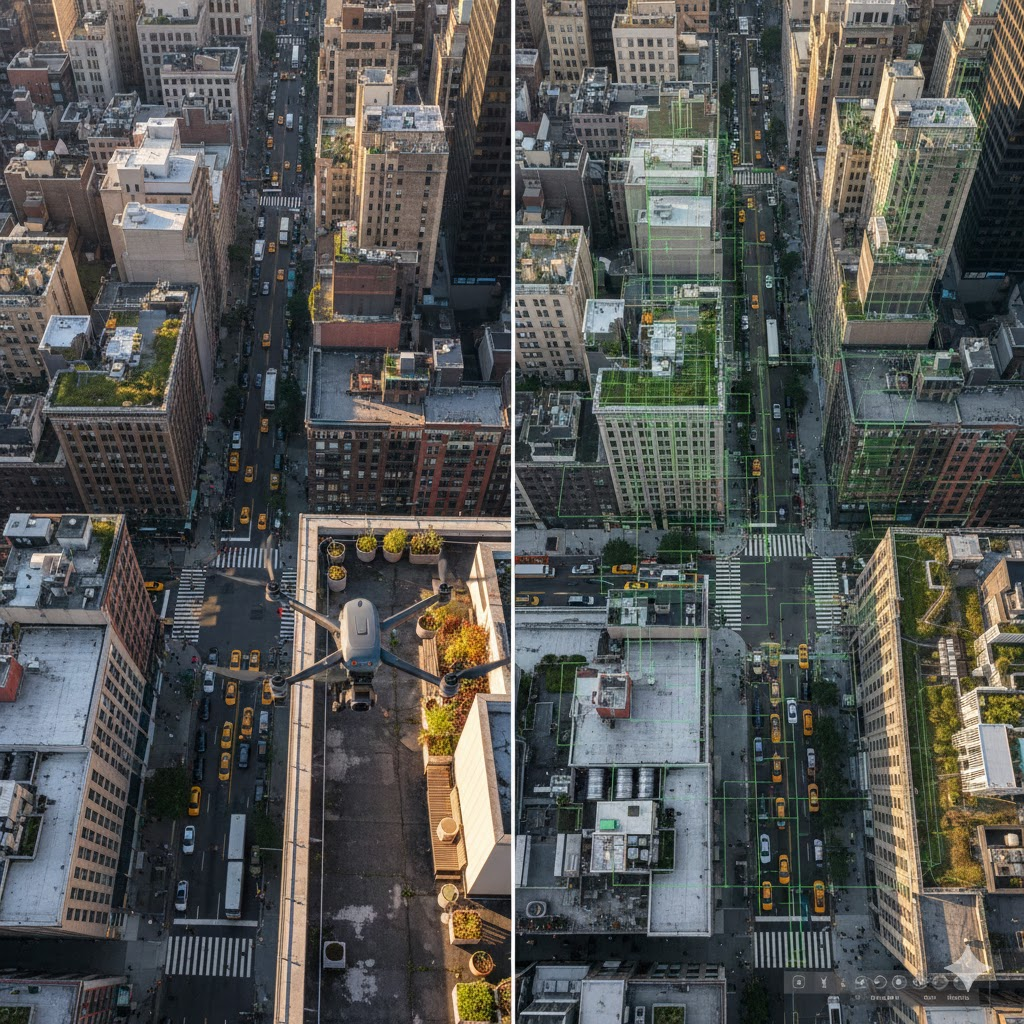
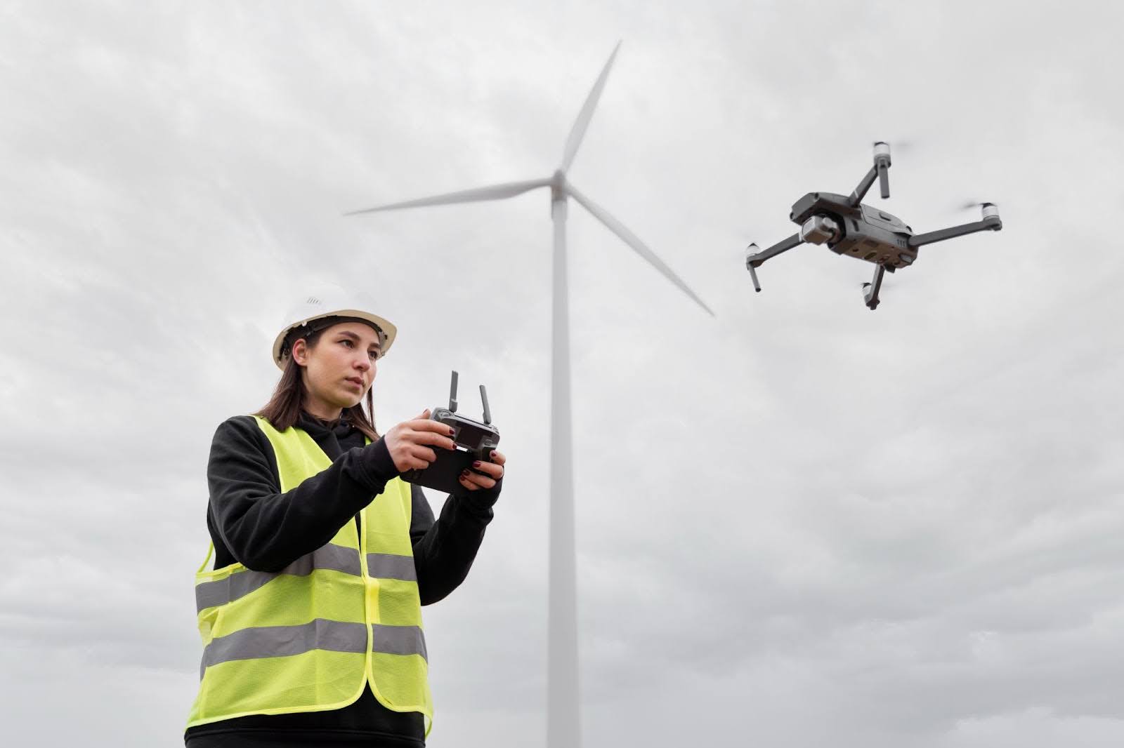
A drone lifts off from a narrow patch of pavement, climbs above a busy city block, and begins its slow, deliberate sweep.
From the ground, it looks unremarkable. From above, it captures thousands of images, angles, shadows, and surfaces that the software will later stitch into a precise three-dimensional model.
Within hours, what was once a physical place becomes a navigable digital replica.
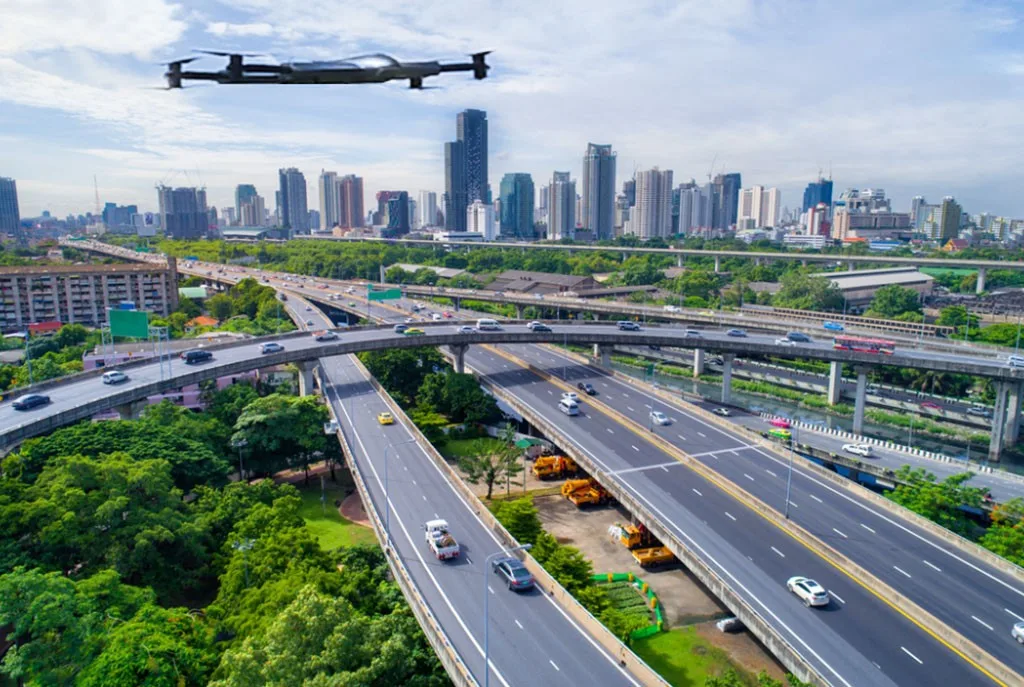
This is happening more often than most people realize. Across cities, coastlines, construction sites, and forests, the world is being quietly scanned from above. The goal isn’t spectacle. It’s understanding.
As planning, safety, and environmental pressures increase, Drone 3D Scanning is emerging as a practical tool for seeing environments more clearly and making better decisions before problems escalate.
What Exactly Is Drone 3D Scanning?
At its simplest, drone 3D mapping is the process of flying a drone over an area to capture detailed aerial 3D scanning images, which are then converted into a three-dimensional model using specialized software.
The result isn’t just a picture. It’s a measurable surface that planners, engineers, and scientists can analyze from multiple angles.
Most systems rely on drone photogrammetry, where overlapping photos are processed to create accurate depth and scale.
In some cases, LiDAR (Light Detection and Ranging) sensors are used to capture fine-grained elevation data, especially in complex terrain or dense vegetation.
What matters most is accuracy. When measurements accurately reflect reality, teams can document sites more efficiently, reduce guesswork, and avoid sending people into risky situations.
That reliability is why drone 3D mapping has moved from niche use to everyday operations in many industries.
Why the World Suddenly Needs These New 3D Maps
Nowadays, cities are growing denser, older, and more complex at the same time. Infrastructure built decades ago now carries demands it was never intended to handle. Roads shift. Coastlines erode. Flood patterns change. Static maps struggle to keep up.
This is where detailed geospatial data capture becomes essential. Drone surveying enables planners to document environments as they exist today, not as they were months or years ago.
After floods or earthquakes, responders rely on fast terrain models to understand access routes and damage patterns.
In heritage preservation, fragile sites are scanned and archived as digital twins, preserving their geometry long after the physical materials have degraded.
There’s also a sustainability angle that often goes unnoticed. Better spatial data leads to better planning. That means fewer material overruns, less rework, and reduced environmental impact. Sometimes efficiency is its own form of conservation.
Industries Being Transformed by Drone 3D Scanning
Across industries, the impact of drone-based 3D capture is less about novelty and more about quiet shifts in how work gets done. Here are some industries benefiting from the Drone 3D Scanning:
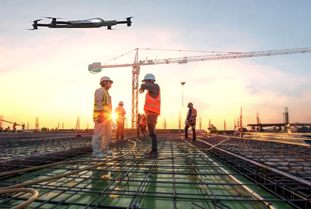
Construction & Engineering
On construction sites, drone surveying has changed how progress is tracked. Weekly or even daily scans allow teams to compare planned versus actual conditions without halting work.
Allowing for minor deviations to surface early. That's what happens when fixes are cheaper and safer to implement.
Construction site mapping through drones also reduces disputes. Visual records provide a shared reference point that’s difficult to argue with.
Environmental & Land Management
Environmental and land management professionals utilize drones in different ways. They look for patterns rather than relying solely on measurements.
Erosion lines along riverbanks, changes in forest density, and the subtle retreat of the coastline. Over time, these layered models tell stories about land use and climate pressure that numbers alone cannot explain.
Disaster Response & Public Safety
In disaster response and public safety, speed is everything. After fires, floods, or earthquakes, drones can scan unstable zones within hours.
Responders gain situational awareness without putting people in unsafe conditions. The models guide navigation, resource deployment, and recovery planning.
Infrastructure Inspection
Infrastructure inspection may be where the impact is most human. Bridges, towers, pipelines, and power lines no longer require workers to climb, rappel, or shut down systems just to inspect them.
High-resolution aerial 3D scanning produces models that engineers can analyze repeatedly, reducing risk while improving long-term maintenance planning.
The Human Side: Safer Jobs, Smarter Cities
Technology stories often focus on efficiency. This one is really about people.
Surveyors spend less time in dangerous locations. Inspectors avoid unnecessary exposure.
Emergency teams enter disaster zones with clearer expectations of what they will encounter.
Planners can simulate how shadows fall between buildings, how water flows through neighborhoods, and how traffic patterns change after design modifications are made.
Cities become more predictable, not in a controlling sense, but in a humane one.
When systems are understood spatially, decisions feel less reactive. Drone surveying doesn’t replace expertise; it gives professionals a better context for applying it. The technology extends human judgment instead of sidelining it.
What Makes Today’s Drone 3D Mapping So Accurate?
Accuracy did not arrive overnight. It came from quieter improvements layered over time. Modern sensors capture finer detail. Stabilized flight systems reduce distortion. Even wind correction is smarter now.
Aerial 3D scanning benefits from software just as much as it does from hardware.
AI-powered 3D modeling facilitates automated mapping workflows, including data cleaning, image alignment, and gap filling, which previously required hours of manual correction.
The result? A system that feels easy and intuitive, even for non-specialists.
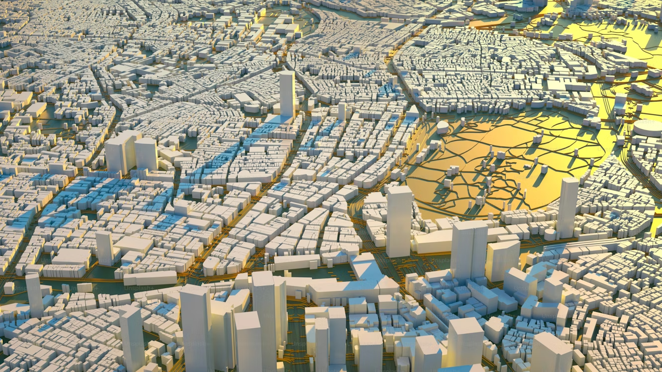
Digital twins are becoming a standard practice. These living models update as new data arrives, allowing teams to track changes rather than rebuild maps from scratch every time.
Challenges and Ethical Questions
With clearer views come more complex questions. Aerial 3D scanning data can potentially compromise privacy, especially in densely populated urban areas.
Even professional use demands transparency, restraint, and respect for boundaries that are not always visible from above.
Flight permissions differ by region, shaping where projects can happen at all. Weather still plays a role as well. Wind, rain, and lightning can affect the results, as can the operator's skill in interpreting what the camera captures.
Drone photogrammetry can look precise while still carrying assumptions and margins of error.
The ethical obligation extends beyond technical accuracy. It includes transparency about limitations, respect for privacy, and a clear explanation of how geospatial data is captured and used. Used wisely, the technology informs rather than overwhelms.
The Future: Will Every Place Have a Digital Twin?
It is easy to imagine cities modeled continuously rather than periodically.
As drones and AI converge, city models may update continuously, not just after major surveys. Construction timelines shorten. Insurance assessments arrive faster. Logistics routes adjust with real conditions, not assumptions.
These large, living replicas could also reshape climate research. Flood patterns, heat islands, and land-use changes become easier to simulate before policies are implemented.
The question that lingers is institutional rather than technical. Will governments maintain digital twins the way they maintain physical roads? Budgeted, regulated, and treated as public infrastructure rather than experimental tools.
Drone 3D Scanning points toward that possibility without demanding it. The promise is not spectacle. It is about coordination, foresight, and making better decisions with a shared spatial understanding.
Conlusion
A quiet transformation is unfolding above our cities and worksites. Drone 3D Scanning is becoming an essential layer of modern infrastructure, supporting safety, planning, and long-term resilience without drawing much attention to itself.
It works best when it stays in the background, turning hard-to-reach spaces into usable knowledge and scattered observations into coherent insight. This is not about replacing expertise. It is about extending it.
As drones continue to map the world from above, they are not just creating digital models. They are helping us understand, protect, and reshape the places we depend on every day.