A day of thunderstorms and heavy showers has been forecast for parts of Wales, the South West and central southern England.
The deluge is set to hit on Friday after days of record-breaking temperatures across much of the UK.
The Met Office has placed a yellow weather warning across most of south and mid-west Wales, and areas including Gloucestershire, Wiltshire, Somerset, Devon, Hampshire and Sussex.
Slow-moving heavy showers and thunderstorms are predicted between 10am and 10pm.
There is 20-25mm of rain expected in less than an hour in some places, with the possibility 40-50mm within two to three hours.
People can expect to see spray and sudden flooding which could lead to difficult driving conditions and road closures.
Train and bus services could be delayed or cancelled in places with flooding and lightning strikes.
There is a slight chance of power cuts, and other services to some homes and businesses could be lost, meteorologists said.
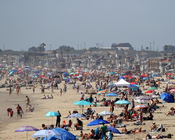
It follows a week in which the UK has for the first time seen temperatures over 40C, with a provisional 40.3C recorded in Coningsby, Lincolnshire, on Tuesday. The previous record was 38.7°C set in 2019.
Wales recorded its highest ever temperature of 37.1C in Hawarden, North Wales, where the previous record of 35.2C was set in August 1990.