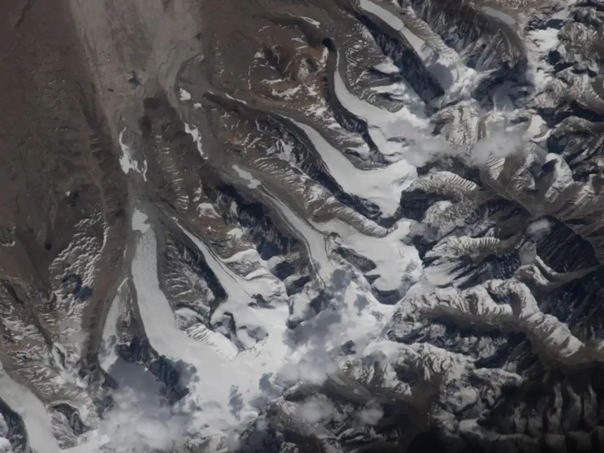
If you ever drove past the Rockies and thought mountains were permanent and unmoving, a recent photo taken from space might make you think again. NASA astronaut Jessica Meir, looking out the window of the International Space Station some 259 miles above Earth, aimed a handheld camera at the Himalayas and captured something most of us never get the chance to see: glaciers actually flowing, like slow-moving rivers of ice, down the mountains’ northern slopes and onto China’s Tibetan Plateau.
According to the Space. com report, published as its "space photo of the day," the image captures a mountain range so vast that even a helicopter ride wouldn't offer the same sweeping view.

How glaciers actually move
It might seem counter-intuitive: how can something made of ice “flow” like a river? The short answer is gravity and time. Glaciers form when snow accumulates faster than it melts, year after year, compressing into dense ice. Once that ice mass gets thick and heavy enough, gravity pulls it downhill, and the ice slowly deforms and slides, carving through valleys the way a river carves through rock, only much more slowly. The speed of a glacier depends on its slope, its thickness, and how much meltwater lubricates its base.
The scale of what's in that one photo
The numbers behind the shot are worth considering. The Himalayas span five countries, Nepal, India, China, Bhutan, and Pakistan, and are about 1,500 miles wide. They contain the tallest peaks on Earth, including Mount Everest, and they are home to over 110 mountain peaks that rise above 24,000 feet in elevation. It is a view that is difficult to capture from the ground, even from a helicopter. Meir's photo, taken from a spacecraft cruising 259 miles above the planet, shows glacial ice carving its way downhill across that entire northern stretch.