Fixing up after Cyclone Gabrielle will be no walk in the park for Auckland Council’s regional parks team
Cyclone Gabrielle brought new meaning to the idea of the ‘beaten track’.
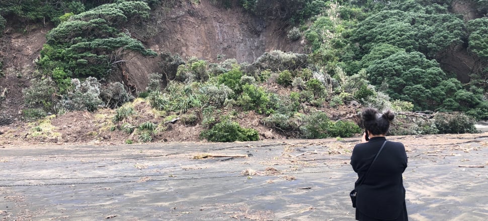
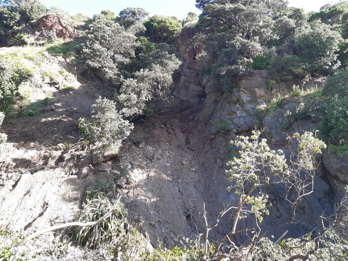
When she battered Auckland’s west coast earlier this month, the forest and cliffside environs of the Waitākere Ranges were hit hard.
READ MORE: * The Waikato town forgotten in the storm * Auckland's battered infrastructure is 'very fragile'
The extreme weather has left walking tracks closed and access to wild places across the region in doubt, with Auckland Council saying it could be years before people can return - if indeed they can.
The closures of six regional parks in Auckland have been extended until Wednesday March 1, at the earliest, but council workers are still embroiled in the mammoth task of assessing every bit of track under their purview.
Auckland Council regional parks manager Scott De Silva said around 56 tracks were closed, with the damage so significant to some that its questionable whether a full-scale repair is worth it.
Most of the damage was to tracks in the Piha, Karekare and Whatipu area - also areas council workers have had difficulty accessing due to slips closing roads.
The future of tracks like Tasman Lookout Path and Laird Thomson - on the northern and southern ends of Piha respectively - are in doubt after land slips took out significant parts of track.
De Silva said the damage was mostly caused by slips and fallen trees.
“I was out this morning at Wenderholm and we have a meandering track there that has had a large pōkutukawa tree fall on it,” he said. “In cases like that we can reroute, but in some cases that may not be feasible.”
It’s a job that could take from six months to years, and it’s not going to be cheap.
“We are still putting this information together across council, but there are going to be some big numbers,” he said.
He pointed out damage to the Upper Nihotupu bridge, which will take some engineering to get back into action.

“Even small works can be quite expensive, when you start looking at stuff that takes quite a bit of time to get in,” he said.
Sometimes repairs require a small digger or other equipment to be helicoptered in, an expensive proposition.
“I’m expecting we are going to be months and months repairing,” De Silva said.
He expects a better idea of the repair programme to be in place next week, as systematic assessment of damage continues.
First on the list will be the most well-used and popular tracks.
Among these could be the track up to Piha’s Kitekite Falls, which has a significant slip, or tracks down to Muriwai’s gannet colony, where slumps have appeared and assessors are concerned about stability.
“It’s actually almost everywhere, to be honest,” De Silva said. “There’s a massive amount of work to do out there.”
Many of these trails had only recently opened up after work to prevent the spread of kauri dieback.
When asked if it was a potential silver lining that trampers would be kept off some of these vulnerable trails, De Silva wasn’t able to agree.
Instead, land slips may have transported dieback vectors through moving soils. It’s yet to be fully investigated, but De Silva suspects there may be some delays in his team coming to the close of their kauri programme, which was supposed to end in June.

Other tracks administered by the Department of Conservation have been closed as well, such as Te Henga Walkway between Te Henga Bethells Beach and Muriwai.
The bridge at the Bethells end of Te Henga Walkway was washed away when Cyclone Gabrielle hit, while the rest of the track is littered with large slips and landslides.
According to DoC, the walkway is completely inaccessible and fully closed for the foreseeable future - as is the case with DoC facilities across the North Island.
DOC’s Deputy Director-General Organisation Support Mike Tully urged the public to bear with the organisation as it assessed the scale of damage.
“This is a huge job for DoC,” he said. “Some sites will need initial checks, formal assessments and then full engineering inspections.”
Popular DoC tracks affected in the storm include the path up to the summit of Rangitoto, which is strewn with fallen trees, and a number of tracks on Kawau Island being closed due to storm damage.
Auckland Emergency Management controller Mace Ward said there had been a range of types of damage to parks across the region, including flooding, damage to facilities and access issues.
Some closures are in part to relieve the load on under-the-pump infrastructure.
“Auckland’s water infrastructure has been impacted by the cyclone. The treatment plant in Muriwai is offline due to the landslide, the reservoir is empty, and so we are supplying residents in the area with emergency water from a tanker,” said Ward.
“When it is open, Muriwai Regional Park, draws up to 50 per cent of the potable water supply which is just one reason why we have made the decision to close some of our regional parks.”
He said although regional parks were much-loved by Aucklanders, safety has to be put first as the council worked with west coast communities.