Get all your news in one place.
100's of premium titles.
One app.
Start reading
The Conversation
The Conversation
Thomas Marlow, Postdoctoral Fellow in the Center for Interacting Urban Networks (CITIES) at NYU Abu Dhabi, New York University

Flood maps show US vastly underestimates contamination risk at old industrial sites

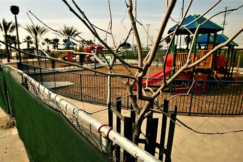
Maywood Riverfront Park was built on the site of eight former industrial properties in Los Angeles County. Luis Sinco/Los Angeles Times via Getty Images

Climate science is clear: Floodwaters are a growing risk for many American cities, threatening to displace not only people and housing but also the land-based pollution left behind by earlier industrial activities.

In 2019, researchers at the U.S. Government Accountability Office investigated climate-related risks at the 1,571 most polluted properties in the country, also known as Superfund sites on the federal National Priorities List. They found an alarming 60% were in locations at risk of climate-related events, including wildfires and flooding.

Sign up to read this article
Read news from 100's of titles, curated specifically for you.
Already a member? Sign in here
Related Stories
Top stories on inkl right now
One subscription that gives you access to news from hundreds of sites
Already a member? Sign in here
Our Picks
Fourteen days free
Download the app
One app. One membership.
100+ trusted global sources.