
Searching for signs of life in the void of Rapanui Easter Island – a dry, wind-blown Oceanic place of isolation and palpable absences.
In spring on Rapanui Easter Island the nights are filled with the chirruping of insects. The filmmaker Aliscia Young observed: "The crickets sparkle and twinkle with layers of sounds, all with their rhythms and beats, producing an amazing collective ensemble that somehow seems to speak for the whole island." Perhaps these insects have language, too, for the vanished ecosystems once dominated by millions of giant Easter Island palm trees (Paschalococos disperta) that became extinct on the island after seven centuries of human habitation. And the lost animal species: six land birds, lizards, several sea mammals, and untold insects and other creatures that were part of the once undisturbed island’s ecological pulse. Easter Island today is a dry, wind-blown Oceanic place of isolation and palpable absences, often paradoxical and interconnected.
The explanation for the absence of forest and land birds was deftly tied together by the philologist and linguist Steven Fischer, of the University of Auckland, in his observation of another haunting absence: of the culture that raised and then, seemingly just as perplexingly, demolished many of the famed 14-tonne, four-metre-high moai statues: "It was like the last palm to be felled on the island. With the deafening thud, an entire way of life suddenly came to an end. Ironically, it coincided with the beginning of the reign of East Island’s great ariki mau [king] – the last man to fill the post of ariki with its original dignity.”
Of all the absences thrown up by Easter Island, it is its remoteness that reigns eternally. Rapanui is 3000km east of its nearest Polynesian neighbour, the Pitcairn Islands, and 3200km west of Chile, which governs the territory. It was James Cook who ‘joined the dots’ while moored in this solitude, and freely acknowledged the skill and intrepid nature of Polynesian sailing. This was the seasoned navigator’s second voyage into the Pacific. Like his Dutch predecessor Abel Tasman, Cook marvelled that "the same Nation should have spread themselves over all the isles in this Vast Ocean from New Zealand to this Island which is almost a fourth part of the circumference of the Globe".
Cook’s was not the first ship, however, to call at this 19km by 12km, three-cornered island, shaped rather like the navigator’s own tricorne hat. That distinction goes to Jacob Roggeveen, another Dutch explorer who, in 1722, named it Easter Island (the expedition arrived there on Easter Sunday). A number of visiting ships recorded that locals scooped up brackish water to drink from its rocky shore. Certainly, Cook landed water for his ship in Hangaroa Bay on the southwest coast, above the southern tip of the island, but he found it too brackish for drinking. However, his crew took on at least enough water to lift their spirits. They then caught the trade winds that took them swiftly back to the Marquesas. Nevertheless, the impression left in the ship’s wake that this was an impoverished island was not accurate. Joseph Gilbert, master of HMS Resolution, spoke of a dry, porous and impoverished soil, with no trees; apart from potatoes and plantains "in the valleys", he had found no "kind of vegetables useful for refreshment. Water is exceedingly scarce and indifferent throughout the island." And John Linton Palmer, who visited the island in 1868, believed he could read the old pathways of former streams in the rocks.
The availability and potability of water for its original inhabitants – and for passing sailing ships – continued to exercise the curiosity of many voyagers – as, of course, did the moai. All who anchored off Rapanui’s rather daunting coast seemed perplexed by the culture they had intruded on, and not least by their own observations of the water supply. Alfred Métraux observed, "Little salt, if any, was used to flavour the food, and even today the natives do without it. It has been noted that they do not need salt, since they drink brackish water and absorb air impregnated with salt."
Alexander Adams, who visited in King Kamehameha’s brig Kaahumana, recorded what he thought he saw, thereby spawning a persistent fallacy: "Perouse says he had seen some of these people drink salt water like the Albatross of Cape Horn, though his officers discovered a spring of a less saline nature. This fact I may corroborate by one of our party having witnessed a native stooping down on the rocks and slaking his thirst from the water of the great Pacific Ocean."
In short order, Cook’s exploration party traversed 32km overland on the island: "The only relief was one spring of what would have been good sweet water if the natives had not combined drinking with bathing." They found the island "treeless and infertile", with some sugarcane, taro, yams, turmeric and a few gourds but no coconuts. This absence of trees gave the Polynesian-wide word for wood, tree or timber, rākau, a new meaning of ‘riches’ or ‘wealth’ in old Rapanui language – "a meaning attached to the word nowhere else in Polynesia", as Fischer notes. (Similarly, the exclusively Hawaiian coinage of the word kānāwai, meaning ‘law’, is based on the word for water.) There had once been extensive forest on Rapanui but, according to Bahn and Flenley, the last trees were felled in about 1660, probably for firewood.
Almost a century later Palmer, a naval surgeon on the HMS Topaze, found that, contrary to Cook’s experience, the water of a sulphur spring close to Terano Kau, although it "had a distinctly mineral taste", was quite palatable and "in sufficient quantity to serve our large and thirsty party. The rocks in most of the gullies are evidently stream-worn, but now not the smallest brook exists. The soil … seems moist enough not to require particular irrigation."
Palmer wrote his observations of water on the island in a detailed Royal Navy casebook in 1868: "On the road from Otuiti [Rano Raraku volcano] are many pools of small size but the natives warned us not to drink of them." He recorded that, while journeying, they chewed sugarcane "to appease their thirst". He writes, "At meal times they use salt water as seasoning with their vegetables, and this must have led to the belief that they used it alone, from the absence of fresh water. At Otuiti I was told distinctly that there was no water, except that in the pools of the crater."
The mystery of the availability of freshwater endured for many years to come – only intensified by the island’s remoteness, and compounded by a suspicion that in the 52 years between the first and second contacts of the 18th century, something tragic but imponderable had occurred. From his brief stay in 1722, Roggeveen did not report toppled statues; in 1774 Cook’s companion the naturalist Johann Forster most certainly did. Roggeveen saw the island as "almost destitute of wood"; yet, he noted, "The size and goodness of their potatoes, yams, sugar canes, etc. are proofs of great fertility and strong vegetation." Roggeveen’s visit, however, was for just one day.
If the assiduous Cook had not been unwell during his stay, it is likely that both mysteries – the existence of freshwater and of the island’s palm forests – would have been interrogated and more fully explained, if not solved. The ecologist and palaeoclimatologist John Flenley, the first to publish evidence that Easter Island was once forested, reminds us of that. Certainly the apparently towering mystery as to the genesis and later toppling of many of those 900 statues – excavated, executed, transported and erected by a Palaeolithic population of fewer than 3000 – may have been better understood earlier. In those missing 52 years between Roggeveen and Cook, when the Rapanui scripture tablets may have been translated, many cultural clues were lost. "Cook encountered a different land," wrote Fischer, whose research into those tablets offers extraordinary insights into the culture. "It was obvious that something terrible had happened in the interim, probably a war." Fischer also brought his skills to the task of ‘glyph-cracking’ Rapanui’s hitherto inaccessible proto-language – the rongorongo ‘code’, enscribed on polished tablets of wood.
All signs pointed to a Rapanui in rapid social and more gradual, but profound, ecological decline. And underneath that, the inevitable effects of long- and short-period climatic shifts.
Cook’s missed opportunity has given rise to a body of other research over the past few decades, with evidence to explain such haunting remnants to a wondering world – not least from modern physical sciences. In recent decades, John Flenley and veteran archaeologists, including Terry Hunt, Carl Lipo, Patrick Kirch and Easter Island’s Edmundo Edwards, have offered increasingly nuanced and comprehensive explanations.
At latitude 27.9° south, Rapanui is a 3000m volcano, rising 510m out of the sea, that formed the island a mere 400,000 years ago. The island is without rivers or permanent streams on its weathered and porous surface, and with variable rainfall and droughts. The only significant reservoirs of potable water, called rano, were trapped in the old craters of Terevaka, the volcanic ancestor of the island. Irrigation was not feasible, and with the available rainfall it was not possible to grow taro. Standard cultigens such as coconut, kava and breadfruit – a staple of its neighbour to the west, Mangareva – were beyond their southern range on Rapanui. Hunt and Lipo, drawing on the DNA analysis work of archaeologist David Addison, point out that: "As options for establishing the mainstay of irrigated taro were dashed the colonists of Rapa Nui must have watched in dismay as critical crops such as breadfruit simply died."
Lack of groundcover, combined with porous surfaces, has been problematical on Rapanui for centuries. One observer wrote: "In spite of the morning’s downpour, the grass isn’t even damp and neither is the ground. How can this land dry out so rapidly, with the earth turning to dust within several hours of rain …?" John Linton Palmer noted a "lack of minimum surface water – high temperature and humidity, high evaporation and porous soil". A scoria quarry on Rapanui is named Puna Pau, ‘exhausted springs’ – a reminder that sources of freshwater once existed on the island. Yet Flenley and Bahn ascertained that "almost everywhere on the island, from the steepest parts of the cliffs and the youngest lava surfaces, there is soil sufficient in quantity and quality to support the growth of trees". Palmer observed: "The ground is so fertile, that a few days’ work suffices for keeping any family in subsistence for the entire year." He also noted: "The whole of the island has formerly been under cultivation, and rahui-stones are met with in every direction."
Part of the explanation for productive fertility in such unpromising ground, say Hunt and Lipo, seems to lie in the practice of ‘lithic mulching’ – the use of buried rock in gardens across the island. This technique, used in many old cultures, can have the effect of regulating the temperature night and day, deflecting wind and introducing minerals to the soil. But Fischer noted that "the removal of forest cover had increased local temperature and humidity, causing greater erosion and leaching of the soil. As the evaporation rate increased, the soil became more porous. Drainage worsened; water was poorly retained …"
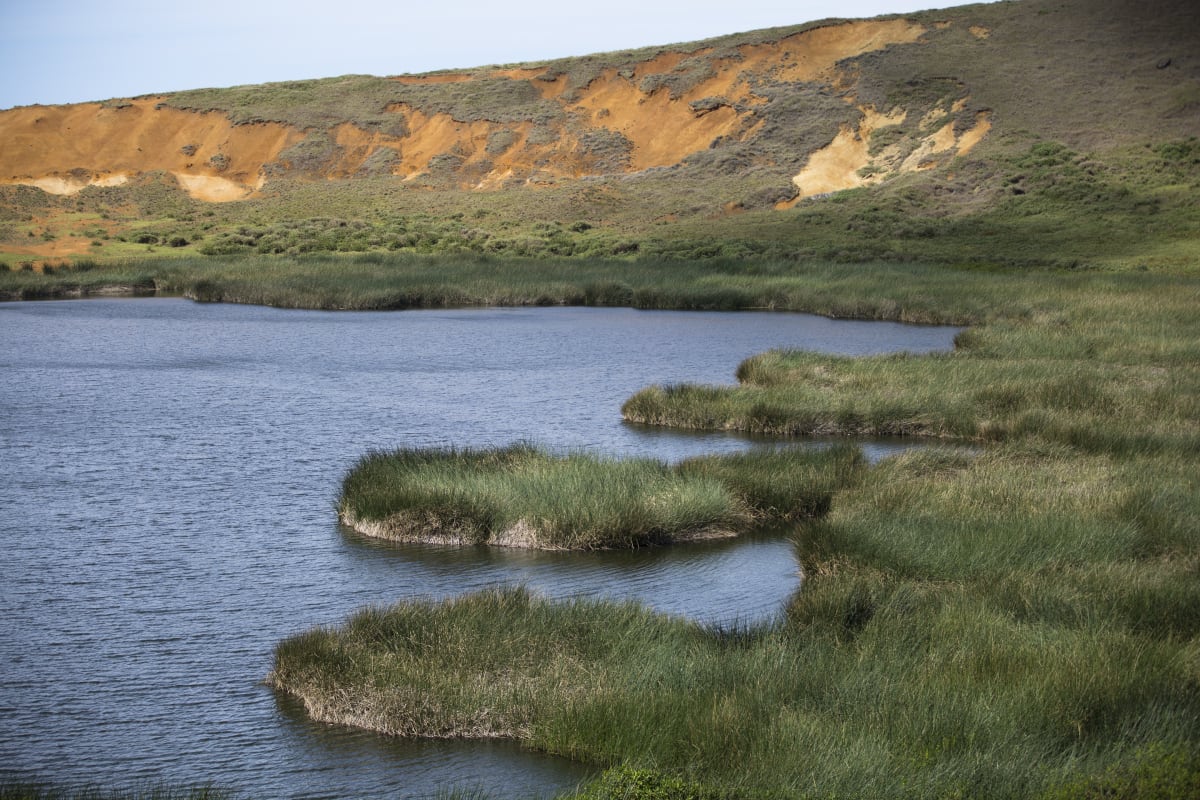
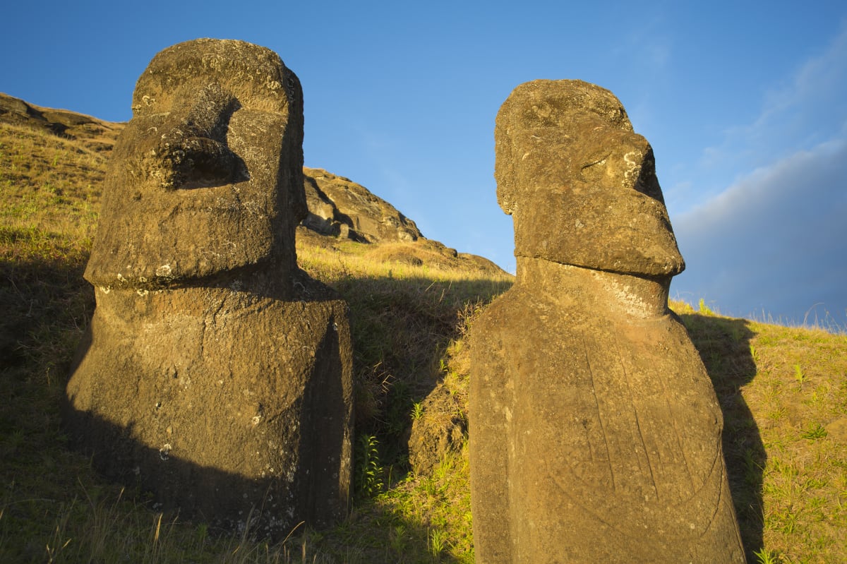
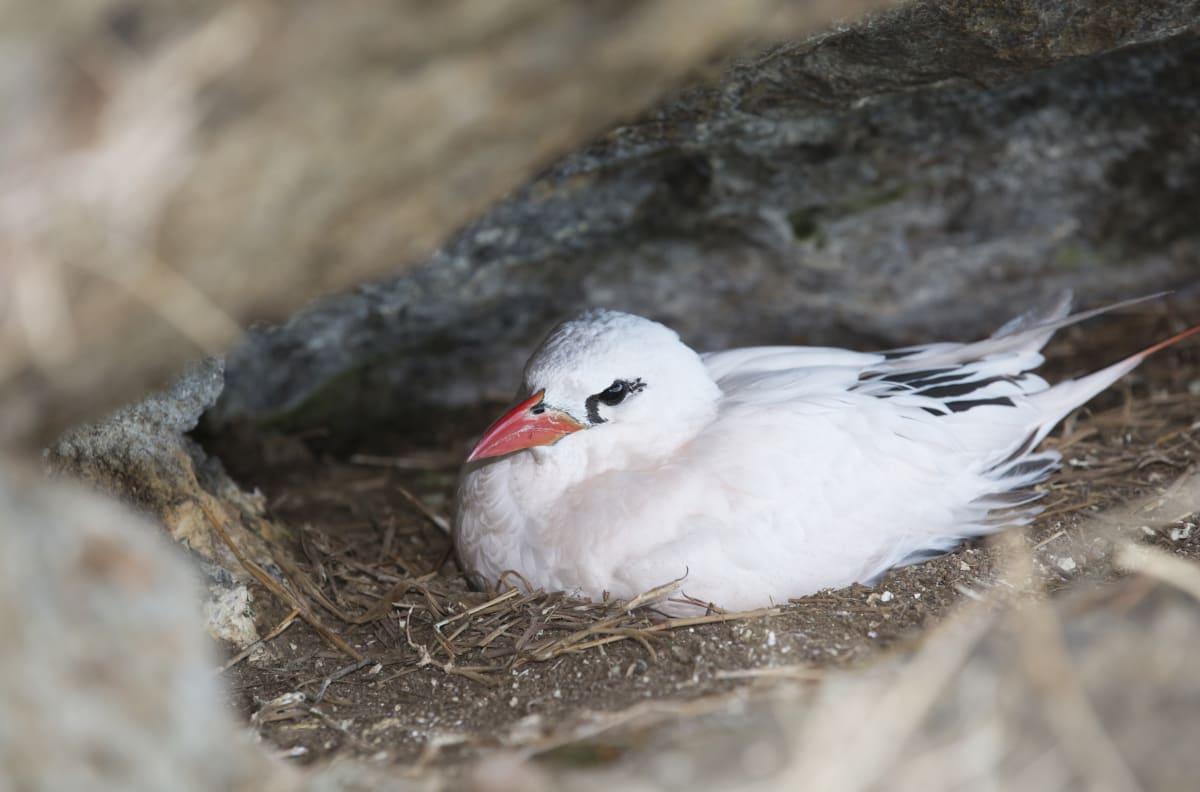
There are three main lakes or swamps in three craters that hold rainwater: Rano Kau (on the most southern edge), Rano Aroi (the crater near the centre of Terevaka) and Rano Raraku in the eastern corner. These were once reliable water sources, but for many years now "none of the fresh water is of value – only reeds grow there". Rano Kau is lined with the endemic toromiro (Sophora toromiro, a cousin to the kōwhai), the predominant plant, and hau hau (Triumfetta semitriloba), a shrub. The crater lakes were never the most convenient source of water, and were also highly mineralised. Rano Raraku was once a quarry to the moai; today it is home to nesting tropicbirds.
However, seepage through lava tubes and caves yielded water beyond the craters – some as springs and some trapped and held in stone basins that had been ‘pecked out’ by the Rapanui. Old placenames with vai (water) or puna (spring) are often the site of a village with a form of well close by. "The ruins of ancient settlements are always thick around water holes," wrote Métraux. He listed the most famous of them: Ahu Te Peu, Puna Marengo and Vai Tara Kai Ua. The latter was deep, "covered with big blocks of stones so that only a small, narrow passage remains, just wide enough for one person. Behind Anakena [bay] abundant water is found."
Palmer formed the impression of "many deep holes" in the volcanoes: "in those of the Terano Kau these are fully 25 feet deep, and I have tasted it pure and fresh from many places near the shore. At Winipoo [Vinapu, in the southern ‘hook’ of the island], not only is there a subterranean reservoir (to which a tunnel leads from the face of the cliff) but on the very sea beach the natives have made a cistern to catch the water which distils from a little runnel. I did not see that the natives had sunk any wells."
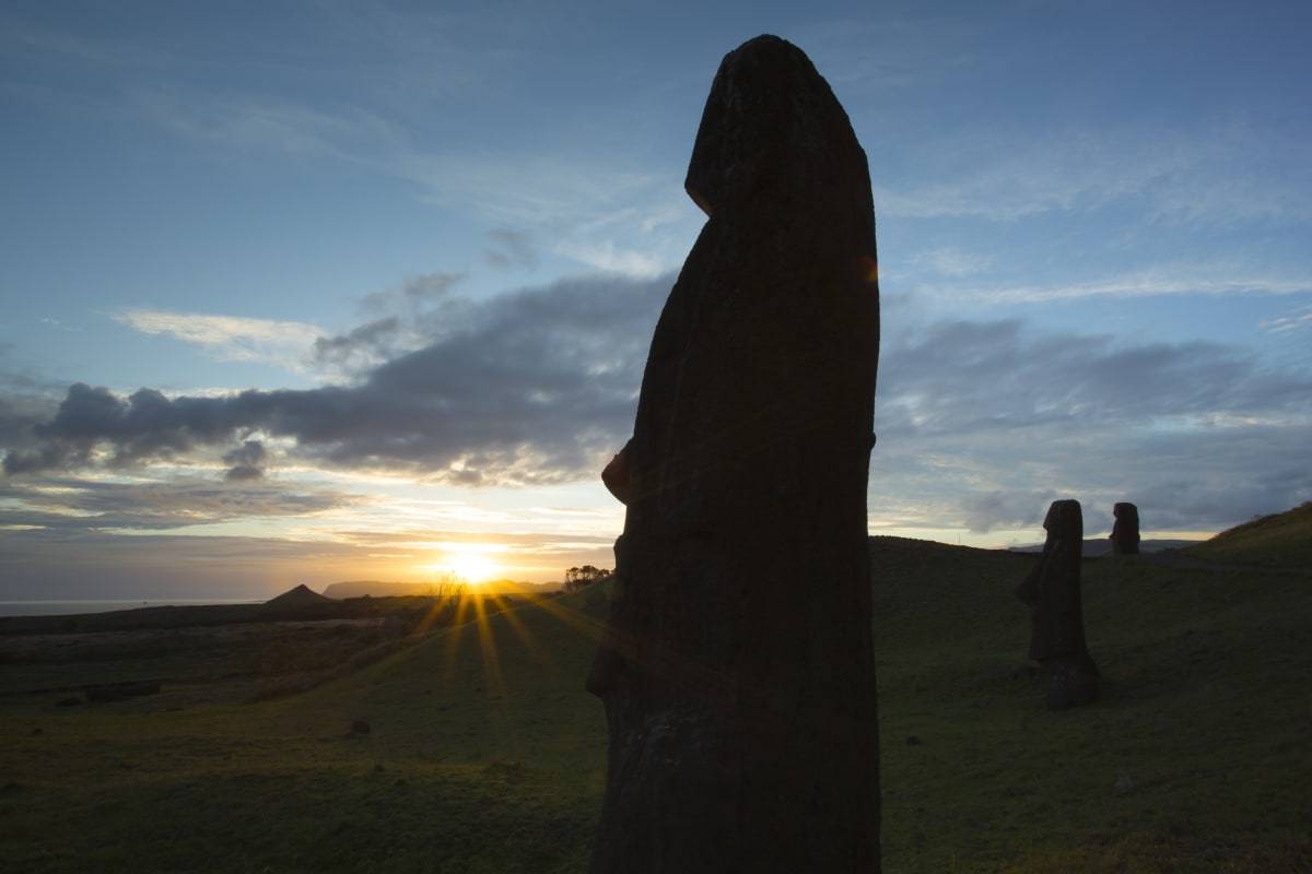
Vinapu was a water source for at least 80 habitations and related cultivations – and another place marked by monuments. Nearby Vaihu was the site of an early ahu, or sacred mound. Each of these sites is marked by moai hewn from volcanic tuff, today facing outwards towards the ocean.
There were other sites for drinking water. In the western corner of the island, Vai a Heva, on which a human face was carved, was an outlet for water, and "well-watered ravines" were to be found, including one near Vaitea, in mid-island.
Among other water-related petroglyphs on the island is a stone named Pu o Hiro (Hiro’s trumpet). To Edmundo Edwards, the ethnographic and archaeological evidence indicates this is Hiro, god of fertility, ‘with two natural cavities that produce a sound similar to that of a [blown] conch shell. The holes are surrounded by petroglyphs of vulvas since according to Rapanui oral tradition, fertility spread over the earth when the holes were sounded.’ Hiro is definitely an expression of a culture that well understood drought: as the god of rain, he was called on to ‘ensure rainfall or prevent a drought’. This was especially the case with the planting of the Rapanui staple, kūmara (sweet potato).
The moai in their original state seem to have marked and addressed freshwater. They wore red scoria headdresses (noted but not explained by the 1786 La Pérouse voyage, which recorded much of island culture and geography). Today the headdresses of the moai are "small stones covered by calcareous algae … found lying near many ceremonial platforms and have been found in [two] excavations. Ethnographic sources indicate that these stones were used in ceremonies to promote rainfall and increase fertility of sweet potatoes."
On Rapanui, Tangaroa is still god of seas and all oceanic life. As in Hawaii, Tangaroa and Tāne are the water-finders, the pair who conjure up the "streams, springs, pools and heavy showers". Interestingly, both Polynesian homes share extensive lava tubes and underground networks of water – the kind of geology that invites the notion of conjuring up water from the ground. Both these gods also govern the Rapanui fortunes of farming, "and were honoured with prayers and offerings during the different stages of crop cultivation, especially when planting and harvesting".
Matariki, the rising of Pleiades, was as important to Rapanui as to Hawaiians and Māori, with a lineage back to the observances of the early Lapita people. Matariki was observed in autumn, with festivals and the bringing in of yam and kūmara harvests for feasting. In parts of the southern hemisphere, including Rapanui, it also marked the end of the rāhui, that other pan-Polynesian practice.
Given such observances, the question inevitably raised by scientists is, what happened to all the trees? Carl Skottsberg is a thoroughgoing Swedish botanist who recorded Rapanui’s botany quite late, during World War 1. Both legend and Skottsberg are clear that a sufficiency and small variety of tree cover at an earlier time in the history of Rapanui had kept the islanders in wood from native plants such as toromiro for canoes, paddles, house framing and extensive carving. In addition, they cultivated plants they had introduced to the island, such as paper mulberry.
It is difficult to explain how a phenomenal 16 million palm trees were "chopped down" within 700-800 years. One possibility, raised in a joint paper in 2004, argues strongly that "the overuse of palm trees was the major reason for their destruction". Christopher Stevenson and his colleagues noted that, together with evidence of a growing demand for firewood, the demise of these Easter Island palms may well have been based on the lack of suitable drinking water. This scarcity may have driven the Rapanui to "harvest palm sap", as is practised in Chile with a similar palm: "The cut trunk of a full-grown palm provides the amount of fresh, drinkable sap needed each day by one person for a period of more than a year." The hundreds of litres each palm provided could have served as a highly nutritious drink, "replacing the scarce freshwater sources on Rapa Nui’. As the last of the natural woodlands were cleared, such a practice would have been another contributor to the breakdown of the centuries-old practice of sustainable land use, they argued. This in itself would have brought profound change to life on the island, possibly exacerbated by ‘a second wave of occupation from outside or new external contacts of the already established people of Rapa Nui".
It can be argued that this hypothesis is too clear-cut. The effects of wind and storm damage, starting at the forest edges, may also have been a factor here. The trade winds at this latitude are driven largely from the east and are affected by many vectors, not least the powerful currents driving out of the Southern Ocean and the cold Humboldt Current moving northwards up the coast of South America. The easterly trade winds are prevalent from November to February. Of course, once an established canopy is cleared, a strong wind can do a lot of damage.
The authors concluded that the inevitable and intensifying conflict over resources may have led to "the abandonment of a peaceful and well-organised megalithic culture". By 1722 the forest, if not already gone, was severely diminished. However, this does not explain the failure of the palms to be sustained naturally from seed throw. For Hunt and Lipo, one question remained: was it introduced rats, thoughtless firing or tree-felling that was the Rapanui people’s greater contribution to the island’s demise? And underlying this are the fundamental, long-period climatic shifts of the Pacific.
The work of Flenley and Bahn anticipated such possible reasons for Easter Island’s ecological demise in the early 1990s: "It is theoretically possible that a drought made things worse, but clearly the islanders brought disaster upon themselves by gradually destroying a crucial resource, the palm, and unwittingly preventing its regeneration through having imported rats. A delicate balance was put under strain and finally upset. The environmental degradation was irreversible."
Drought struck again across much of the planet from 500 to 1200AD. However, the effects were not all negative. This was a time of extended climatic stability. It saw the development of irrigation and terracing, with high food production, long-distance navigation and new settlements on many Pacific Islands, notably in Eastern Polynesia – including Rapanui. A group of climate scientists argue that, from 1200AD, wetter weather filled Rapanui’s lakes, creating a cooler climate and stormier conditions until about 1570. This was marked by a densification of the palm forests at Rano Aroi, but also what may have been deliberate firing, which reduced forest at Rano Raraku. Until 1500 these conditions underpinned prosperity and the cultural flowering of the Rapanui people, embodied most evidently in the tablets and monumental moai. Valenti Rull and his team argue that the palm forests were virtually removed, very swiftly, from both sites between 1570 and 1620: "This was the coup de grace of the deforestation of these basins and, likely, of the whole island."
The questions of agency in regard to the ecological and cultural decline on Rapanui have, with ongoing research, become more and more entwined. Techniques for core sampling sediments in peatlands have proved to be a highly accurate tool in many Pacific islands: they can identify not only the pollen of old forests, but also the arrival of Polynesians to new islands. The core samples extract the original layers of hard seeds and palm nuts with teeth marks throughout the Pacific that – in these hitherto mammal-free lands – are proof positive of the time of arrival of the Polynesian rat or kiore.
Rats were brought on waka as a source of protein to new, unfamiliar islands. Once established they ravaged the flora and mammal-naive fauna, especially ground-nesting creatures such as seabirds. Core sampling by a team at Ordy Pond on the Ewa Plain, Oahu, showed telltale layers of charcoal but, unexpectedly, these occurred at a later date than indications of the presence of rats. Some forests here too – palm and woody shrub – disappeared within just 100 years. Hunt and Lipo commented, "What Athens proposed was quite radical: the Polynesian rat (Rattus exulans) had caused the rapid demise of the forest."
But more detailed research took scientists to a slightly different, more subtle interpretation of the sequence on Rapanui. While the Polynesian rats had something to answer for, sampling of sedimentation from Rapanui’s crater lakes revealed that it was not until the introduction of the much larger ship rat and Norwegian rat (Rattus rattus and Rattus norvegicus) that changes possibly already under way became irreversible. So it was exotic predators – ship-borne, not waka-borne – that administered the coup de grace to an already stressed island ecology: the obliteration of nesting seabirds, the end of palm regeneration and, with these, the collapse of the culture.
Such lessons are indicated on many islands, large and small, throughout the Pacific. Wherever it fetched up, the impact of the kiore on ground-nesting birds and other natives has been variable – and often considerable. On islands where birds have not co-evolved with rats, the effect of their introduction has "outweighed all other causes of extermination of island birds". Those on Rapanui are no exception. In cooler conditions, and when starving, kiore will abandon their vegetarian diet to prey on smaller animals such as chicks and lizards and, in Aotearoa, young tuatara.
As always, though, it is the relationship between climate and forest, forest and water, water and soil, and the over-exploitation by Rapanui Easter Island / 189 human communities of these matrices, that is fundamental. Many islands where kiore were introduced by Polynesians – and, later, the larger rat species arrived as stowaways on foreign shipping – now have extermination programmes in place, usually targeting the larger rat species.
We can’t yet say definitively exactly what brought such abrupt changes to the ecology and society on Rapanui. But when it comes to cultural decline, by 2011 Fischer, with his historical linguistic reach, and Hunt and Lipo were in no doubt. The Easter Islanders continued to survive for hundreds of years in their now highly modified environment, only to be savagely compromised and defeated by outsiders: "Through a series of disastrous encounters with foreign visitors, the Rapanui population had collapsed, rebounded, collapsed again, and then recovered to a degree, only to be ravished in slave raids."
We who inhabit the islands across the Pacific have learned with ever greater clarity of the intertwining vectors that were in play to bring down the forests, the moai and the civilisation that shone so brightly from a small, highly inventive and industrious Polynesian community. Climate and water are both implicated in this narrative, as are, now most certainly, Rattus exulans, Rattus rattus and Rattus norvegicus.
This chapter, then, comes down to an understanding of the relationship between rats and good water on Pacific islands – large and, especially, small. The modelling for climate change since the 1980s continues to be shown, over and over, to be, if anything, far too conservative. Meantime, the role of forest as both carbon sink and ‘curator’ of water quality and availability assumes ever greater significance. If native forests are to play their full role in natural soil and water conservation, the birds, lizards and insects that co-evolved with them need to be actively protected. The intrinsic and extrinsic reasons for this are inseparable – the role of fauna in seed dispersal alone justifies their protection. That is why today, on archipelagos such as Aotearoa and Hawaii, there is such an emphasis on eliminating the exotic predators, as well as exotic invasive weeds. For such work to be fully realised in democracies, a shift to a deeper understanding by populations and their politicians becomes imperative. Like measures of climate change itself, some policies are simply too urgent to be at the mercy of populism and other hubristic manifestations of politics.
It is only quite recently, however, that scientific concerns are being raised about the effects of cats, dogs, ants, rats and introduced hawks on Rapanui – in particular with regard to a relatively recent colony of nesting redtailed tropicbirds at Rano Raraku.
Extracted from Wai Pasifika: Indigenous Ways in a Changing Climate by David Young (Otago University Press, $60), available in bookstores nationwide.


