Strong winds and heavy rains pound Gujarat’s coastal belt as cyclone Biparjoy made a landfall near Jakhau Port in Gujarat’s Kutch district after churning across the Arabian Sea for over 10 days, the India Meteorological Department (IMD) said on Thursday evening.
Several areas of the affected districts plunged into darkness as the cyclonic storm disrupted power supply and blew away electricity poles.
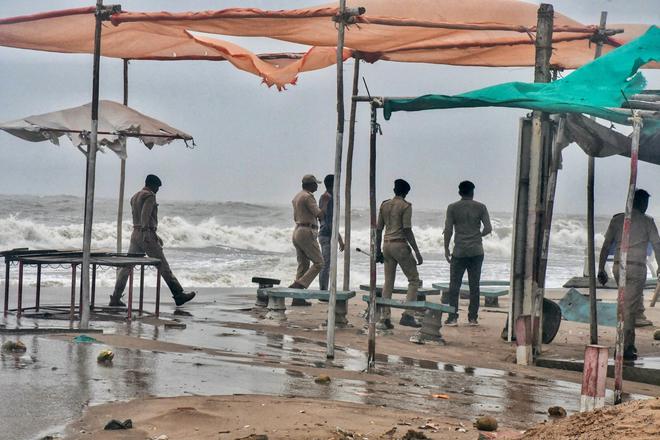
As per reports, several people have been injured and two drowned in flood waters in Saurashtra. However, exact details of the damages and casualty will be known only after the landfall is complete.
The Gujarat government has shut schools and other education institutions for Friday as the State is likely to receive heavy downpour in the aftermath of the cyclonic storm.
Due to strong winds, there were two major incidents of fire in coal storage grounds in Okha and Jamnagar in which stock lying in the ground gutted before the fire was brought under the control.
The Railways cancelled or short-terminated more than 70 trains.
Prime Minister Narendra Modi had a telephonic talk with Gujarat Chief Minister Bhupendra Patel, who briefed him about the situation on the ground.
Many people recalled the devastation caused by a massive cyclone exactly 25 years ago in June 1998, when over 3,000 people were killed in Kutch and the coastal areas of Saurashtra.
Strong winds
Since Thursday morning, strong winds and heavy rains battered Kutch and Saurashtra coasts as agencies of the State and Centre remain on high alert even as the authorities shifted around one lakh people to approximately 1,500 temporary shelters set up as part of the disaster management efforts by the State.
There are reports of hundreds of trees being uprooted by the winds and hoardings, electricity poles and some houses falling down due to the gusty winds in coastal districts.
The IMD said the landfall process would be completed by Thursday midnight.
“Dense convective clouds have entered Kutch and Devbhumi Dwarka districts and therefore, the landfall process has commenced. It will continue till midnight,” IMD Director General Mrutyunjay Mohapatra said in a media briefing.
“The eye of the cyclone is around 50 km in diametre. Biparjoy is marching ahead with a speed of 13-14 kmph. Thus, it will take around five hours for the wall cloud and the eye to completely cross into the land,” the IMD chief added.
Evacuation efforts
In last few days till Thursday noon, the State and Central agencies have carried out shifting of around one lakh people living in vulnerable areas following a warning from the IMD about the “extensive damaging potential” of the cyclone.
According to the State government release, 18 NDRF teams, 12 teams of the State Disaster Response Force and personnel of the Army, Navy, Air Force, Coast Guard and Border Security Force have been deployed for relief and rescue operations in eight coastal districts where the IMD has issued a Red Alert as the cyclonic storm with potential to cause massive damage is set to sweep through the region.
Rescue and relief
The Gujarat Chief Minister held several meetings at the State emergency operation centre to take stock of the preparedness and relief operations by government agencies.
Food packets are being delivered by government agencies at all temporary shelters, while Opposition party leaders and NGOs have also joined the efforts to provide food and other relief services to vulnerable communities in the coastal regions.
Risk of flooding
The IMD had earlier warned of very heavy (11.5 cm to 20.4 cm) to extremely heavy rainfall (over 20.5 cm) in Kutch, Devbhumi Dwarka, Jamnagar, Porbandar, Rajkot, Morbi and Junagarh districts.
“We won’t be surprised if some areas record more than 25 cm of rainfall. Usually, they do not receive such intense precipitation at this time of the year. Therefore, there is a risk of flooding in the low-lying areas,” Mr. Mohapatra had cautioned.
IMD scientists and meteorologists had also warned of extensive damage to standing crops, houses, roads, electricity and communication poles, and flooding of escape routes, and high tides which could inundate the low-lying areas of the Saurashtra and Kutch coasts.
Biparjoy, the first cyclone in the Arabian Sea this year, rapidly intensified on June 6 and June 7, escalating from a cyclonic circulation to a very severe cyclonic storm in just 48 hours, defying earlier predictions. It has also sustained its strength for a longer-than-normal duration, which meteorologists attribute to unusually warm Arabian Sea.