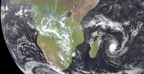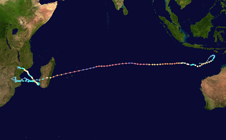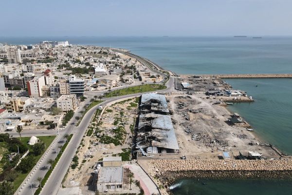
On February 4, a storm off the north-west coast of Australia was named Cyclone Freddy. It rapidly strengthened and headed west across the Indian Ocean, eventually causing devastation in eastern Africa. Hundreds of people died, tens of thousands more were displaced, national energy grids were crippled, flash flooding was widespread and socioeconomic impacts have been severe.
At its peak on February 21, Freddy had wind gusts of up to 270 km/h, making it a category 5 storm, the highest category on the Saffir-Simpson scale used to measure cyclone intensity. The following day, Freddy was upgraded further to a “very intense tropical cyclone”, which is science-speak for “off the chart”.
Freddy was the most energetic storm on record. It also went through the most cycles of weakening and re-intensifying, and may have been the longest-lived cyclone in history.
So was this megastorm a one-off event, or a harbinger of the global warming–fuelled cyclones of the future? And, either way, what does it tell us about preparing for what lies ahead?
A remarkable journey
Australia has experienced cyclones in the past with comparable strengths to Freddy. According to the Bureau of Meteorology, 48 category-5 tropical cyclones have formed in the Australian region since 1975. That’s about one a year, although most do not cross the coast, or weaken by the time they do.
Cyclone Mahina, which hit Queensland in 1899, is widely considered Australia’s strongest recorded tropical cyclone. Further back in the palaeoclimate record, we find evidence of stronger events still.
What was truly remarkable about Freddy was its journey. Freddy was a named tropical cyclone for 39 consecutive days and travelled more than 8,000 kilometres across the entire South Indian Ocean.
It may have been the longest-lasting tropical cyclone on record (this is currently being confirmed by the World Meteorological Organization). The 31-day Hurricane John set the previous record in 1994.

Freddy appears to have had an accumulated cyclone energy (the index used to measure the energy released by a tropical cyclone over its lifetime) equivalent to an average full North Atlantic hurricane season.
Was Cyclone Freddy driven by climate change?
It’s no easy task to join the dots between climate change and any given extreme weather event, such as a cyclone or heatwave.
A relatively new area of study called “climate attribution science” attempts to do it by determining how much more likely a given event was in today’s climate compared to the past climate.
The main idea in attribution science is to model extreme weather events under present-day climate conditions, and then do it again when the model is run with no human-made greenhouse gases in the atmosphere. This process is repeated many times to try to understand the likelihood of a weather event occurring with and without human-driven warming.
To date, these studies have had most success with large-scale, slow-moving extreme weather events – like the February 2019 European heatwave. The jury is still out on how well we can do this for tropical cyclones.
So we can’t yet say what role climate change may have played in making a cyclone like Freddy more likely, but the science is moving fast.
The future of cyclones: fewer, slower, stronger
Cyclone behaviour is already changing, and our climate models project it will change more in the future.
In many parts of the world, the number of cyclones making landfall is on the rise. In Australia, however, this number is decreasing – and most climate models indicate this decrease will likely continue under a warming climate. This is related to the weakening of Pacific atmospheric circulation, which is less favourable for the formation of tropical cyclones.
This is good news for Australia, although other changes in projected cyclone behaviour may give us less cause for optimism.
While the total number of cyclones may decrease, research indicates those that do make landfall may be stronger. Other research indicates cyclones may be moving more slowly and also roaming farther from the equator. The amount of rain any one cyclone can hold will also likely increase in a warming atmosphere.
All these changes would increase cyclone risk on the east coast of Australia. However, these projections are uncertain. The only discernible trend so far is a reduction in overall cyclone frequency.
The influence of La Nina
Australia is famously a land of droughts and flooding rains. Regardless of underlying trends, large swings in climate conditions are common from year to year.
In Australia, most cyclone (and flood) impacts occur during La Nina periods: over 60% of cyclone losses and 75% of insured flood losses.
The La Nina period that has just ended meant the waters of the tropical East Indian Ocean were warmer than usual. This extra heat may have sustained Freddy in its trans-oceanic journey.
Similarly, a marine heatwave in the Southwest Pacific contributed to the lifetime and amount of rain produced by ex-tropical cyclone Gabrielle in New Zealand in February.
Building for the future
Cyclone impacts are traditionally hit-and-miss affairs in Australia. We can get a category 5 cyclone screaming through north-western WA and only a few cattle really know about it.
However, as population increases, the number of people in harm’s way also potentially increases. No matter how cyclones may change in the future, we need to ensure resilience is a core feature in building future housing stock.
In Australia, it is encouraging to see more government emphasis on reducing disaster risk (rather then just cleaning up afterwards), through frameworks such as the Disaster Ready Fund.
Elsewhere, we should throw our support behind resilience programs in the Global South like those in countries hit by Freddy, where vulnerabilities remain high.
Thomas Mortlock works for Aon Reinsurance Solutions
This article was originally published on The Conversation. Read the original article.


