A cold front is set to sweep across Australia’s south-east in the coming days, bringing icy winds and steep drops in temperature.
The front is brushing the southern tip of Western Australia and is expected to strengthen and intensify as it approaches south-eastern Australia.
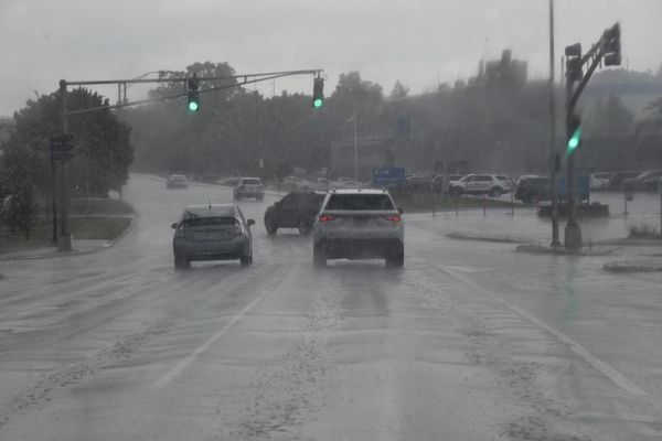
The Bureau of Meteorology is forecasting the front will bring rain, very gusty winds, storms and snow, with the cold expected to hit Adelaide and Melbourne on Thursday.
That cold front will be followed by a high-pressure system at the weekend, which could bring clear skies and light wind but will also cause temperatures to tumble.
On Saturday temperatures are set to hit a minimum of 8C in Melbourne and 10C in Adelaide, with showers forecast from Thursday through to next Wednesday.
Towns including Bendigo and Ballarat will see temperatures drop even lower, to 3C on Friday and 4C on Saturday.
The cold front is expected to hit Sydney in the early hours of Friday, with temperatures dropping to as low as 7C on Sunday.
Dubbo and Temora are expected to experience freezing temperatures at the weekend, with the mercury set to drop to -1C on Saturday, amid a forecast of snow along the southern and central ranges in New South Wales.
A senior meteorologist at the Bureau of Meteorology, Sarah Scully, said the front would bring rain, hail and snow, and could generate severe weather warnings.
“We’re forecasting some showers, potential accumulation of small hail and snow down to low levels,” she said, adding: “The main concern for us is damaging wind gusts.”
Severe weather warnings have been issued for Tasmania, central and eastern parts of Victoria, and south-eastern parts of NSW.
“Maximum wind gusts are going to be around 100km/h for parts of Victoria, NSW, but could reach up to 120 in elevated areas of Tasmania as well,” Scully said.
She said widespread frost was forecast for large areas of the country.
“I expect that there’ll be frost warnings issued as well, and even frost getting up into the Northern Territory, and even the northern half of WA and parts of Queensland,” she said.
A hazardous surf warning is also expected to be issued on Friday in NSW, with the cold front developing into a low-pressure system as it moves off the coast, generating large waves.