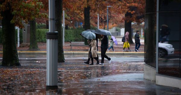
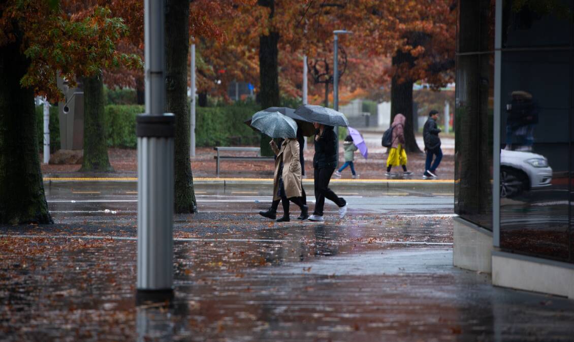
The wet week is expected to continue into the weekend. Thursday is forecast to be colder than Wednesday, with maximum temperatures then creeping up over the weekend to 21 degrees on Monday.
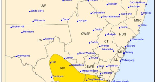
The Bureau of Meteorology said at 4pm on Wednesday that a "general severe thunderstorm warning remains current for the Australian Capital Territory and parts of the Southern Tablelands, North West Slopes and Plains, Central West Slopes and Plains, Upper Western, Snowy Mountains, Central Tablelands and South West Slopes districts".
The ACT State Emergency Service advised people to move cars under coveror away from trees if it was safe to do so. They should also "take extra precaution when walking outside or driving. Secure or put away loose items that are outside."
For Thursday, the Bureau of Meteorology said "cloudy" for Canberra, with a "high chance of showers, most likely in the morning". Winds will remain brisk.
Minimums will be just above freezing. The median minimum for this month is usually much higher than that at 6 degrees.
The Bureau was warning of "cold temperatures, showers and westerly winds" on higher slopes around Canberra on Thursday.
Spring is a time of year where there are big fluctuations in weather and temperature, meteorologist Angus Hines said.
The season was characterised by "fast-moving" weather systems where it could be warm one day and cold the next.
"I wouldn't say it's unusual," he said. "We're not really approaching the record for the coldest day of October."
The average maximum temperature for the month is 21 degrees and the coldest October day on record is October 11, 2012, where the maximum temperature was 8.6 degrees.
We've made it a whole lot easier for you to have your say. Our new comment platform requires only one log-in to access articles and to join the discussion on The Canberra Times website. Find out how to register so you can enjoy civil, friendly and engaging discussions. See our moderation policy here.