A powerful winter storm lashing California threatened floods, blizzards and avalanches Saturday while adding frigid temperatures to the misery mix.
Overnight lows could drop below freezing in some areas while downtown San Francisco could see record-breaking cold temperatures Saturday morning, according to the National Weather Service. Projected temperatures of 38 degrees Fahrenheit (3 degrees Celsius) would see the city at its coldest since 2009, the weather service said.
Flash flood warnings were issued from Friday through 1 a.m. or 2 a.m. Saturday in Los Angeles and Ventura counties, a region with some 6 million people. The weather service said flash flooding was occurring late Friday in Ventura County, where up to 7 inches (18 centimeters) inches of rain had fallen and up to 10 inches (25.4 centimeters) were possible before the storm turned showery on Saturday afternoon.
In Los Angeles County, forecasters said life-threatening flash flooding was possible near creeks, streams, urban areas, highways and areas that were burned by wildfires. The threat zone included downtown LA, Hollywood, Beverly Hills and many suburbs.
“Shallow landslides and mudslides are expected,” the weather service said.
Despite the heavy downpour, no serious problems were immediately reported.
Rain falling at up to an inch an hour raised the fear of flooding or mudslides. Evacuation warnings were issued in some burn-scarred areas and for a mile-long stretch of Oceano, which lies on the central coast near a levee that overflowed during storms last month. Residents were urged to be ready to flee at short notice.
Meanwhile, people farther east were struggling to deal with the fallout from storms earlier this week.
More than a half-million people in Michigan were still without power late Friday night, days after one of the worst ice storms in decades caused widespread power outages by knocking down some 3,000 ice-coated power lines.
Promises of power restoration by Sunday, when low temperatures were expected to climb back above zero (minus 18 Celsius), were of little consolation.
“That’s four days without power in such weather,” said Apurva Gokhale, of Walled Lake, Michigan. “It’s unthinkable.”
Back in California, the Weather Prediction Center of the National Weather Service predicted heavy snow over the Cascade Mountains and the Sierra Nevada into the weekend.
California’s wine country wasn’t spared from the rare brew of wind and snow. Mark Neal told KPIX-TV that he woke up Friday morning to see a foot (30.4 centimeters) of snow — more than he’d seen in more than 40 years — and dozens of his oak trees snapped in half.
“It’s pretty much a battleground if you look at it. Some of them are over 200 years old,” he said. Luckily, the vines were safely dormant.
The low-pressure system pushing the atmospheric river off the Pacific Ocean into central and Southern California on Friday was driving inland and is expected to bring widespread rain and snow into southern Nevada by Saturday afternoon and then across northwest Arizona Saturday night and Sunday morning, the National Weather Service office in Las Vegas said.
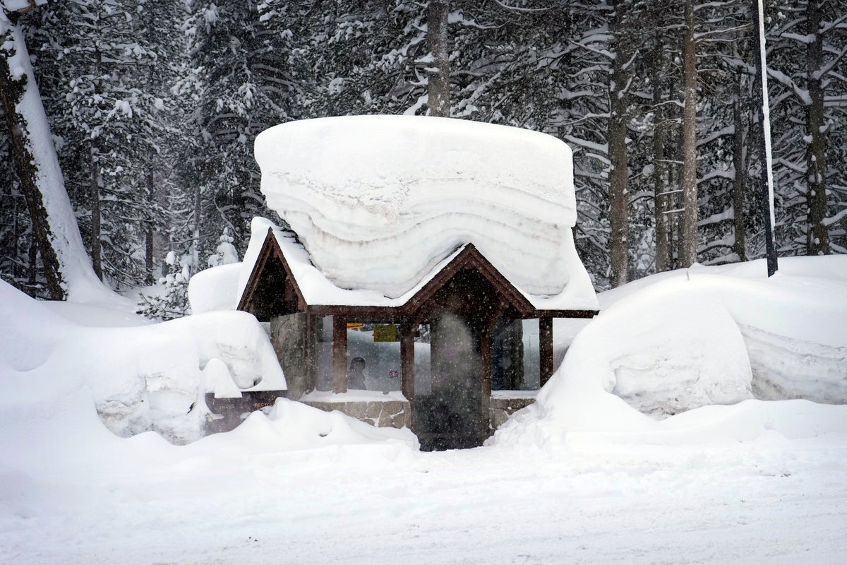
An avalanche warning was issued for the Sierra Nevada backcountry around Lake Tahoe, which straddles the California-Nevada border. Nearly 2 feet (61 cm) of new snow had fallen by Friday and up to another 5 feet (1.5 meters) was expected when another storm moves in with the potential for gale-force winds and high-intensity flurries Sunday, the weather service said.
In Arizona, the heaviest snow was expected late Saturday through midday Sunday, with up to a foot of new snow possible in Flagstaff, forecasters said.
Weekend snow also was forecast for parts of the upper Midwest to the Northeast, with pockets of freezing rain over some areas of the central Appalachians. The storm was expected to reach the central high Plains by Sunday evening.
Yet the cold weather blasting the North and West has avoided the southern states, leading to wild temperatures differences. The high temperature for the U.S. on Friday was 93 degrees Fahrenheit (34 degrees Celsius) at Falcon Lake, Texas, while the low was minus-35 degrees Fahrenheit (1.7 Celsius) near Huntley, Montana.
The wintry blasts have led to hundreds of cancelled flights at airports around the country and shut down miles of major highways in several states.
In California, some motorists were trapped overnight on snowy, icy State Route 17, a major road in the San Francisco Bay Area mountains, before it reopened Friday morning.
Interstate 5, the West Coast’s major north-south highway, was closed south of the Oregon border as snow fell to the floor of the Sacramento Valley. The Grapevine, a high mountain pass north of Los Angeles, was closed for more than 12 hours. After reopening Friday evening, traffic crept through under police escort and there was a chance of more closures as forecasters predicted strong winds leading to blizzard conditions in mountain ranges and passes.
Much of a long stretch of Interstate 80 remained closed most of Friday over the top of the Sierra Nevada mountain range between Sacramento, California, and Reno, Nevada.
Harsh weather prompted Los Angeles County to keep its emergency shelters open into March as wind chill was expected to drop weekend temperatures below freezing in the San Fernando and San Gabriel valleys. The county's large homeless population was at special risk.
At least three people have died in the coast-to-coast storms. A Michigan firefighter died Wednesday after coming in contact with a downed power line, while in Rochester, Minnesota, a pedestrian died after being hit by a city-operated snowplow. Authorities in Portland, Oregon, said a person died of hyperthermia.
Much of Portland was shut down with icy roads not expected to thaw until Saturday after the city’s second-heaviest snowfall on record this week: nearly 11 inches (28 centimeters).
Tim Varner sat huddled with blankets in a Portland storefront doorway shielding him from some of the wind, ice and snow. Local officials opened six overnight shelters but the 57-year-old, who has been homeless for two decades, said it was too hard to push a shopping cart containing his belongings to reach one.
“It’s impossible,” he said. “The snow gets built up on the wheels of your cart and then you find slippery spots and can’t get no traction. So you’re stuck.”


