The UK has been hit with relentless rain in recent weeks, but the arrival of a Saharan dust cloud in Europe could now result in showers of “blood rain” as soon as Tuesday.
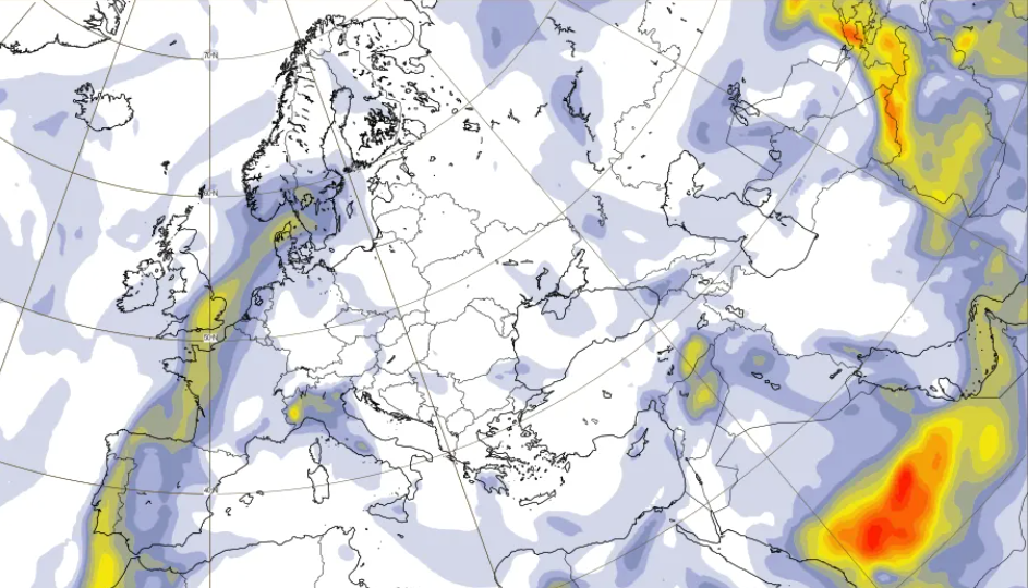
Experts at Copernicus Atmosphere Monitoring Service (CAMS) are monitoring a large plume of red dust and some smoke from Equatorial Africa moving across the North Atlantic. The latest forecast shows it is predicted to reach Europe imminently, with another branch heading towards South America.
That forecast shows a plume reaching north-western parts of Europe. CAMS states it is not uncommon at this time of the year, but it can impact air quality and visibility in places like the Canary Islands and Madeira.
The plumes could result in hazy skies in other parts of the continent and, when the dust mixes with rainfall, it can impart its red colour, creating “blood rain”.
About such a phenomenon, the Met Office said: “It's understood that blood rain occurs when relatively high concentrations of red coloured dust or particles get mixed into rain, giving it a red appearance as it falls.”
What is blood rain?
Despite the name, there is no reason to be concerned by such an occurrence, but it can leave behind dusty residue on cars and windows.
Mark Parrington, senior scientist at CAMS, said: “The Saharan dust plume is predicted to reach the UK during Tuesday, with more on Wednesday.”
He added: “Our latest forecast indicates that it will mostly pass over southern England and the Channel at higher altitudes in the atmosphere but may result in some wet deposition at ground level if it mixes with weather forecasts also showing some rain.
“It is possible that there could be some deposition to the ground which could leave some dusty residue on cars and windows as it passes over.
“There have been cases in the past of a red colour to rain when dust is mixed with it. This is usually more likely closer to where the dust originates, and the plume will be somewhat reduced by the time it passes the UK.
“The forecasts over the next couple of days will show if there is any change in intensity that could increase the chances.”
Latest forecasts from CAMS show a small plume will pass over the British Isles on Tuesday evening, before a larger amount will pass over south-eastern parts of the country on Wednesday evening.
Mr Parrington said people are more likely to notice orange skies over the next two evenings than they are to see blood rain.
He explained: “An aerosol optical depth value of one typically means hazy skies, and the values in the plume are relatively high. So it could cause more reddish or orange skies during Tuesday and Wednesday evening.”
On the potential health impact, he added: “The forecast isn't indicating any particular increase in particulate matter concentrations at ground-level, and we don't expect there to be any noticeable air quality impacts as the plume crosses the UK.”
Met Office latest forecast
Tuesday
Breezy with occasional rain across many north-western areas today. Elsewhere, rather cloudy but mainly dry throughout the morning, though some patchy rain possible across windward coasts and hills. Turning brighter from the South during the afternoon with some sunny spells.
Tuesday night
Remaining cloudy with further spells of rain across parts of the North and West. Clear spells elsewhere allowing some mist and fog to develop, especially across southern England.
Wednesday
Further spells of rain across Scotland, Northern Ireland, and parts of Wales and northern England. Elsewhere, early fog clearing leading to a very mild day with plenty of sunshine.
UK must ‘prepare for the worst’ after Trump tariff change, government warned
Almost 60 UK royals have been arrested – and Charles I was not the last since Andrew
Trade, Ukraine and new world order are top concerns on German leader's visit to China
Are Premium Bonds still worth it with another prize cut and worse odds coming?
PM reiterates Ukraine support on fourth anniversary of Russian invasion
Chelsea legend in court over ban on using sun terrace at £3m London home