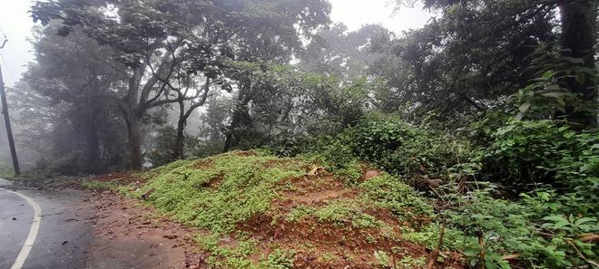
Hidden in plain sight, under a mound of excavated sand dumped unceremoniously on top of it, is a unique rock which serves as a reminder to those looking out for Coonoor’s disappearing colonial legacy. Like many of the colonial bungalows and buildings in the picturesque hill district of the Nilgiris that have been left in the sands of time, this unique sign, an actual milestone, could soon find itself moved out of the way for expanding roads and building high rises.
The huge milestone, which reads ‘1 MILE FROM THE BUNGALOW’, would have been a welcome sight for weary travellers from Coimbatore and surrounding regions making the arduous multi-day journey to Coonoor and Udhagamandalam in the 19th Century and in the early part of the 20 Century.
A court building now
Tshe bungalow that the milestone refers to is now the Coonoor Judicial Magistrate Court. In the 1830s, when the road was built, it served as a travellers bungalow where weary British travellers on bullock carts and horseback would rest for the night before heading to Udhagamandalam.
“Prior to the construction of the road, which is called the Old Ooty Road, people would have to travel through Kil Kotagiri to Dhimbatty and from there to Doddabetta before reaching Udhagamandalam town,” says P.J. Vasanthan, a history enthusiast from Coonoor. Eventually, Stephen Rumbold Lushington, the Governor of Madras from 1827 to 1835, ordered that a more direct route be built to Udhagamandalam through Coonoor. This directive led to the construction of the Old Ooty Road. It was Lushington’s decision to build the new road to Ooty through Coonoor that led to the foundation of Coonoor town.
Mentioned in 1833 map
Dr. Benza, who was commissioned to do a geological survey of the Nilgiris, mentions the travellers’ bungalow in his map published in 1833. “Till date, a walk from the milestone till the municipal court is precisely 1.6 kilometres, or a mile,” says Mr. Vasanthan.
What is also of interest is that the milestone has the Tamil alphabet ‘Ka’, denoting ‘1’, so that Tamil-speaking operators of bullock carts and travellers on horseback would also know that they were close to their destination, adds Mr. Vasanthan.
The Old Ooty Road fell into disuse because of the steep gradients, which meant that horse-carriages would not be able to ascend from the plains. This led to the construction of the current road between Mettupalayam and Udhagamandalam for wheeled-traffic in the form of carriages and tonga carts.
With the construction of the new road, the Old Ooty Road and the milestone seem to have been forgotten. Both remain relics of the starting point of the commercial exploitation of the Nilgiris.
Today, the milestone stands by the side of the road near the Kanni Mariamman Kovil Street at Coonoor. Recent road expansion projects have led to the milestone being completely covered with mud, with only a small portion of it still visible.
Seen in lithograph
The milestone is said to have been one of the two such markers. The second milestone is seen in a lithograph by Colonel Stephen Ponsonby Peacocke in the 1830s. It is titled, ‘View of the Low Country from the 2nd Mile Stone, Coonoor Pass’.
The previous commissioners of the Coonoor municipality had shown little interest in protecting the milestone. It now seems that one of the earliest surviving reminders of the reasons for the founding of Coonoor could soon be lost.
Official apathy
The past curators of the Ooty Museum had also voiced their support for a plan to mark the location of the milestone and detail its historic significance. However, this plan seems to have gone nowhere. The serving municipal officials are even unaware of the existence of the milestone.
“It needs efforts to preserve the milestone. There is something extremely touching about having a piece of the town’s history lying forgotten and uncared-for...,” says Mr. Vasanthan.


